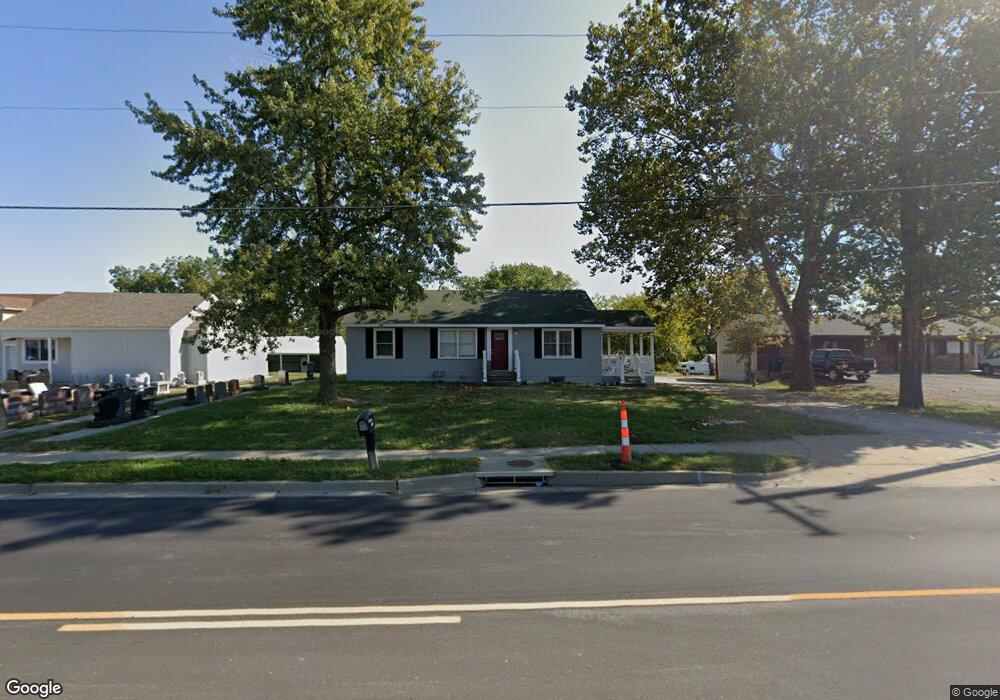
1104 N State Route 7 Pleasant Hill, MO 64080
Estimated Value: $209,278 - $286,000
3
Beds
2
Baths
1,321
Sq Ft
$180/Sq Ft
Est. Value
About This Home
This home is located at 1104 N State Route 7, Pleasant Hill, MO 64080 and is currently estimated at $238,070, approximately $180 per square foot. 1104 N State Route 7 is a home located in Cass County with nearby schools including Pleasant Hill Primary School, Pleasant Hill Elementary School, and Pleasant Hill Middle School.
Ownership History
Date
Name
Owned For
Owner Type
Purchase Details
Closed on
May 7, 2024
Sold by
Bank 21
Bought by
Gold Rentals Llc
Current Estimated Value
Home Financials for this Owner
Home Financials are based on the most recent Mortgage that was taken out on this home.
Original Mortgage
$280,000
Outstanding Balance
$276,006
Interest Rate
6.79%
Mortgage Type
Seller Take Back
Estimated Equity
-$37,936
Purchase Details
Closed on
Feb 29, 2024
Sold by
Cgg Properties Llc
Bought by
Bank 21
Create a Home Valuation Report for This Property
The Home Valuation Report is an in-depth analysis detailing your home's value as well as a comparison with similar homes in the area
Home Values in the Area
Average Home Value in this Area
Purchase History
| Date | Buyer | Sale Price | Title Company |
|---|---|---|---|
| Gold Rentals Llc | -- | None Listed On Document | |
| Bank 21 | -- | None Listed On Document | |
| Bank 21 | -- | None Listed On Document |
Source: Public Records
Mortgage History
| Date | Status | Borrower | Loan Amount |
|---|---|---|---|
| Open | Gold Rentals Llc | $280,000 |
Source: Public Records
Tax History Compared to Growth
Tax History
| Year | Tax Paid | Tax Assessment Tax Assessment Total Assessment is a certain percentage of the fair market value that is determined by local assessors to be the total taxable value of land and additions on the property. | Land | Improvement |
|---|---|---|---|---|
| 2024 | $975 | $13,520 | $3,420 | $10,100 |
| 2023 | $968 | $13,520 | $3,420 | $10,100 |
| 2022 | $867 | $11,890 | $3,420 | $8,470 |
| 2021 | $844 | $11,890 | $3,420 | $8,470 |
| 2020 | $804 | $11,600 | $3,420 | $8,180 |
| 2019 | $793 | $11,600 | $3,420 | $8,180 |
| 2018 | $698 | $10,080 | $2,740 | $7,340 |
| 2017 | $673 | $10,080 | $2,740 | $7,340 |
| 2016 | $673 | $9,680 | $2,740 | $6,940 |
| 2015 | $682 | $9,680 | $2,740 | $6,940 |
| 2014 | $685 | $9,680 | $2,740 | $6,940 |
| 2013 | -- | $9,680 | $2,740 | $6,940 |
Source: Public Records
Map
Nearby Homes
- 1002 Lexington Rd
- 1004 Wright St
- 1206 Sycamore St
- 1003 Truman St
- 1307 Deena St
- 1521 Lexington Rd
- 501 Lexington Rd
- 502 N Armstrong St
- 1504 Hawthorne Cir
- 601 Hillcrest St
- 1209 Crest Dr
- 1413 Country Club Dr
- 1512 Country Club Dr
- 1202 Ashford St
- 418 N Taylor St
- 207 Lexington Rd
- 1704 Mulberry St
- 1700 Mulberry St
- 204 Lexington Rd
- 0 Route 7
- 1106 N State Route 7
- 1017 N State Route 7
- 1020 N State Route 7
- 1108 N State Route 7
- 1101 Lexington Rd
- 1101 N State Route 7
- 1105 Lexington Rd
- 1023 Lexington Rd
- 1204 N State Route 7
- 1021 Lexington Rd
- 1107 Lexington Rd
- 1015 N State Route 7
- 1019 Lexington Rd
- 1002 Independence St
- 000 Independence St
- 1008 Willow Ln
- 1017 Lexington Rd
- 1109 Lexington Rd
- 1009 N State Route 7
- 1010 Willow Ln