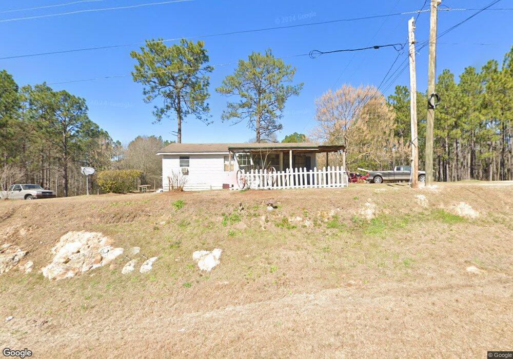
1104 Ralph Keen Rd East Dublin, GA 31027
Estimated Value: $117,000 - $131,000
--
Bed
2
Baths
1,092
Sq Ft
$115/Sq Ft
Est. Value
About This Home
This home is located at 1104 Ralph Keen Rd, East Dublin, GA 31027 and is currently estimated at $125,806, approximately $115 per square foot. 1104 Ralph Keen Rd is a home located in Laurens County with nearby schools including Northwest Laurens Elementary School, Southwest Laurens Elementary School, and East Laurens Primary School.
Ownership History
Date
Name
Owned For
Owner Type
Purchase Details
Closed on
Aug 1, 2025
Sold by
Johnson Susie D
Bought by
Edge Darrell
Current Estimated Value
Purchase Details
Closed on
May 22, 2024
Sold by
Johnson John Quincy
Bought by
Johnson Susie Drew
Purchase Details
Closed on
Oct 19, 2022
Sold by
Johnson Johns Quincy
Bought by
Johnson Susie Drew
Purchase Details
Closed on
Sep 9, 1909
Bought by
Johnson Quincy
Create a Home Valuation Report for This Property
The Home Valuation Report is an in-depth analysis detailing your home's value as well as a comparison with similar homes in the area
Home Values in the Area
Average Home Value in this Area
Purchase History
| Date | Buyer | Sale Price | Title Company |
|---|---|---|---|
| Edge Darrell | $125,000 | -- | |
| Johnson Susie Drew | -- | -- | |
| Johnson Susie Drew | -- | -- | |
| Johnson Quincy | -- | -- |
Source: Public Records
Tax History Compared to Growth
Tax History
| Year | Tax Paid | Tax Assessment Tax Assessment Total Assessment is a certain percentage of the fair market value that is determined by local assessors to be the total taxable value of land and additions on the property. | Land | Improvement |
|---|---|---|---|---|
| 2024 | $709 | $41,757 | $20,502 | $21,255 |
| 2023 | $365 | $40,312 | $20,502 | $19,810 |
| 2022 | $413 | $39,715 | $19,905 | $19,810 |
| 2021 | $425 | $34,576 | $14,313 | $20,263 |
| 2020 | $423 | $34,576 | $14,313 | $20,263 |
| 2019 | $421 | $34,576 | $14,313 | $20,263 |
| 2018 | $419 | $34,576 | $14,313 | $20,263 |
| 2017 | $416 | $34,576 | $14,313 | $20,263 |
| 2016 | $414 | $34,576 | $14,313 | $20,263 |
| 2015 | $411 | $20,936 | $673 | $20,263 |
| 2014 | $391 | $13,682 | $743 | $12,940 |
Source: Public Records
Map
Nearby Homes
- 0 Ralph Keen Rd Unit 21905127
- 520 Kenneth Hilburn Cir
- 437 Mccord Rd
- 461 Mccord Rd
- 859 Silver Rd
- 1613 Georgia 29
- 0 Mamie Graham Rd Unit 257372
- 0 Mamie Graham Rd Unit 10647192
- 0 Mamie Graham Rd Unit 30544
- 132 Shaddock Creek Cir
- 509 Maddox Rd
- 532 Ned Collins Rd
- 445 Saint Charles Dr
- LOT 4 Wind Song Dr
- 844 Windward Way
- 335 Windsong Dr
- 644 Blue Jay Dr
- 134 Long Pines Cir
- 6.98 ACRES Brewton Lovett Rd
- 3.5 ACRES Brewton Lovett Rd
- 502 Quintons Way
- 0 Ralph Keen Rd Unit 7491084
- 0 Ralph Keen Rd Unit 3136107
- 0 Ralph Keen Rd Unit 8717750
- 1155 Ralph Keen Rd
- 529 Robert Webb Rd
- 529 Robert Webb Rd
- 530 Robert Webb Rd
- 530 Robert Webb Rd
- 615 Kenneth Hilburn Cir
- 634 Kenneth Hilburn Cir
- 542 Robert Webb Rd
- 624 Kenneth Hilburn Cir
- 1160 Ralph Keen Rd
- 620 Kenneth Hilburn Cir
- 610 Kenneth Hilburn Cir
- 512 Ralph Keen Rd
- 591 Kenneth Hilburn Cir
- 606 Kenneth Hilburn Cir
- 606 Kenneth Hilburn Cir