
Seller's Agent in 2026
Monica Dempsey
BHHS Ambassador Real Estate
(402) 321-2614
2 in this area
49 Total Sales


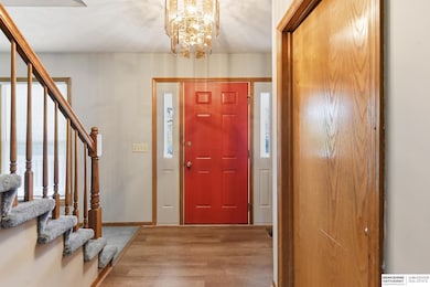

Great 3-bedroom, 3-bathroom home with a prime location near Bellevue West. This property is beautifully decorated and offers spacious bedrooms, each featuring a walk-in closet. The eat-in kitchen is a highlight, complete with a center island for added functionality and style. The basement provides ample storage space, making it ideal for those who need extra room. Conveniently located close to shopping centers and Offutt Air Force Base, this home combines comfort and convenience.
Last Agent to Sell the Property
BHHS Ambassador Real Estate License #20150884 Listed on: 11/11/2025
We collect this data history from publicly available records. To have your information removed, we recommend requesting removal directly through your county’s website.
We collect this data history from publicly available records. To have your information removed, we recommend requesting removal directly through your county’s website.
| Date | Type | Sale Price | Title Company |
|---|---|---|---|
| Warranty Deed | $313,000 | Omni Title Services | |
| Warranty Deed | $140,000 | -- |
We collect this data history from publicly available records. To have your information removed, we recommend requesting removal directly through your county’s website.
| Date | Status | Loan Amount | Loan Type |
|---|---|---|---|
| Open | $250,000 | New Conventional | |
| Previous Owner | $142,250 | No Value Available |
We collect this data history from publicly available records. To have your information removed, we recommend requesting removal directly through your county’s website.
| Date | Event | Price | List to Sale | Price per Sq Ft |
|---|---|---|---|---|
| 04/06/2026 04/06/26 | Sold | $313,000 | -0.6% | $157 / Sq Ft |
| 02/04/2026 02/04/26 | Pending | -- | -- | -- |
| 12/22/2025 12/22/25 | Price Changed | $315,000 | -4.5% | $158 / Sq Ft |
| 11/11/2025 11/11/25 | For Sale | $330,000 | -- | $165 / Sq Ft |
We collect this data history from publicly available records. To have your information removed, we recommend requesting removal directly through your county’s website.
| Year | Tax Paid | Tax Assessment Tax Assessment Total Assessment is a certain percentage of the fair market value that is determined by local assessors to be the total taxable value of land and additions on the property. | Land | Improvement |
|---|---|---|---|---|
| 2025 | -- | $292,208 | $40,000 | $252,208 |
| 2024 | -- | $267,841 | $40,000 | $227,841 |
| 2023 | $4,775 | $231,012 | $35,000 | $196,012 |
| 2022 | $4,775 | $221,901 | $30,000 | $191,901 |
| 2021 | $4,556 | $209,432 | $30,000 | $179,432 |
| 2020 | $4,198 | $192,397 | $30,000 | $162,397 |
| 2019 | $3,864 | $178,195 | $23,000 | $155,195 |
| 2018 | $3,484 | $164,962 | $23,000 | $141,962 |
| 2017 | $3,486 | $163,927 | $23,000 | $140,927 |
| 2016 | $3,253 | $156,359 | $23,000 | $133,359 |
| 2015 | $3,159 | $152,754 | $23,000 | $129,754 |
| 2014 | $3,112 | $149,484 | $23,000 | $126,484 |
| 2012 | -- | $157,299 | $23,000 | $134,299 |
Seller's Agent in 2026
Monica Dempsey
BHHS Ambassador Real Estate
(402) 321-2614
2 in this area
49 Total Sales
Buyer's Agent in 2026
Stephany Cabrales
Meraki Realty Group
(928) 259-8170
3 in this area
11 Total Sales
Source: Great Plains Regional MLS
MLS Number: 22532498
APN: 011129875
Disclaimer: Certain information contained herein is derived from information provided by parties other than Homes.com. All information provided is deemed reliable, but is not guaranteed to be accurate and should be independently verified.
![]() Listing information is provided by Participants of the Great Plains Regional Multiple Listing Service Inc.
Listing information is provided by Participants of the Great Plains Regional Multiple Listing Service Inc.
IDX information is provided exclusively for personal, non-commercial use, and may not be used for any purpose other than to identify prospective properties consumers may be interested in purchasing.
Information is deemed reliable but not guaranteed.
Copyright 2026, Great Plains Regional MLS LLC
Ask me questions while you tour the home.