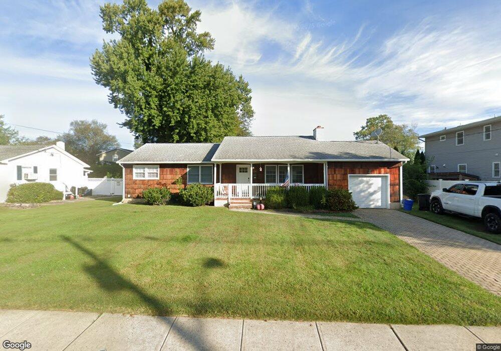
1104 Wall Rd Spring Lake, NJ 07762
Estimated Value: $930,000 - $1,104,000
3
Beds
2
Baths
1,248
Sq Ft
$824/Sq Ft
Est. Value
About This Home
This home is located at 1104 Wall Rd, Spring Lake, NJ 07762 and is currently estimated at $1,028,461, approximately $824 per square foot. 1104 Wall Rd is a home located in Monmouth County with nearby schools including Spring Lake Heights Elementary School and The Brookside School.
Ownership History
Date
Name
Owned For
Owner Type
Purchase Details
Closed on
Sep 18, 2014
Sold by
Losch Michael and Losch Ann
Bought by
Rampone Christie P
Current Estimated Value
Home Financials for this Owner
Home Financials are based on the most recent Mortgage that was taken out on this home.
Original Mortgage
$295,500
Outstanding Balance
$226,057
Interest Rate
4.12%
Mortgage Type
New Conventional
Estimated Equity
$802,404
Purchase Details
Closed on
Dec 13, 2004
Sold by
Egan William
Bought by
Losch Michael and Losch Ann
Purchase Details
Closed on
May 28, 2003
Sold by
Boyan Joseph
Bought by
Egan William and Egan Jeanne
Home Financials for this Owner
Home Financials are based on the most recent Mortgage that was taken out on this home.
Original Mortgage
$304,300
Interest Rate
5.46%
Create a Home Valuation Report for This Property
The Home Valuation Report is an in-depth analysis detailing your home's value as well as a comparison with similar homes in the area
Home Values in the Area
Average Home Value in this Area
Purchase History
We collect this data history from publicly available records. To have your information removed, we recommend requesting removal directly through your county’s website.
| Date | Buyer | Sale Price | Title Company |
|---|---|---|---|
| Rampone Christie P | $394,000 | Oceanview Title Agency Llc | |
| Losch Michael | $350,000 | -- | |
| Egan William | $358,000 | -- |
Source: Public Records
Mortgage History
We collect this data history from publicly available records. To have your information removed, we recommend requesting removal directly through your county’s website.
| Date | Status | Borrower | Loan Amount |
|---|---|---|---|
| Open | Rampone Christie P | $295,500 | |
| Previous Owner | Egan William | $304,300 |
Source: Public Records
Tax History
| Year | Tax Paid | Tax Assessment Tax Assessment Total Assessment is a certain percentage of the fair market value that is determined by local assessors to be the total taxable value of land and additions on the property. | Land | Improvement |
|---|---|---|---|---|
| 2025 | $7,765 | $795,600 | $610,700 | $184,900 |
| 2024 | $6,544 | $737,400 | $555,900 | $181,500 |
| 2023 | $6,544 | $584,300 | $407,000 | $177,300 |
| 2022 | $6,585 | $551,000 | $374,300 | $176,700 |
| 2021 | $6,585 | $487,800 | $327,200 | $160,600 |
| 2020 | $6,423 | $473,000 | $327,200 | $145,800 |
| 2019 | $6,433 | $468,900 | $327,200 | $141,700 |
| 2018 | $6,461 | $458,200 | $327,200 | $131,000 |
| 2017 | $6,208 | $456,500 | $327,200 | $129,300 |
| 2016 | $6,044 | $438,900 | $287,900 | $151,000 |
| 2015 | $5,973 | $435,000 | $287,900 | $147,100 |
| 2014 | $6,078 | $452,600 | $306,500 | $146,100 |
Source: Public Records
Map
Nearby Homes
- 15 Old Mill Ct
- 3 Ashford Ct
- 907 Woodcrest Dr
- 3 Willow Ln
- 57 Maple Dr
- 2008 Fairway Dr
- 2005 Nassau Dr
- 9 Dogwood Ct
- 1705 Beverly Ave
- 1909 Cottage Place
- 1310 Xanadu Ln Unit 23A
- 2104 Xanadu Ln Unit 2104
- 1726 M St
- 1936 Troy Dr
- 2121 4th Ave
- 1017 18th Ave
- 604 State Route 71
- 600 State Route 71 Unit 9
- 327 South Blvd
- 513 Mercer Ave
- 2401 Hamilton Ave
- 2405 Hamilton Ave
- 1108 Wall Rd
- 2404 Emerson Ave
- 2407 Hamilton Ave
- 1101 Wall Rd
- 2400 Hamilton Ave
- 2409 Hamilton Ave
- 2408 Emerson Ave
- 1103 Wall Rd
- 2404 Hamilton Ave
- 2401 Emerson Ave
- 1024 Wall Rd
- 2411 Hamilton Ave
- 1107 Wall Rd
- 1109 Wall Rd
- 2408 Hamilton Ave
- 2412 Emerson Ave
- 1013 Wall Rd
- 1201 Holly Place
Your Personal Tour Guide
Ask me questions while you tour the home.