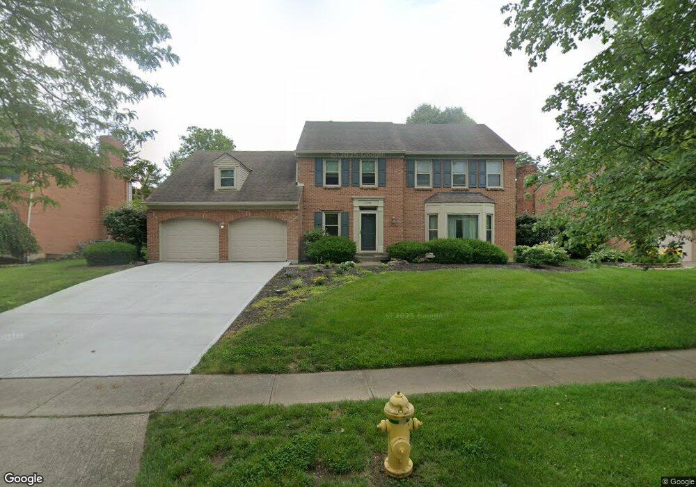
11040 Allenhurst Blvd E Cincinnati, OH 45241
Estimated Value: $461,000 - $608,000
4
Beds
3
Baths
2,478
Sq Ft
$207/Sq Ft
Est. Value
About This Home
This home is located at 11040 Allenhurst Blvd E, Cincinnati, OH 45241 and is currently estimated at $513,653, approximately $207 per square foot. 11040 Allenhurst Blvd E is a home located in Hamilton County with nearby schools including Sharonville Elementary School, Princeton Community Middle School, and Princeton High School.
Ownership History
Date
Name
Owned For
Owner Type
Purchase Details
Closed on
Oct 19, 1994
Sold by
Schulte Neal G and Schulte Kristin C
Bought by
Seelaus Robert Henry and Seelaus Beth B
Current Estimated Value
Home Financials for this Owner
Home Financials are based on the most recent Mortgage that was taken out on this home.
Original Mortgage
$146,400
Interest Rate
8.53%
Create a Home Valuation Report for This Property
The Home Valuation Report is an in-depth analysis detailing your home's value as well as a comparison with similar homes in the area
Home Values in the Area
Average Home Value in this Area
Purchase History
| Date | Buyer | Sale Price | Title Company |
|---|---|---|---|
| Seelaus Robert Henry | -- | -- |
Source: Public Records
Mortgage History
| Date | Status | Borrower | Loan Amount |
|---|---|---|---|
| Previous Owner | Seelaus Robert Henry | $146,400 |
Source: Public Records
Tax History
| Year | Tax Paid | Tax Assessment Tax Assessment Total Assessment is a certain percentage of the fair market value that is determined by local assessors to be the total taxable value of land and additions on the property. | Land | Improvement |
|---|---|---|---|---|
| 2025 | $5,688 | $119,630 | $19,075 | $100,555 |
| 2024 | $4,854 | $119,630 | $19,075 | $100,555 |
| 2023 | $4,859 | $119,630 | $19,075 | $100,555 |
| 2022 | $4,611 | $91,228 | $18,886 | $72,342 |
| 2021 | $4,482 | $91,228 | $18,886 | $72,342 |
| 2020 | $4,535 | $91,228 | $18,886 | $72,342 |
| 2019 | $4,523 | $83,692 | $17,325 | $66,367 |
| 2018 | $4,242 | $83,692 | $17,325 | $66,367 |
| 2017 | $3,972 | $83,692 | $17,325 | $66,367 |
| 2016 | $4,337 | $90,637 | $16,853 | $73,784 |
| 2015 | $4,379 | $90,637 | $16,853 | $73,784 |
| 2014 | $4,393 | $90,637 | $16,853 | $73,784 |
| 2013 | $4,011 | $84,707 | $15,750 | $68,957 |
Source: Public Records
Map
Nearby Homes
- 11108 Huntwicke Place
- 4051 Falling Creek Ct
- 4138 Radcliff Ln
- 4036 Haverstraw Dr
- 4365 Classic Dr
- 4254 Fox Hollow Dr
- 4071 E Kemper Rd
- 10480 Wintergreen Ct
- 3816 Glendale Milford Rd
- 3380 Spurrier Ln
- 3706 Glendale Milford Rd
- 3703 Moorhill Dr
- 10561 Plainfield Rd
- 10432 Hickory Point Dr
- 4204 Magnolia Aly
- 4270 Parkview Dr
- 5078 Arabella Cir
- 10301 Giverny Blvd
- 5074 Arabella Cir
- 5070 Arabella Cir
- 11034 Allenhurst Blvd E
- 11046 Allenhurst Blvd E
- 11051 Sycamore Grove Ln
- 11041 Sycamore Grove Ln
- 11052 Allenhurst Blvd E
- 11028 Allenhurst Blvd E
- 11059 Allenhurst Blvd E
- 11053 Allenhurst Blvd E
- 11063 Sycamore Grove Ln
- 11065 Allenhurst Blvd E
- 11027 Sycamore Grove Ln
- 4174 Whitetail Ct
- 11073 Sycamore Grove Ln
- 11071 Allenhurst Blvd E
- 11058 Allenhurst Blvd E
- 4157 Malaer Dr
- 4163 Malaer Dr
- 4175 Whitetail Ct
- 4168 Whitetail Ct
- 4169 Malaer Dr
Your Personal Tour Guide
Ask me questions while you tour the home.