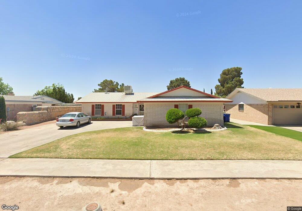
11040 Bob Stone Dr El Paso, TX 79936
Glen Cove NeighborhoodEstimated Value: $217,211 - $273,000
--
Bed
2
Baths
1,464
Sq Ft
$166/Sq Ft
Est. Value
About This Home
This home is located at 11040 Bob Stone Dr, El Paso, TX 79936 and is currently estimated at $243,303, approximately $166 per square foot. 11040 Bob Stone Dr is a home located in El Paso County with nearby schools including Tierra Del Sol Elementary School, J M Hanks High School, and EL PASO LEADERSHIP ACADEMY - MIDDLE EAST.
Ownership History
Date
Name
Owned For
Owner Type
Purchase Details
Closed on
May 10, 2008
Sold by
Kelley David T and Kelley Meredith N
Bought by
Lopez David Z and Lopez Rebecca M
Current Estimated Value
Home Financials for this Owner
Home Financials are based on the most recent Mortgage that was taken out on this home.
Original Mortgage
$107,500
Outstanding Balance
$68,115
Interest Rate
5.89%
Mortgage Type
Seller Take Back
Estimated Equity
$175,188
Create a Home Valuation Report for This Property
The Home Valuation Report is an in-depth analysis detailing your home's value as well as a comparison with similar homes in the area
Home Values in the Area
Average Home Value in this Area
Purchase History
| Date | Buyer | Sale Price | Title Company |
|---|---|---|---|
| Lopez David Z | -- | None Available |
Source: Public Records
Mortgage History
| Date | Status | Borrower | Loan Amount |
|---|---|---|---|
| Open | Lopez David Z | $107,500 |
Source: Public Records
Tax History Compared to Growth
Tax History
| Year | Tax Paid | Tax Assessment Tax Assessment Total Assessment is a certain percentage of the fair market value that is determined by local assessors to be the total taxable value of land and additions on the property. | Land | Improvement |
|---|---|---|---|---|
| 2025 | $2,384 | $207,528 | $39,611 | $167,917 |
| 2024 | $2,384 | $188,958 | -- | -- |
| 2023 | $2,283 | $171,780 | $0 | $0 |
| 2022 | $4,849 | $156,164 | $0 | $0 |
| 2021 | $4,615 | $151,475 | $25,634 | $125,841 |
| 2020 | $4,076 | $129,061 | $19,019 | $110,042 |
| 2018 | $4,013 | $129,045 | $19,019 | $110,026 |
| 2017 | $3,602 | $117,831 | $19,019 | $98,812 |
| 2016 | $3,602 | $117,831 | $19,019 | $98,812 |
| 2015 | $2,777 | $117,831 | $19,019 | $98,812 |
| 2014 | $2,777 | $117,337 | $19,019 | $98,318 |
Source: Public Records
Map
Nearby Homes
- 11013 Bob Stone Dr
- 11016 Bob Stone Dr
- 11012 Bob Stone Dr
- 2009 Bobby Jones Dr Unit B
- 2001 Bobby Jones Dr Unit A
- 1901 Bobby Jones Dr
- 11008 Johnny Miller Dr
- 1817 Hugh Royer Place
- 2308 Tom Watson Ct
- 1868 Tom Bolt Dr
- 1913 Seagull Dr
- 2604 Anise Dr
- 2325 Ken Venturi Ln
- 2348 Sea Side Dr
- 1844 Jack Nicklaus Dr Unit 1846
- 2313 Frank Beard Dr
- 10916 Miller Barber Dr
- 2820 Beachcomber Dr
- 11132 Wharf Cove Dr
- 2825 Wong Place Unit A/D
- 11036 Bob Stone Dr
- 11044 Bob Stone Dr
- 11041 Tom Weiskopf Dr
- 11045 Tom Weiskopf Dr
- 11037 Tom Weiskopf Dr
- 11032 Bob Stone Dr
- 11048 Bob Stone Dr
- 11041 Bob Stone Dr
- 11049 Tom Weiskopf Dr
- 11037 Bob Stone Dr
- 11045 Bob Stone Dr
- 11033 Tom Weiskopf Dr
- 11033 Bob Stone Dr
- 11028 Bob Stone Dr
- 11053 Tom Weiskopf Dr
- 11052 Bob Stone Dr
- 11049 Bob Stone Dr
- 11029 Tom Weiskopf Dr
- 11040 Tom Weiskopf Dr
- 11044 Tom Weiskopf Dr