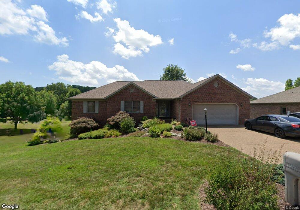
11041 Farm Way Rd Evansville, IN 47712
Estimated Value: $339,000 - $462,000
3
Beds
3
Baths
1,879
Sq Ft
$220/Sq Ft
Est. Value
About This Home
This home is located at 11041 Farm Way Rd, Evansville, IN 47712 and is currently estimated at $413,441, approximately $220 per square foot. 11041 Farm Way Rd is a home located in Posey County with nearby schools including Mount Vernon Junior High School, Mount Vernon High School, and St. Philip School.
Ownership History
Date
Name
Owned For
Owner Type
Purchase Details
Closed on
Jul 10, 2009
Sold by
Fleck Jason L and Fleck Deborah L
Bought by
Vanover Scott M and Vanover Michelle
Current Estimated Value
Home Financials for this Owner
Home Financials are based on the most recent Mortgage that was taken out on this home.
Original Mortgage
$188,800
Outstanding Balance
$120,885
Interest Rate
4.94%
Mortgage Type
New Conventional
Estimated Equity
$292,556
Purchase Details
Closed on
Jul 9, 2009
Sold by
Jason L Fleck
Bought by
Vanover Scott M and Vanover Michelle V
Home Financials for this Owner
Home Financials are based on the most recent Mortgage that was taken out on this home.
Original Mortgage
$188,800
Outstanding Balance
$120,885
Interest Rate
4.94%
Mortgage Type
New Conventional
Estimated Equity
$292,556
Create a Home Valuation Report for This Property
The Home Valuation Report is an in-depth analysis detailing your home's value as well as a comparison with similar homes in the area
Home Values in the Area
Average Home Value in this Area
Purchase History
| Date | Buyer | Sale Price | Title Company |
|---|---|---|---|
| Vanover Scott M | -- | None Available | |
| Vanover Scott M | $236,000 | Regional Title Services Llc |
Source: Public Records
Mortgage History
| Date | Status | Borrower | Loan Amount |
|---|---|---|---|
| Open | Vanover Scott M | $188,800 |
Source: Public Records
Tax History Compared to Growth
Tax History
| Year | Tax Paid | Tax Assessment Tax Assessment Total Assessment is a certain percentage of the fair market value that is determined by local assessors to be the total taxable value of land and additions on the property. | Land | Improvement |
|---|---|---|---|---|
| 2024 | $3,220 | $372,200 | $32,400 | $339,800 |
| 2023 | $2,579 | $314,500 | $30,000 | $284,500 |
| 2022 | $2,304 | $262,300 | $31,700 | $230,600 |
| 2021 | $1,924 | $220,000 | $31,700 | $188,300 |
| 2020 | $1,921 | $215,400 | $31,100 | $184,300 |
| 2019 | $2,347 | $257,800 | $36,600 | $221,200 |
| 2018 | $2,368 | $264,200 | $36,600 | $227,600 |
| 2017 | $2,198 | $261,000 | $36,600 | $224,400 |
| 2016 | $2,152 | $264,900 | $36,600 | $228,300 |
| 2014 | $1,688 | $238,800 | $38,500 | $200,300 |
| 2013 | $1,688 | $243,200 | $38,500 | $204,700 |
Source: Public Records
Map
Nearby Homes
- 6855 Lakeside Ln
- 0 Fox Ridge Rd
- 11314 Vixen Dr
- 10311 Eastgate Dr S
- 10900 Woodside Dr S
- 5225 Star Dr
- 5015 Alysia St
- 2734 Marycrest Dr
- 2646 Marycrest Dr
- Little Rock Craftsman Plan at Westridge Commons
- Revolution Craftsman Plan at Westridge Commons
- Revolution Farmhouse Plan at Westridge Commons
- Walnut Craftsman Plan at Westridge Commons
- Patriot Modern Plan at Westridge Commons
- National Farmhouse Plan at Westridge Commons
- Cumberland Farmhouse 3-Car Plan at Westridge Commons
- National Modern Plan at Westridge Commons
- National Craftsman Plan at Westridge Commons
- Cumberland Modern 3-Car Plan at Westridge Commons
- Patriot Farmhouse Plan at Westridge Commons
- 11021 Farm Way Rd
- 11061 Farm Way Rd
- 6561 Orchard Way Rd
- 11001 Farm Way Rd
- 11101 Farm Way Rd
- 11100 Farm Way Rd
- 6518 W Franklin Rd
- 6551 Orchard Way
- 6550 Orchard Way
- 6540 Orchard Way Rd
- 6550 Orchard Way Rd
- 11040 Forest Edge Rd
- 11060 Forest Edge Rd
- 11020 Forest Edge Rd
- 11121 Farm Way Rd
- 11140 Farm Way Rd
- 11100 Forest Edge Rd
- 11000 Forest Edge Rd
- 11101 Forest Edge Rd
- 11141 Farm Way Rd