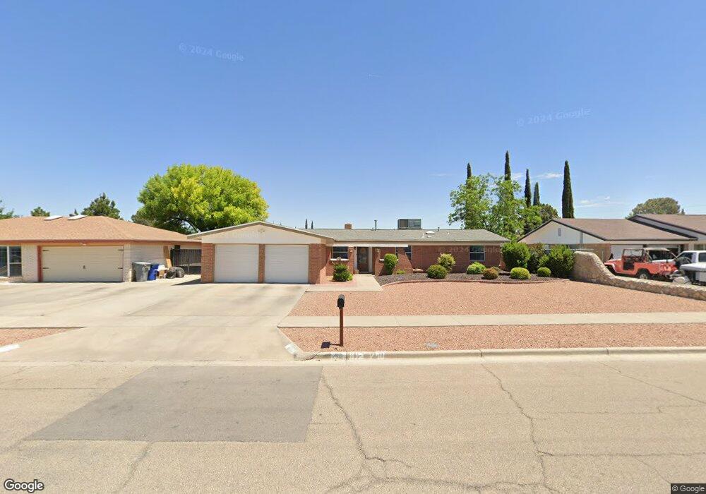
11049 Bob Stone Dr El Paso, TX 79936
Glen Cove NeighborhoodEstimated Value: $239,830 - $278,000
--
Bed
2
Baths
1,846
Sq Ft
$142/Sq Ft
Est. Value
About This Home
This home is located at 11049 Bob Stone Dr, El Paso, TX 79936 and is currently estimated at $261,958, approximately $141 per square foot. 11049 Bob Stone Dr is a home located in El Paso County with nearby schools including Tierra Del Sol Elementary School, J M Hanks High School, and EL PASO LEADERSHIP ACADEMY - MIDDLE EAST.
Ownership History
Date
Name
Owned For
Owner Type
Purchase Details
Closed on
Jun 30, 1994
Sold by
Haynes Lyle E and Haynes Dolores E
Bought by
Ramirez Stephen and Ramirez Elizabeth
Current Estimated Value
Home Financials for this Owner
Home Financials are based on the most recent Mortgage that was taken out on this home.
Original Mortgage
$80,573
Interest Rate
8.47%
Mortgage Type
FHA
Create a Home Valuation Report for This Property
The Home Valuation Report is an in-depth analysis detailing your home's value as well as a comparison with similar homes in the area
Home Values in the Area
Average Home Value in this Area
Purchase History
| Date | Buyer | Sale Price | Title Company |
|---|---|---|---|
| Ramirez Stephen | -- | -- |
Source: Public Records
Mortgage History
| Date | Status | Borrower | Loan Amount |
|---|---|---|---|
| Closed | Ramirez Stephen | $80,573 |
Source: Public Records
Tax History Compared to Growth
Tax History
| Year | Tax Paid | Tax Assessment Tax Assessment Total Assessment is a certain percentage of the fair market value that is determined by local assessors to be the total taxable value of land and additions on the property. | Land | Improvement |
|---|---|---|---|---|
| 2025 | $3,865 | $226,851 | -- | -- |
| 2024 | $3,865 | $206,228 | $26,393 | $179,835 |
| 2023 | $3,800 | $195,961 | $0 | $0 |
| 2022 | $5,532 | $178,146 | $0 | $0 |
| 2021 | $5,264 | $163,152 | $26,393 | $136,759 |
| 2020 | $4,650 | $147,228 | $19,582 | $127,646 |
| 2018 | $4,431 | $142,498 | $19,582 | $122,916 |
| 2017 | $4,079 | $133,455 | $19,582 | $113,873 |
| 2016 | $4,079 | $133,455 | $19,582 | $113,873 |
| 2015 | $3,216 | $133,455 | $19,582 | $113,873 |
| 2014 | $3,216 | $134,291 | $19,582 | $114,709 |
Source: Public Records
Map
Nearby Homes
- 11016 Bob Stone Dr
- 11013 Bob Stone Dr
- 11012 Bob Stone Dr
- 2009 Bobby Jones Dr Unit B
- 2001 Bobby Jones Dr Unit A
- 1901 Bobby Jones Dr
- 1817 Hugh Royer Place
- 1868 Tom Bolt Dr
- 1913 Seagull Dr
- 11008 Johnny Miller Dr
- 2308 Tom Watson Ct
- 2604 Anise Dr
- 2348 Sea Side Dr
- 2325 Ken Venturi Ln
- 1844 Jack Nicklaus Dr Unit 1846
- 2313 Frank Beard Dr
- 10916 Miller Barber Dr
- 2101 E Glen Dr
- 2820 Beachcomber Dr
- 11132 Wharf Cove Dr
- 11053 Bob Stone Dr
- 11045 Bob Stone Dr
- 11052 Art Wall Dr
- 11048 Art Wall Dr
- 11057 Bob Stone Dr
- 11041 Bob Stone Dr
- 11054 Art Wall Dr
- 11044 Art Wall Dr
- 11048 Bob Stone Dr
- 11052 Bob Stone Dr
- 11044 Bob Stone Dr
- 11054 Bob Stone Dr
- 11061 Bob Stone Dr
- 11040 Art Wall Dr
- 11037 Bob Stone Dr
- 11058 Art Wall Dr
- 11040 Bob Stone Dr
- 11049 Tom Weiskopf Dr
- 11053 Tom Weiskopf Dr
- 11051 Art Wall Dr