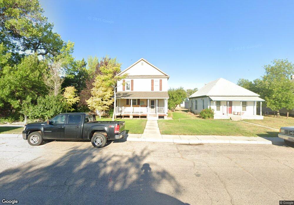
1105 10th St Wheatland, WY 82201
Estimated Value: $226,000 - $254,975
--
Bed
--
Bath
1,952
Sq Ft
$124/Sq Ft
Est. Value
About This Home
This home is located at 1105 10th St, Wheatland, WY 82201 and is currently estimated at $241,744, approximately $123 per square foot. 1105 10th St is a home located in Platte County.
Ownership History
Date
Name
Owned For
Owner Type
Purchase Details
Closed on
Oct 23, 2020
Sold by
Ehde Thad S and Ehde Tifanie E
Bought by
Ehde Thad S and Ehde Tifanie E
Current Estimated Value
Home Financials for this Owner
Home Financials are based on the most recent Mortgage that was taken out on this home.
Original Mortgage
$154,400
Outstanding Balance
$137,080
Interest Rate
2.8%
Mortgage Type
New Conventional
Estimated Equity
$104,664
Create a Home Valuation Report for This Property
The Home Valuation Report is an in-depth analysis detailing your home's value as well as a comparison with similar homes in the area
Home Values in the Area
Average Home Value in this Area
Purchase History
| Date | Buyer | Sale Price | Title Company |
|---|---|---|---|
| Ehde Thad S | -- | None Available | |
| Ehde Thad S | -- | None Listed On Document |
Source: Public Records
Mortgage History
| Date | Status | Borrower | Loan Amount |
|---|---|---|---|
| Open | Ehde Thad S | $154,400 | |
| Closed | Ehde Thad S | $154,400 |
Source: Public Records
Tax History Compared to Growth
Tax History
| Year | Tax Paid | Tax Assessment Tax Assessment Total Assessment is a certain percentage of the fair market value that is determined by local assessors to be the total taxable value of land and additions on the property. | Land | Improvement |
|---|---|---|---|---|
| 2025 | $1,938 | $19,425 | $1,027 | $18,398 |
| 2024 | $1,938 | $26,544 | $1,317 | $25,227 |
| 2023 | $1,889 | $25,877 | $1,164 | $24,713 |
| 2022 | $1,730 | $22,757 | $1,164 | $21,593 |
| 2021 | $1,428 | $18,792 | $1,097 | $17,695 |
| 2020 | $1,388 | $18,263 | $1,097 | $17,166 |
| 2019 | $1,290 | $17,089 | $878 | $16,211 |
| 2018 | $1,721 | $22,791 | $878 | $21,913 |
| 2017 | $1,729 | $22,907 | $878 | $22,029 |
| 2016 | $1,464 | $19,397 | $878 | $18,519 |
| 2015 | $1,307 | $19,336 | $878 | $18,458 |
| 2014 | $1,307 | $17,365 | $878 | $16,487 |
Source: Public Records
Map
Nearby Homes
- 1107 10th St
- 1101 10th St
- 1109 10th St
- 1055 Cedar St Unit 1057
- 1104 10th St
- 1053 Cedar St
- 1106 10th St
- 1108 10th St
- 1100 10th St
- 1056 Spruce St
- 1056 Spruce St Unit 10th Street
- 1104 11th St
- 1203 10th St
- 1007 10th St
- 1106 11th St
- 1053 Spruce St
- 1052 Cedar St
- 1008 10th St
- 1008 10th St Unit 2
- 1008 11th St