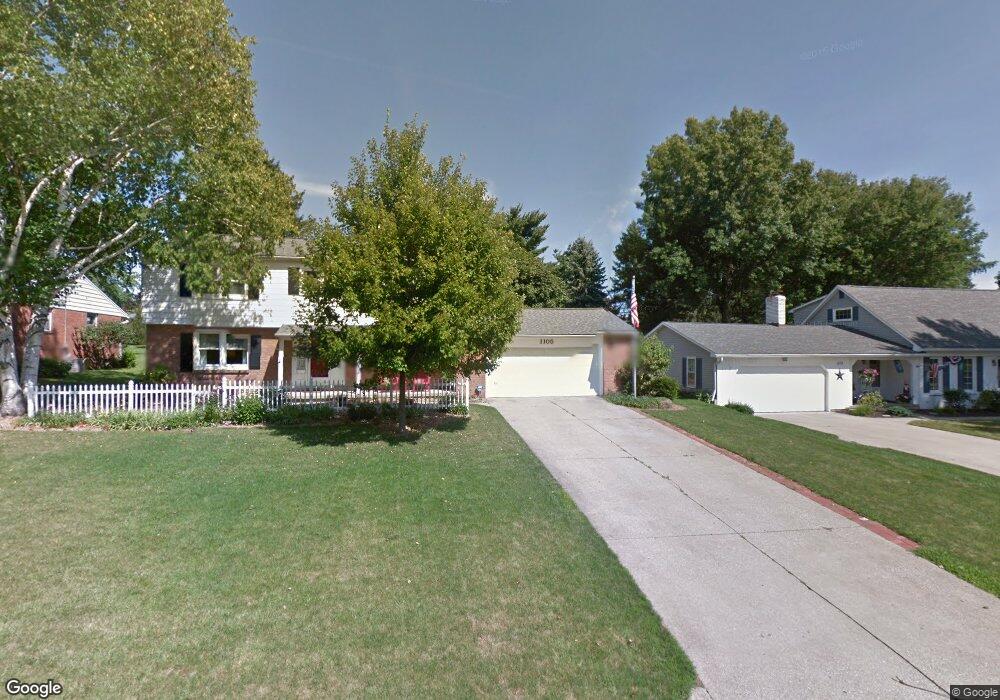
1105 Devonwood Rd Mansfield, OH 44907
Estimated Value: $277,000 - $294,000
4
Beds
3
Baths
2,605
Sq Ft
$111/Sq Ft
Est. Value
About This Home
This home is located at 1105 Devonwood Rd, Mansfield, OH 44907 and is currently estimated at $287,975, approximately $110 per square foot. 1105 Devonwood Rd is a home located in Richland County with nearby schools including Mansfield Christian School, Discovery School, and Mansfield Seventh-day Adventist School.
Ownership History
Date
Name
Owned For
Owner Type
Purchase Details
Closed on
Jul 21, 1995
Sold by
Kline Henry Michael
Bought by
Spires James W and Spires Jennifer G
Current Estimated Value
Home Financials for this Owner
Home Financials are based on the most recent Mortgage that was taken out on this home.
Original Mortgage
$123,750
Interest Rate
7.5%
Mortgage Type
New Conventional
Purchase Details
Closed on
May 12, 1993
Sold by
Scroggins Paul
Bought by
Kline Henry Michael
Purchase Details
Closed on
Apr 1, 1986
Create a Home Valuation Report for This Property
The Home Valuation Report is an in-depth analysis detailing your home's value as well as a comparison with similar homes in the area
Home Values in the Area
Average Home Value in this Area
Purchase History
| Date | Buyer | Sale Price | Title Company |
|---|---|---|---|
| Spires James W | $137,500 | -- | |
| Kline Henry Michael | $125,000 | -- | |
| -- | $85,000 | -- |
Source: Public Records
Mortgage History
| Date | Status | Borrower | Loan Amount |
|---|---|---|---|
| Closed | Spires James W | $123,750 |
Source: Public Records
Tax History
| Year | Tax Paid | Tax Assessment Tax Assessment Total Assessment is a certain percentage of the fair market value that is determined by local assessors to be the total taxable value of land and additions on the property. | Land | Improvement |
|---|---|---|---|---|
| 2024 | $3,460 | $75,580 | $8,100 | $67,480 |
| 2023 | $3,539 | $75,580 | $8,100 | $67,480 |
| 2022 | $3,226 | $57,740 | $7,060 | $50,680 |
| 2021 | $3,249 | $57,740 | $7,060 | $50,680 |
| 2020 | $3,322 | $57,740 | $7,060 | $50,680 |
| 2019 | $3,120 | $48,940 | $5,990 | $42,950 |
| 2018 | $3,078 | $48,940 | $5,990 | $42,950 |
| 2017 | $2,995 | $48,940 | $5,990 | $42,950 |
| 2016 | $3,102 | $49,150 | $5,690 | $43,460 |
| 2015 | $3,102 | $49,150 | $5,690 | $43,460 |
| 2014 | $2,924 | $49,150 | $5,690 | $43,460 |
| 2012 | $1,173 | $51,730 | $5,990 | $45,740 |
Source: Public Records
Map
Nearby Homes
- 1179 Burkwood Rd
- 0 Lexington Ave Unit 224009661
- 489 Clifton Blvd
- 400 James Ave
- 104 Elmridge Rd
- 0 George Ave
- 810 Lexington Ave
- 33 Rambleside Dr
- 575 Crescent Rd
- 986 Woodland Rd
- 695 S Andover Rd
- 65 Logan Rd
- 101 Chilton Ave
- 470 Lexington Ave
- 466 Lexington Ave
- 456 Lexington Ave
- 755 Locust Ln
- 680 Weller Ave
- 50 Lilac Ct E
- 655 Woodhill Rd
- 1115 Devonwood Rd
- 1091 Devonwood Rd
- 1106 Yorkwood Rd
- 1106 Devonwood Rd
- 1116 Yorkwood Rd
- 1125 Devonwood Rd
- 1081 Devonwood Rd
- 1116 Devonwood Rd
- 1090 Yorkwood Rd
- 1126 Yorkwood Rd
- 1090 Devonwood Rd
- 1080 Yorkwood Rd
- 1135 Devonwood Rd
- 1126 Devonwood Rd
- 1080 Devonwood Rd
- 1136 Yorkwood Rd
- 1091 Yorkwood Rd
- 1067 Devonwood Rd
- 1081 Yorkwood Rd
- 1136 Devonwood Rd
Your Personal Tour Guide
Ask me questions while you tour the home.