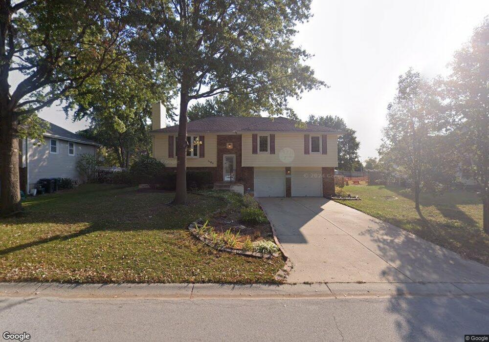
1105 NE Westwind Dr Lees Summit, MO 64086
Estimated Value: $292,000 - $308,363
About This Home
This home is located at 1105 NE Westwind Dr, Lees Summit, MO 64086 and is currently estimated at $301,591, approximately $235 per square foot. 1105 NE Westwind Dr is a home located in Jackson County with nearby schools including Underwood Elementary School, Bernard C. Campbell Middle School, and Lee's Summit North High School.
Ownership History
We collect this data history from publicly available records. To have your information removed, we recommend requesting removal directly through your county’s website.
Purchase Details
Home Financials for this Owner
Home Financials are based on the most recent Mortgage that was taken out on this home.Home Values in the Area
Average Home Value in this Area
Purchase History
We collect this data history from publicly available records. To have your information removed, we recommend requesting removal directly through your county’s website.
| Date | Buyer | Sale Price | Title Company |
|---|---|---|---|
| -- | -- |
Mortgage History
We collect this data history from publicly available records. To have your information removed, we recommend requesting removal directly through your county’s website.
| Date | Status | Borrower | Loan Amount |
|---|---|---|---|
| Open | $91,100 |
Tax History
We collect this data history from publicly available records. To have your information removed, we recommend requesting removal directly through your county’s website.
| Year | Tax Paid | Tax Assessment Tax Assessment Total Assessment is a certain percentage of the fair market value that is determined by local assessors to be the total taxable value of land and additions on the property. | Land | Improvement |
|---|---|---|---|---|
| 2025 | $3,561 | $44,475 | $6,851 | $37,624 |
| 2024 | $3,535 | $49,315 | $5,651 | $43,664 |
| 2023 | $3,535 | $49,315 | $6,312 | $43,003 |
| 2022 | $2,715 | $33,630 | $5,064 | $28,566 |
| 2021 | $2,771 | $33,630 | $5,064 | $28,566 |
| 2020 | $2,609 | $31,360 | $5,064 | $26,296 |
| 2019 | $2,538 | $31,360 | $5,064 | $26,296 |
| 2018 | $2,489 | $28,536 | $4,261 | $24,275 |
| 2017 | $2,503 | $28,536 | $4,261 | $24,275 |
| 2016 | $2,503 | $28,405 | $4,047 | $24,358 |
| 2014 | $2,494 | $27,746 | $4,048 | $23,698 |
Map
- 1128 NE Westwind Dr
- 717 NE Ball Dr
- 724 NE Hunters Ridge
- 705 NE Banner Dr
- 815 NE Independence Ave
- 1204 NE Hendrix Dr
- 1412 NE Ernest Way
- 1512 NE Westwind Dr
- 1416 NE Ernest Way
- 1300 NE Browning Ln
- 809 NE Mulberry St
- 1490 NE Independence Ave
- 705 NE Swann Cir
- 1108 NE Colleen Dr
- 613 NE Coronado Ave
- 1200 NE Colleen Dr
- 908 NE Michael Dr
- 718 NE Mulberry St
- 809 NE Cedar St
- 1700 NE Bluff St
- 1104 NE Westwind Dr
- 1100 NE Westwind Dr
- 1108 NE Westwind Dr
- 1101 NE Westwind Dr
- 1112 NE Westwind Dr
- 1109 NE Westwind Dr
- 1105 NE Ridgeview Dr
- 1101 NE Ridgeview Dr
- 1113 NE Westwind Dr
- 1109 NE Ridgeview Dr
- 1116 NE Westwind Dr
- 1113 NE Ridgeview Dr
- 1117 NE Westwind Dr
- 1120 NE Westwind Dr
- 1117 NE Ridgeview Dr
- 1100 NE Ridgeview Dr
- 1106 NE Richardson Place
- 1102 NE Richardson Place
- 1112 NE Ridgeview Dr
- 1110 NE Richardson Place
Ask me questions while you tour the home.