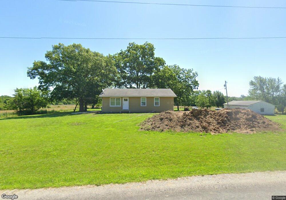
1105 SW 551st Rd Chilhowee, MO 64733
Estimated Value: $135,288 - $475,000
3
Beds
1
Bath
1,104
Sq Ft
$229/Sq Ft
Est. Value
About This Home
This home is located at 1105 SW 551st Rd, Chilhowee, MO 64733 and is currently estimated at $253,322, approximately $229 per square foot. 1105 SW 551st Rd is a home located in Johnson County with nearby schools including Chilhowee Elementary School and Chilhowee High School.
Ownership History
Date
Name
Owned For
Owner Type
Purchase Details
Closed on
Feb 17, 2011
Sold by
Secretary Of Hud
Bought by
Abercrombie Bradley and Gustafson Kelly
Current Estimated Value
Purchase Details
Closed on
Jan 2, 2010
Sold by
Dean Jonathan J
Bought by
Metlife Home Loans
Purchase Details
Closed on
Sep 19, 2008
Sold by
Larkins Veronica H
Bought by
Dean Jonathan J
Home Financials for this Owner
Home Financials are based on the most recent Mortgage that was taken out on this home.
Original Mortgage
$62,505
Interest Rate
6.6%
Mortgage Type
FHA
Purchase Details
Closed on
May 21, 2008
Sold by
Tompkins Bonnie Mae
Bought by
Larkins Veronica H
Home Financials for this Owner
Home Financials are based on the most recent Mortgage that was taken out on this home.
Original Mortgage
$58,450
Interest Rate
5.86%
Mortgage Type
New Conventional
Create a Home Valuation Report for This Property
The Home Valuation Report is an in-depth analysis detailing your home's value as well as a comparison with similar homes in the area
Purchase History
| Date | Buyer | Sale Price | Title Company |
|---|---|---|---|
| Abercrombie Bradley | -- | -- | |
| Metlife Home Loans | $67,456 | None Available | |
| Dean Jonathan J | -- | -- | |
| Larkins Veronica H | -- | -- |
Source: Public Records
Mortgage History
| Date | Status | Borrower | Loan Amount |
|---|---|---|---|
| Previous Owner | Dean Jonathan J | $62,505 | |
| Previous Owner | Larkins Veronica H | $58,450 |
Source: Public Records
Tax History
| Year | Tax Paid | Tax Assessment Tax Assessment Total Assessment is a certain percentage of the fair market value that is determined by local assessors to be the total taxable value of land and additions on the property. | Land | Improvement |
|---|---|---|---|---|
| 2025 | $766 | $10,389 | $0 | $0 |
| 2024 | $766 | $9,531 | $0 | $0 |
| 2023 | $721 | $9,531 | $0 | $0 |
| 2022 | $685 | $9,137 | $0 | $0 |
| 2021 | $686 | $9,137 | $0 | $0 |
| 2020 | $666 | $8,741 | $0 | $0 |
| 2019 | $653 | $8,741 | $0 | $0 |
| 2017 | $629 | $8,741 | $0 | $0 |
| 2016 | $632 | $8,741 | $0 | $0 |
| 2015 | $658 | $8,741 | $0 | $0 |
| 2014 | $644 | $8,741 | $0 | $0 |
Source: Public Records
Map
Nearby Homes
- 206 N Ohio St
- 924 NW 501 Rd
- 720 SW 800th Rd
- 1044 SW 101st Rd
- TBD SW 101st Rd
- 1231 SW 101st Rd
- 6830 NW N Hwy
- 169 SW 800th Rd
- 12 NW 1400th Rd
- 1287 SE State Route 13 N A
- 1246 Missouri 13
- 1287 SE State Route 13
- 9569 NW N Hwy
- Hwy 13
- 1106 SW County Road Kk N A
- 922 NW 501 Rd
- 800 NW 950th Rd
- 0 Lot 5 Tbd 500 Rd
- 1059 SW 1301st Rd
- 0 Rd
- 204 N Rock Island Rd
- 1097 SW Highway F
- 303 E State Route 2
- 209 E State Route 2
- 206 E State Route 2
- 306 N F Hwy
- 107 N Perry Rd
- 207 E State Route 2
- 100 N Rock Island Rd
- 105 N Perry Rd
- 106 N Perry Rd
- 209 N Pennsylvania St
- 209 N Pennsylvania St
- 207 N Pennsylvania St
- 200 E 2 Hwy
- 205 N Pennsylvania St
- 205 N Pennsylvania St
- 201 N Pennsylvania St
- 104 N Perry Rd
- 113 N Pennsylvania St
Your Personal Tour Guide
Ask me questions while you tour the home.