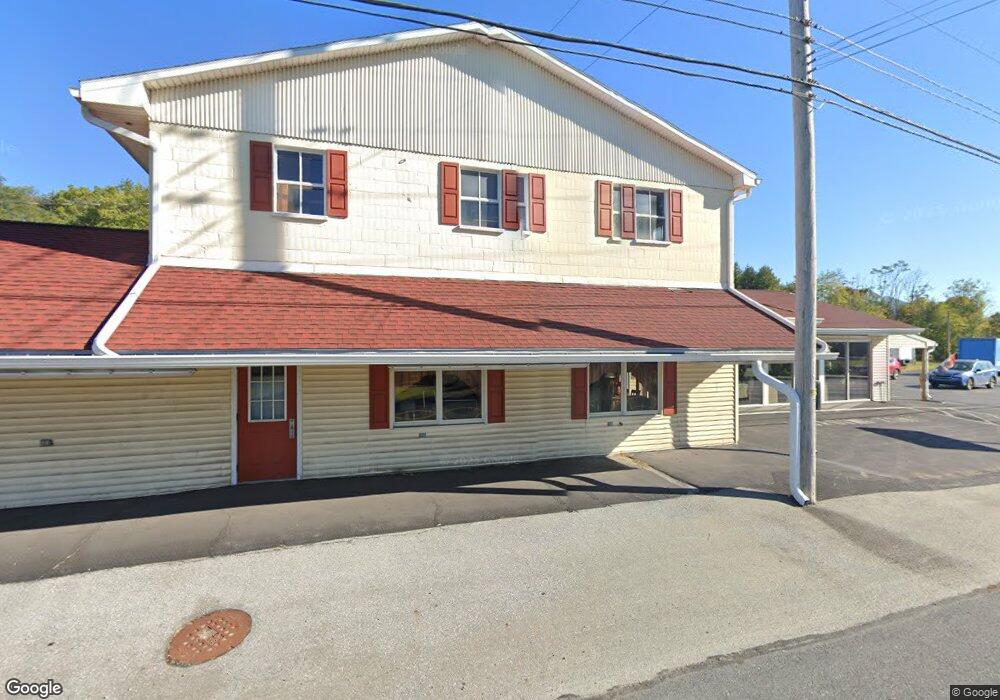
1105 W Main St Mount Joy, PA 17552
--
Bed
--
Bath
8,196
Sq Ft
4
Acres
About This Home
This home is located at 1105 W Main St, Mount Joy, PA 17552. 1105 W Main St is a home located in Lancaster County with nearby schools including Donegal Intermediate School and Donegal High School.
Ownership History
Date
Name
Owned For
Owner Type
Purchase Details
Closed on
May 15, 2003
Sold by
Herr C Willis
Bought by
Moyer Daryl S and Moyer Kay L
Home Financials for this Owner
Home Financials are based on the most recent Mortgage that was taken out on this home.
Original Mortgage
$312,000
Outstanding Balance
$136,095
Interest Rate
5.84%
Mortgage Type
Commercial
Create a Home Valuation Report for This Property
The Home Valuation Report is an in-depth analysis detailing your home's value as well as a comparison with similar homes in the area
Home Values in the Area
Average Home Value in this Area
Purchase History
| Date | Buyer | Sale Price | Title Company |
|---|---|---|---|
| Moyer Daryl S | $390,000 | -- |
Source: Public Records
Mortgage History
| Date | Status | Borrower | Loan Amount |
|---|---|---|---|
| Open | Moyer Daryl S | $312,000 | |
| Closed | Moyer Daryl S | $75,000 |
Source: Public Records
Tax History Compared to Growth
Tax History
| Year | Tax Paid | Tax Assessment Tax Assessment Total Assessment is a certain percentage of the fair market value that is determined by local assessors to be the total taxable value of land and additions on the property. | Land | Improvement |
|---|---|---|---|---|
| 2025 | $9,449 | $370,200 | $153,800 | $216,400 |
| 2024 | $9,449 | $370,200 | $153,800 | $216,400 |
| 2023 | $9,414 | $370,200 | $153,800 | $216,400 |
| 2022 | $9,158 | $370,200 | $153,800 | $216,400 |
| 2021 | $8,800 | $370,200 | $153,800 | $216,400 |
| 2020 | $8,800 | $370,200 | $153,800 | $216,400 |
| 2019 | $8,795 | $370,200 | $153,800 | $216,400 |
| 2018 | $6,725 | $370,200 | $153,800 | $216,400 |
| 2017 | $8,305 | $286,900 | $151,800 | $135,100 |
| 2016 | $8,162 | $286,900 | $151,800 | $135,100 |
| 2015 | $1,717 | $286,900 | $151,800 | $135,100 |
| 2014 | $6,319 | $286,900 | $151,800 | $135,100 |
Source: Public Records
Map
Nearby Homes
- Carter Plan at Florin Hill - Single Family
- Dundee Plan at Florin Hill - Single Family
- Marlow Plan at Florin Hill - Single Family
- Elgin Plan at Florin Hill - Single Family
- Andover Plan at Florin Hill - Single Family
- Anders Plan at Florin Hill - Single Family
- Darby Plan at Florin Hill - Single Family
- Arundel Plan at Florin Hill - Single Family
- Bromley Plan at Florin Hill - Single Family
- Helston Plan at Florin Hill - Single Family
- 104 Merchant Ave Unit ANDOVER
- 104 Merchant Ave Unit MARLOW
- 104 Merchant Ave Unit ELGIN
- 104 Merchant Ave Unit DUNDEE
- 104 Merchant Ave Unit ANDERS
- 104 Merchant Ave Unit ARUNDEL
- 104 Merchant Ave Unit CARTER
- 104 Merchant Ave Unit HELSTON
- 104 Merchant Ave Unit BROMLEY
- 104 Merchant Ave Unit DARBY
- 825/840 W Main Pink
- 1096 W Main St
- 1150 W Main St
- 1113 W Main St
- 126 Lauver Dr
- 1195 W Main St
- 134 Lauver Dr
- 104 Talbot St Unit 1
- 104 Talbot St
- 130 Snyder Rd
- 102 Talbot St
- 100 N Melhorn Dr
- 105 Talbot St
- 105 Talbot St Unit 4
- 138 Snyder Rd
- COG Brittany Ln
- ROG Brittany Ln
- ELG Brittany Ln
- RO Brittany Ln
- EL Brittany Ln