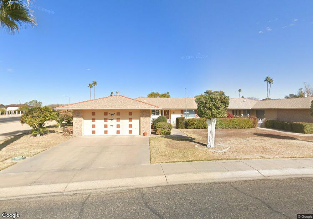
11054 W Caron Dr Sun City, AZ 85351
Estimated Value: $195,901 - $293,000
--
Bed
2
Baths
1,658
Sq Ft
$157/Sq Ft
Est. Value
About This Home
This home is located at 11054 W Caron Dr, Sun City, AZ 85351 and is currently estimated at $259,725, approximately $156 per square foot. 11054 W Caron Dr is a home located in Maricopa County with nearby schools including Desert Mirage Elementary School, Ombudsman - Northwest Charter, and Peoria Accelerated High School.
Ownership History
Date
Name
Owned For
Owner Type
Purchase Details
Closed on
Dec 29, 2000
Sold by
Theiss Elmer A and Theiss Doris I
Bought by
Theiss Elmer A and Theiss Doris I
Current Estimated Value
Purchase Details
Closed on
Jul 15, 1999
Sold by
Nelson Dorothy J and Nelson Lauris C
Bought by
Theiss Elmer A and Theiss Doris I
Home Financials for this Owner
Home Financials are based on the most recent Mortgage that was taken out on this home.
Original Mortgage
$50,000
Interest Rate
8.09%
Mortgage Type
New Conventional
Create a Home Valuation Report for This Property
The Home Valuation Report is an in-depth analysis detailing your home's value as well as a comparison with similar homes in the area
Home Values in the Area
Average Home Value in this Area
Purchase History
| Date | Buyer | Sale Price | Title Company |
|---|---|---|---|
| Theiss Elmer A | -- | -- | |
| Theiss Elmer A | $111,000 | First American Title |
Source: Public Records
Mortgage History
| Date | Status | Borrower | Loan Amount |
|---|---|---|---|
| Previous Owner | Theiss Elmer A | $50,000 |
Source: Public Records
Tax History Compared to Growth
Tax History
| Year | Tax Paid | Tax Assessment Tax Assessment Total Assessment is a certain percentage of the fair market value that is determined by local assessors to be the total taxable value of land and additions on the property. | Land | Improvement |
|---|---|---|---|---|
| 2025 | $334 | $8,823 | -- | -- |
| 2024 | $365 | -- | -- | -- |
| 2023 | $365 | $15,420 | $3,080 | $12,340 |
| 2022 | $372 | $15,420 | $3,080 | $12,340 |
| 2021 | $409 | $15,420 | $3,080 | $12,340 |
| 2020 | $388 | $13,670 | $2,730 | $10,940 |
| 2019 | $373 | $12,500 | $2,500 | $10,000 |
| 2018 | $349 | $10,920 | $2,180 | $8,740 |
| 2017 | $326 | $9,930 | $1,980 | $7,950 |
| 2016 | $161 | $8,460 | $1,690 | $6,770 |
| 2015 | $266 | $7,050 | $1,410 | $5,640 |
Source: Public Records
Map
Nearby Homes
- 11005 W Kelso Dr
- 9415 N 111th Ave
- 9459 N 111th Ave
- 11138 W Hatcher Rd
- 9614 N 110th Ave
- 8842 N 112th Ave
- 10825 W Caron Dr
- 11211 W Lawrence Ln
- 10731 W Mission Ln Unit 200
- 10816 W Venturi Dr
- 10732 W Denham Dr Unit 17
- 10726 W Denham Dr Unit 16
- 10726 W Kelso Dr Unit 172
- 10801 W Mountain View Rd
- 10788 W Cinnebar Ave
- 10707 W Mission Ln
- 11160 W Cinnebar Ave
- 9202 N 107th Ave Unit 8
- 11241 W Ruth Ave
- 10758 W Cinnebar Ave Unit 47
- 11050 W Caron Dr
- 11046 W Caron Dr
- 11021 W Kelso Dr
- 11025 W Kelso Dr
- 11015 W Kelso Dr
- 11049 W Caron Dr
- 11011 W Kelso Dr
- 11042 W Caron Dr
- 11045 W Caron Dr
- 11036 W Caron Dr
- 11039 W Caron Dr
- 11001 W Kelso Dr
- 11102 W Caron Ct
- 11035 W Caron Dr
- 11032 W Caron Dr
- 9227 N 111th Ave
- 9225 N 111th Ave Unit 271
- 9229 N 111th Ave
- 11054 W Tonada Dr
- 9233 N 111th Ave Unit 6G