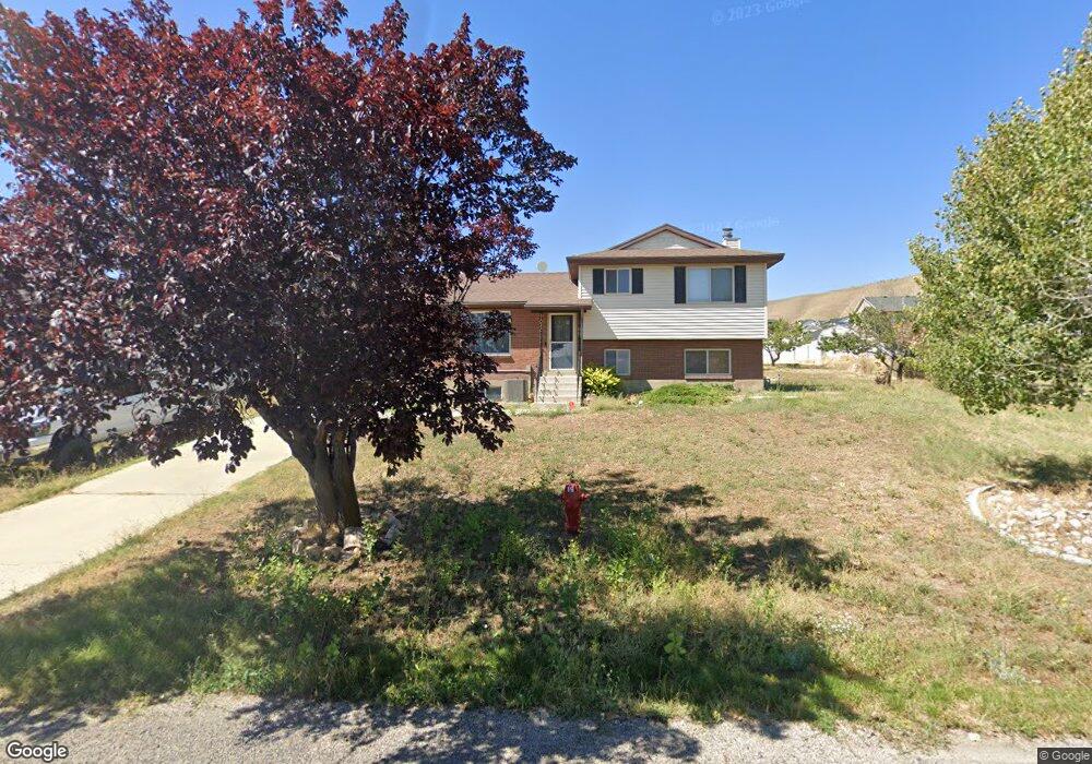
11055 N Anderson Way Tremonton, UT 84337
Estimated Value: $385,000 - $413,000
4
Beds
2
Baths
2,300
Sq Ft
$171/Sq Ft
Est. Value
About This Home
This home is located at 11055 N Anderson Way, Tremonton, UT 84337 and is currently estimated at $393,479, approximately $171 per square foot. 11055 N Anderson Way is a home located in Box Elder County with nearby schools including Garland School, Alice C. Harris Intermediate School, and Bear River Middle School.
Ownership History
Date
Name
Owned For
Owner Type
Purchase Details
Closed on
Nov 7, 2024
Sold by
Adair Kai and Adair Attie
Bought by
Wynne Jason and Wynne Isabelle
Current Estimated Value
Home Financials for this Owner
Home Financials are based on the most recent Mortgage that was taken out on this home.
Original Mortgage
$22,000
Outstanding Balance
$21,779
Interest Rate
6.08%
Estimated Equity
$371,700
Purchase Details
Closed on
Apr 20, 2023
Sold by
Sellers Colin
Bought by
Adair Kai and Adair Attie
Home Financials for this Owner
Home Financials are based on the most recent Mortgage that was taken out on this home.
Original Mortgage
$8,850
Interest Rate
6.73%
Purchase Details
Closed on
Jul 27, 2022
Sold by
Gregory Stephen R
Bought by
Sellers Colin
Home Financials for this Owner
Home Financials are based on the most recent Mortgage that was taken out on this home.
Original Mortgage
$383,625
Interest Rate
5.78%
Mortgage Type
New Conventional
Purchase Details
Closed on
Jul 22, 2022
Sold by
Colin Sellers
Bought by
Sellers Colin and Sellers Laura
Home Financials for this Owner
Home Financials are based on the most recent Mortgage that was taken out on this home.
Original Mortgage
$383,625
Interest Rate
5.78%
Mortgage Type
New Conventional
Purchase Details
Closed on
Feb 6, 2020
Sold by
Wharton Brandon C and Wharton Lacey D
Bought by
Gregory Stephen R
Home Financials for this Owner
Home Financials are based on the most recent Mortgage that was taken out on this home.
Original Mortgage
$243,434
Interest Rate
3.74%
Mortgage Type
New Conventional
Purchase Details
Closed on
Mar 24, 2016
Sold by
Rawlinson Jan
Bought by
Wharton Brandon C and Wharton Lacey D
Home Financials for this Owner
Home Financials are based on the most recent Mortgage that was taken out on this home.
Original Mortgage
$164,524
Interest Rate
3.65%
Mortgage Type
New Conventional
Create a Home Valuation Report for This Property
The Home Valuation Report is an in-depth analysis detailing your home's value as well as a comparison with similar homes in the area
Home Values in the Area
Average Home Value in this Area
Purchase History
| Date | Buyer | Sale Price | Title Company |
|---|---|---|---|
| Wynne Jason | -- | First American Title Insurance | |
| Wynne Jason | -- | First American Title Insurance | |
| Adair Kai | -- | Advanced Title | |
| Sellers Colin | -- | None Listed On Document | |
| Sellers Colin | -- | Advanced Title | |
| Gregory Stephen R | -- | American Secure Ttl Tremonto | |
| Wharton Brandon C | -- | American Secure Title Tremon |
Source: Public Records
Mortgage History
| Date | Status | Borrower | Loan Amount |
|---|---|---|---|
| Open | Wynne Jason | $22,000 | |
| Closed | Wynne Jason | $22,000 | |
| Open | Wynne Jason | $368,207 | |
| Closed | Wynne Jason | $368,207 | |
| Previous Owner | Adair Kai | $8,850 | |
| Previous Owner | Adair Kai | $396,682 | |
| Previous Owner | Sellers Colin | $383,625 | |
| Previous Owner | Gregory Stephen R | $243,434 | |
| Previous Owner | Wharton Brandon C | $164,524 |
Source: Public Records
Tax History Compared to Growth
Tax History
| Year | Tax Paid | Tax Assessment Tax Assessment Total Assessment is a certain percentage of the fair market value that is determined by local assessors to be the total taxable value of land and additions on the property. | Land | Improvement |
|---|---|---|---|---|
| 2025 | $1,600 | $358,577 | $120,000 | $238,577 |
| 2024 | $1,600 | $356,274 | $120,000 | $236,274 |
| 2023 | $1,644 | $370,012 | $120,000 | $250,012 |
| 2022 | $1,538 | $179,515 | $22,000 | $157,515 |
| 2021 | $1,296 | $216,939 | $23,000 | $193,939 |
| 2020 | $1,181 | $216,939 | $23,000 | $193,939 |
| 2019 | $1,046 | $101,539 | $12,650 | $88,889 |
| 2018 | $992 | $89,945 | $12,650 | $77,295 |
| 2017 | $1,028 | $163,536 | $12,650 | $140,536 |
| 2016 | $978 | $86,264 | $12,650 | $73,614 |
| 2015 | $876 | $79,572 | $12,650 | $66,922 |
| 2014 | $876 | $76,385 | $12,650 | $63,735 |
| 2013 | -- | $70,591 | $12,650 | $57,941 |
Source: Public Records
Map
Nearby Homes
- Stanton Plan at Marble Hills
- Xavier Plan at Marble Hills
- Somerley Plan at Marble Hills
- Northfield Plan at Marble Hills
- Norfolk Plan at Marble Hills
- Knighton Plan at Marble Hills
- Kensington Plan at Marble Hills
- Denford Plan at Marble Hills
- Edgeworth Plan at Marble Hills
- Clearpoint Plan at Marble Hills
- Canyon Plan at Marble Hills
- Cambria Plan at Marble Hills
- Berrington Plan at Marble Hills
- Brantwood Plan at Marble Hills
- Ashland Plan at Marble Hills
- 10965 N Wallace Ln
- 10645 N 10800 W Unit 1
- 13464 N 10800 W Unit 4
- 9530 N 11600 W
- 10230 W 11200 N
- 11041 N Anderson Way
- 11041 N Anderson Way
- 11041 N Anderson Way
- 12505 Edna Way
- 11050 N Anderson Way
- 11080 N Cullimore Ln
- 11048 N Cullimore Ln
- 11092 Cullimore Ln
- 11092 N Cullimore Ln
- 11025 Anderson Way
- 11030 N Anderson Way
- 12475 W Edna Way Unit 107
- 12475 W Edna Way Unit 107
- 12475 W Edna Way Unit 107
- 12500 W Edna Way Unit 83
- 11040 N Cullimore Ln W Unit 125
- 12530 W Edna Way
- 11016 N Anderson Way
- 12470 Edna Way
- 11005 Anderson Way