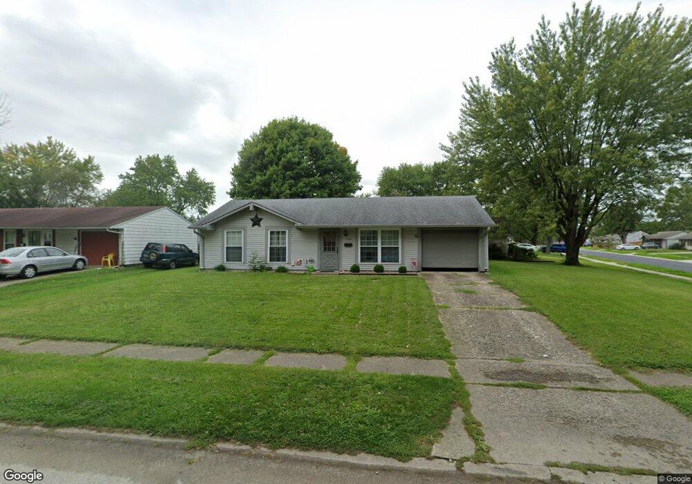
1106 Ashland Ave Whiteland, IN 46184
Estimated Value: $181,906 - $200,000
3
Beds
1
Bath
950
Sq Ft
$203/Sq Ft
Est. Value
About This Home
This home is located at 1106 Ashland Ave, Whiteland, IN 46184 and is currently estimated at $192,477, approximately $202 per square foot. 1106 Ashland Ave is a home located in Johnson County with nearby schools including Break-O-Day Elementary School, Clark-Pleasant Middle School, and Whiteland Community High School.
Ownership History
Date
Name
Owned For
Owner Type
Purchase Details
Closed on
Sep 26, 2008
Sold by
Mccullough Raymond D and Mccullough Derlene
Bought by
Clyngenpeel Jill R
Current Estimated Value
Home Financials for this Owner
Home Financials are based on the most recent Mortgage that was taken out on this home.
Original Mortgage
$84,354
Outstanding Balance
$56,094
Interest Rate
6.43%
Mortgage Type
FHA
Estimated Equity
$136,383
Create a Home Valuation Report for This Property
The Home Valuation Report is an in-depth analysis detailing your home's value as well as a comparison with similar homes in the area
Home Values in the Area
Average Home Value in this Area
Purchase History
| Date | Buyer | Sale Price | Title Company |
|---|---|---|---|
| Clyngenpeel Jill R | -- | First American Title Insuran |
Source: Public Records
Mortgage History
| Date | Status | Borrower | Loan Amount |
|---|---|---|---|
| Open | Clyngenpeel Jill R | $84,354 |
Source: Public Records
Tax History Compared to Growth
Tax History
| Year | Tax Paid | Tax Assessment Tax Assessment Total Assessment is a certain percentage of the fair market value that is determined by local assessors to be the total taxable value of land and additions on the property. | Land | Improvement |
|---|---|---|---|---|
| 2025 | $1,197 | $144,600 | $42,000 | $102,600 |
| 2024 | $1,197 | $137,800 | $42,000 | $95,800 |
| 2023 | $1,229 | $135,600 | $42,000 | $93,600 |
| 2022 | $1,198 | $124,700 | $35,000 | $89,700 |
| 2021 | $1,156 | $117,600 | $35,000 | $82,600 |
| 2020 | $643 | $84,900 | $21,900 | $63,000 |
| 2019 | $546 | $79,100 | $16,700 | $62,400 |
| 2018 | $526 | $77,600 | $14,100 | $63,500 |
| 2017 | $520 | $76,800 | $14,100 | $62,700 |
| 2016 | $483 | $74,000 | $14,100 | $59,900 |
| 2014 | $457 | $67,400 | $14,300 | $53,100 |
| 2013 | $457 | $67,800 | $13,400 | $54,400 |
Source: Public Records
Map
Nearby Homes
- 190 Tracy Ridge Blvd
- 53 Oakden Ct
- 57 Oakden Ct
- 256 Bittersweet Dr
- 106 Tracy Ridge Blvd
- 6540 N Us Highway 31
- 1119 Chateaugay Ct
- 1041 Mount Olive Rd
- 638 Harvest Meadow Way
- 559 Genisis Dr
- 821 Princeton Dr
- 840 Sweetbriar Ave
- 250 Southlane Dr
- 50 Meadow Creek Blvd
- 111 Meadow Creek Blvd
- 0 E 700 N Unit MBR22036500
- 624 Sweetbriar Ave
- 12 Rypma Row
- 539 Delbrook Dr
- 239 Shelton Place
- 1104 Ashland Ave
- 137 Windemere Rd
- 1107 Ashland Ave
- 142 Brentwood Ln
- 1110 Ashland Ave
- 1109 Ashland Ave
- 1105 Ashland Ave
- 138 Brentwood Ln
- 1111 Ashland Ave
- 135 Windemere Rd
- 1103 Ashland Ave
- 138 Windemere Rd
- 1112 Ashland Ave
- 136 Brentwood Ln
- 1113 Ashland Ave
- 1110 Warwick Rd
- 1112 Warwick Rd
- 136 Windemere Rd
- 202 Brentwood Ln
- 133 Windemere Rd