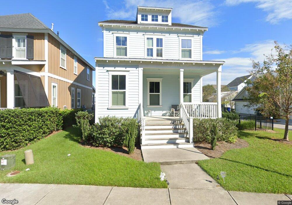
1106 John McEnery Rd Charleston, SC 29412
James Island NeighborhoodEstimated Value: $857,000 - $972,000
3
Beds
4
Baths
2,310
Sq Ft
$392/Sq Ft
Est. Value
About This Home
This home is located at 1106 John McEnery Rd, Charleston, SC 29412 and is currently estimated at $906,668, approximately $392 per square foot. 1106 John McEnery Rd is a home located in Charleston County with nearby schools including James Island Elementary School, Camp Road Middle, and Septima P Clark Corporate Academy.
Ownership History
Date
Name
Owned For
Owner Type
Purchase Details
Closed on
Mar 30, 2016
Sold by
Ashton Charleston Residential Llc
Bought by
Dawson Albert E and Bickel Lauren Elizabeth
Current Estimated Value
Home Financials for this Owner
Home Financials are based on the most recent Mortgage that was taken out on this home.
Original Mortgage
$373,500
Outstanding Balance
$296,333
Interest Rate
3.64%
Mortgage Type
New Conventional
Estimated Equity
$610,335
Purchase Details
Closed on
Oct 16, 2014
Sold by
Freeman Point Developers Llc
Bought by
Ashton Charleston Residential Llc
Create a Home Valuation Report for This Property
The Home Valuation Report is an in-depth analysis detailing your home's value as well as a comparison with similar homes in the area
Home Values in the Area
Average Home Value in this Area
Purchase History
| Date | Buyer | Sale Price | Title Company |
|---|---|---|---|
| Dawson Albert E | $415,000 | -- | |
| Ashton Charleston Residential Llc | $2,200,000 | -- |
Source: Public Records
Mortgage History
| Date | Status | Borrower | Loan Amount |
|---|---|---|---|
| Open | Dawson Albert E | $373,500 |
Source: Public Records
Tax History Compared to Growth
Tax History
| Year | Tax Paid | Tax Assessment Tax Assessment Total Assessment is a certain percentage of the fair market value that is determined by local assessors to be the total taxable value of land and additions on the property. | Land | Improvement |
|---|---|---|---|---|
| 2024 | $2,506 | $19,090 | $0 | $0 |
| 2023 | $2,506 | $19,090 | $0 | $0 |
| 2022 | $2,335 | $19,090 | $0 | $0 |
| 2021 | $2,450 | $19,090 | $0 | $0 |
| 2020 | $2,541 | $19,090 | $0 | $0 |
| 2019 | $2,259 | $16,600 | $0 | $0 |
| 2017 | $2,181 | $16,600 | $0 | $0 |
| 2016 | $6,341 | $24,900 | $0 | $0 |
Source: Public Records
Map
Nearby Homes
- 1028 Hills Plantation Dr
- 1344 Seaside Plantation Dr
- 114 Sea Cotton Cir
- 1250 Seaside Plantation Dr
- 1470 Eutaw Battalion Dr
- 1370 Tidal Creek Cove
- 1173 Sea Eagle Watch
- 632 Goodlet Cir
- 1667 Back Creek Rd
- 1245 Lakefront Dr
- 746 Goodlet Cir
- 742 Majestic Oak Dr
- 1445 Swamp Angel Ct
- 1143 Sea Eagle Watch
- 0 Rafael Ln
- 1601 Secessionville Rd
- 1422 Wexford Sound Dr
- 1338 Garrison St
- 623 Majestic Oaks Dr
- 1410 Ordinance Point
- 1036 Hills Plantation Dr
- 1110 John McEnery Rd
- 1114 John McEnery Rd
- 1024 Hills Plantation Dr
- 1020 Hills Plantation Dr
- 1032 Hills Plantation Dr
- 1122 John McEnery Rd
- 1126 John McEnery Rd
- 1044 Hills Plantation Dr
- 1263 Adela Hills Dr
- 1259 Adela Hills Dr
- 1255 Adela Hills Dr
- 1130 John McEnery Rd
- 1251 Adela Hills Dr
- 1048 Hills Plantation Dr
- 1239 Adela Hills Dr
- 1134 John McEnery Rd
- 1243 Adela Hills Dr
- 1052 Hills Plantation Dr
- 1235 Adela Hills Dr