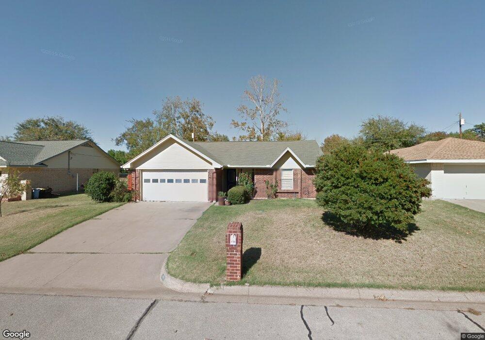
1106 Kay Dr Weatherford, TX 76086
Estimated Value: $248,422 - $296,000
3
Beds
2
Baths
1,249
Sq Ft
$214/Sq Ft
Est. Value
About This Home
This home is located at 1106 Kay Dr, Weatherford, TX 76086 and is currently estimated at $267,606, approximately $214 per square foot. 1106 Kay Dr is a home located in Parker County with nearby schools including Wright Elementary School, Hall Middle School, and Weatherford High School.
Ownership History
Date
Name
Owned For
Owner Type
Purchase Details
Closed on
Dec 5, 2014
Sold by
Holladay Jack and Seidler Robert
Bought by
Moore Ii William Thomas and Moore Lane Allison
Current Estimated Value
Purchase Details
Closed on
Feb 29, 2012
Sold by
Lemons Jeffrey S and Lemons Carolyn D
Bought by
Moore William Thomas and Lane Allison
Purchase Details
Closed on
Nov 30, 2000
Sold by
Cooper Thomas V and Cooper Jacqueline S
Bought by
Moore William Thomas and Lane Allison
Purchase Details
Closed on
Apr 19, 1994
Bought by
Moore William Thomas and Lane Allison
Purchase Details
Closed on
Oct 30, 1992
Bought by
Moore William Thomas and Lane Allison
Purchase Details
Closed on
Mar 9, 1992
Bought by
Moore William Thomas and Lane Allison
Purchase Details
Closed on
Mar 3, 1992
Bought by
Moore William Thomas and Lane Allison
Purchase Details
Closed on
Jul 18, 1986
Bought by
Moore William Thomas and Lane Allison
Create a Home Valuation Report for This Property
The Home Valuation Report is an in-depth analysis detailing your home's value as well as a comparison with similar homes in the area
Home Values in the Area
Average Home Value in this Area
Purchase History
| Date | Buyer | Sale Price | Title Company |
|---|---|---|---|
| Moore Ii William Thomas | -- | Parker County Title Services | |
| Moore William Thomas | -- | -- | |
| Holladay Jack | -- | Parker County Title Services | |
| Moore William Thomas | -- | -- | |
| Moore William Thomas | -- | -- | |
| Moore William Thomas | -- | -- | |
| Moore William Thomas | -- | -- | |
| Moore William Thomas | -- | -- | |
| Moore William Thomas | -- | -- |
Source: Public Records
Tax History Compared to Growth
Tax History
| Year | Tax Paid | Tax Assessment Tax Assessment Total Assessment is a certain percentage of the fair market value that is determined by local assessors to be the total taxable value of land and additions on the property. | Land | Improvement |
|---|---|---|---|---|
| 2025 | $4,405 | $230,540 | $50,000 | $180,540 |
| 2024 | $4,405 | $228,540 | $40,000 | $188,540 |
| 2023 | $4,405 | $228,540 | $40,000 | $188,540 |
| 2022 | $3,465 | $156,230 | $20,000 | $136,230 |
| 2021 | $3,752 | $156,230 | $20,000 | $136,230 |
| 2020 | $3,065 | $126,870 | $20,000 | $106,870 |
| 2019 | $3,240 | $126,870 | $20,000 | $106,870 |
| 2018 | $2,816 | $109,800 | $20,000 | $89,800 |
| 2017 | $2,889 | $109,800 | $20,000 | $89,800 |
| 2016 | $2,769 | $105,230 | $20,000 | $85,230 |
| 2015 | $2,711 | $105,230 | $20,000 | $85,230 |
| 2014 | $2,196 | $87,440 | $20,000 | $67,440 |
Source: Public Records
Map
Nearby Homes
- 918 El Dorado St
- 905 Eldorado St
- 1816 Barberry
- 102 Bob White Ave
- 612 W Park Ave
- 1813 Barberry Way
- 741 Nandina Rd
- 423 Live Oak Ln
- 106 Marys Ln
- 1921 Bay Laurel Dr
- 209 S Hill Dr
- 1413 Westwood Dr
- 1525 Oak Tree Cir
- 323 W Rentz St
- 1015 W Park Ave Unit D
- 1015 W Park Ave Unit LOT A
- 1015 W Park Ave Unit LOT B
- 1213 S Lamar St
- 1220 S Brazos St
- 122 Rachel Rd