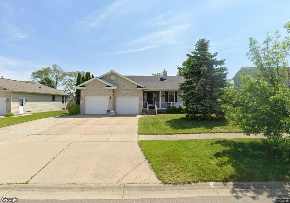
1106 Lois Ln Saint Johns, MI 48879
Estimated Value: $292,000 - $396,000
3
Beds
3
Baths
2,543
Sq Ft
$130/Sq Ft
Est. Value
About This Home
This home is located at 1106 Lois Ln, Saint Johns, MI 48879 and is currently estimated at $331,071, approximately $130 per square foot. 1106 Lois Ln is a home located in Clinton County with nearby schools including St. Johns High School and St Joseph Catholic School.
Ownership History
Date
Name
Owned For
Owner Type
Purchase Details
Closed on
Oct 1, 2024
Sold by
Brown Robert
Bought by
Brown Robert F and Brown Gail A
Current Estimated Value
Purchase Details
Closed on
Apr 29, 2009
Sold by
Wadsworth Steven R and Wadsworth Sharon L
Bought by
Federal Home Loan Mortgage Corporation
Purchase Details
Closed on
Jan 22, 2009
Sold by
Wadsworth Steven Richard
Bought by
Wadsworth Sharon Louise
Create a Home Valuation Report for This Property
The Home Valuation Report is an in-depth analysis detailing your home's value as well as a comparison with similar homes in the area
Home Values in the Area
Average Home Value in this Area
Purchase History
| Date | Buyer | Sale Price | Title Company |
|---|---|---|---|
| Brown Robert F | -- | None Listed On Document | |
| Federal Home Loan Mortgage Corporation | $143,921 | None Available | |
| Wadsworth Sharon Louise | -- | None Available |
Source: Public Records
Tax History
| Year | Tax Paid | Tax Assessment Tax Assessment Total Assessment is a certain percentage of the fair market value that is determined by local assessors to be the total taxable value of land and additions on the property. | Land | Improvement |
|---|---|---|---|---|
| 2025 | $4,425 | $163,400 | $15,000 | $148,400 |
| 2024 | $30 | $155,500 | $15,000 | $140,500 |
| 2023 | $2,836 | $142,500 | $0 | $0 |
| 2022 | $3,972 | $130,800 | $13,100 | $117,700 |
| 2021 | $3,880 | $123,200 | $11,200 | $112,000 |
| 2020 | $3,748 | $114,500 | $10,300 | $104,200 |
| 2019 | $3,624 | $103,600 | $10,300 | $93,300 |
| 2018 | $3,413 | $99,300 | $10,300 | $89,000 |
| 2017 | -- | $91,900 | $10,300 | $81,600 |
| 2016 | -- | $87,000 | $10,400 | $76,600 |
| 2015 | -- | $86,100 | $0 | $0 |
| 2011 | -- | $88,400 | $0 | $0 |
Source: Public Records
Map
Nearby Homes
- 1103 Kelcrasta Dr
- 606 W Gibbs St
- 509 W Gibbs St
- 719 N Clinton Ave
- 608 N Morton St
- 609 N Morton St Unit 13
- 609 N Morton St Unit 80
- 609 N Morton St Unit 57
- 609 N Morton St Unit 17
- 905 W Gibbs St Unit 28
- 111 W Steel St
- 107 W Steel St
- 210 Ross St
- 810 Joyce Ln
- 808 Joyce Ln
- 705 N Us127
- 912 Randy Ln Unit 6
- 502 W State St
- 100 N Oakland St
- 1455 W Hyde Rd
- 1108 Lois Ln
- 1104 Lois Ln
- 1102 Lois Ln
- 0 S Lowell Unit 230978
- 0 S Dewitt Unit 227644
- 0 S Lowell Unit 224667
- 0 W Maple Rapids Unit 224322
- 0 Gibbs Unit 1841102
- 0 Pratt Rd Unit 30047339
- 0 Krepps Unit 30063135
- 0 W Maple Rapids Unit 219949
- 0 S Lowell Unit 219209
- 605 N Br127 St
- 0 S Dewitt Unit 218080
- 1 Colony Rd St
- 1 Walker Rd St
- 0 Lowe Rd Parcel A Unit 72426
- 00 S Dewitt Rd Parcel A St
- 0 S Lowell Unit 215571
- 0 S Lowell Unit 215572
Your Personal Tour Guide
Ask me questions while you tour the home.