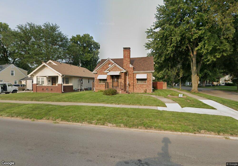
1106 N Oakland Ave Decatur, IL 62522
Garfield Park NeighborhoodEstimated Value: $53,332 - $106,000
--
Bed
--
Bath
1,307
Sq Ft
$57/Sq Ft
Est. Value
About This Home
This home is located at 1106 N Oakland Ave, Decatur, IL 62522 and is currently estimated at $74,083, approximately $56 per square foot. 1106 N Oakland Ave is a home located in Macon County with nearby schools including Stephen Decatur Middle School, Northwest Christian Campus, and Teen Challenge-Home For Girls.
Ownership History
Date
Name
Owned For
Owner Type
Purchase Details
Closed on
Jul 27, 2023
Sold by
Sangster Tonya L and Sangster Jacolby
Bought by
Sangster Tonya L and Sangster Jacolby
Current Estimated Value
Home Financials for this Owner
Home Financials are based on the most recent Mortgage that was taken out on this home.
Original Mortgage
$20,000
Outstanding Balance
$18,187
Interest Rate
6.1%
Mortgage Type
New Conventional
Estimated Equity
$55,896
Create a Home Valuation Report for This Property
The Home Valuation Report is an in-depth analysis detailing your home's value as well as a comparison with similar homes in the area
Home Values in the Area
Average Home Value in this Area
Purchase History
| Date | Buyer | Sale Price | Title Company |
|---|---|---|---|
| Sangster Tonya L | -- | None Listed On Document |
Source: Public Records
Mortgage History
| Date | Status | Borrower | Loan Amount |
|---|---|---|---|
| Open | Sangster Tonya L | $20,000 |
Source: Public Records
Tax History Compared to Growth
Tax History
| Year | Tax Paid | Tax Assessment Tax Assessment Total Assessment is a certain percentage of the fair market value that is determined by local assessors to be the total taxable value of land and additions on the property. | Land | Improvement |
|---|---|---|---|---|
| 2024 | $928 | $13,339 | $437 | $12,902 |
| 2023 | $954 | $12,867 | $422 | $12,445 |
| 2022 | $981 | $12,141 | $390 | $11,751 |
| 2021 | $987 | $11,339 | $365 | $10,974 |
| 2020 | $1,020 | $10,813 | $349 | $10,464 |
| 2019 | $1,020 | $10,813 | $349 | $10,464 |
| 2018 | $1,007 | $11,863 | $198 | $11,665 |
| 2017 | $1,004 | $12,179 | $203 | $11,976 |
| 2016 | $1,013 | $12,303 | $205 | $12,098 |
| 2015 | $980 | $12,085 | $201 | $11,884 |
| 2014 | $919 | $13,603 | $222 | $13,381 |
| 2013 | $915 | $14,114 | $230 | $13,884 |
Source: Public Records
Map
Nearby Homes
- 917 N Wilder Ave
- 1319 W Waggoner St
- 1065 W Green St
- 837 W Grand Ave
- 1451 W Marietta St
- 933 W Division St
- 1535 N Mcclellan Ave
- 1530 W Cushing St
- 925 W Olive St
- 1645 W Center St
- 1653 N Maple Ave
- 1675 W Center St
- 1545 N Monroe St
- 1415 N Dennis Ave
- 875 N Monroe St
- 1504 N Monroe St
- 958 W William St
- 644 W Division St
- 1706 W Division St
- 415 W Green St
- 1116 N Oakland Ave
- 1086 W Packard St
- 1109 N Oakland Ave
- 1140 N Oakland Ave
- 1117 N Oakland Ave
- 1133 N Oakland Ave
- 1073 W Leafland Ave
- 1076 W Packard St
- 1052 N Oakland Ave
- 1075 W Packard St
- 1073 W Packard St
- 1057 N Oakland Ave
- 1062 W Packard St
- 1069 W Packard St
- 1061 W Leafland Ave
- 1124 W Packard St
- 1047 N Oakland Ave
- 1141 N Oakland Ave
- 1034 N Oakland Ave
- 1059 W Packard St