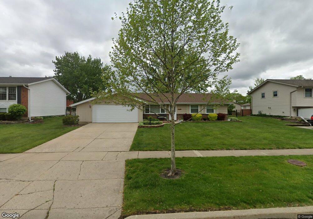
1106 S Cedarcrest Dr Schaumburg, IL 60193
South Schaumburg NeighborhoodEstimated Value: $425,000 - $472,000
3
Beds
2
Baths
1,390
Sq Ft
$321/Sq Ft
Est. Value
About This Home
This home is located at 1106 S Cedarcrest Dr, Schaumburg, IL 60193 and is currently estimated at $445,527, approximately $320 per square foot. 1106 S Cedarcrest Dr is a home located in Cook County with nearby schools including Edwin Aldrin Elementary School, Robert Frost Junior High School, and Schaumburg High School.
Ownership History
Date
Name
Owned For
Owner Type
Purchase Details
Closed on
Apr 21, 2010
Sold by
Barsanti Robert P
Bought by
Deering Mary A
Current Estimated Value
Home Financials for this Owner
Home Financials are based on the most recent Mortgage that was taken out on this home.
Original Mortgage
$100,000
Interest Rate
4.81%
Mortgage Type
New Conventional
Create a Home Valuation Report for This Property
The Home Valuation Report is an in-depth analysis detailing your home's value as well as a comparison with similar homes in the area
Home Values in the Area
Average Home Value in this Area
Purchase History
| Date | Buyer | Sale Price | Title Company |
|---|---|---|---|
| Deering Mary A | $220,000 | Atgf Inc |
Source: Public Records
Mortgage History
| Date | Status | Borrower | Loan Amount |
|---|---|---|---|
| Previous Owner | Deering Mary A | $100,000 |
Source: Public Records
Tax History Compared to Growth
Tax History
| Year | Tax Paid | Tax Assessment Tax Assessment Total Assessment is a certain percentage of the fair market value that is determined by local assessors to be the total taxable value of land and additions on the property. | Land | Improvement |
|---|---|---|---|---|
| 2024 | $4,857 | $32,000 | $7,866 | $24,134 |
| 2023 | $4,859 | $32,000 | $7,866 | $24,134 |
| 2022 | $4,859 | $32,000 | $7,866 | $24,134 |
| 2021 | $6,087 | $23,412 | $5,899 | $17,513 |
| 2020 | $6,050 | $23,412 | $5,899 | $17,513 |
| 2019 | $6,054 | $26,014 | $5,899 | $20,115 |
| 2018 | $5,112 | $20,468 | $5,025 | $15,443 |
| 2017 | $5,049 | $20,468 | $5,025 | $15,443 |
| 2016 | $4,964 | $20,468 | $5,025 | $15,443 |
| 2015 | $5,363 | $20,549 | $4,370 | $16,179 |
| 2014 | $5,320 | $20,549 | $4,370 | $16,179 |
| 2013 | $5,166 | $20,549 | $4,370 | $16,179 |
Source: Public Records
Map
Nearby Homes
- 415 Laconia Ln
- 1109 Beach Comber Dr
- 357 Lucille Ln Unit 30
- 1342 Lunt Ct Unit 56
- 1520 Grant St
- 1008 Shannock Ln
- 727 Killarney Ct Unit 1C
- 988 Chelsea Ln
- 818 Brentwood Ct
- 635 Limerick Ln Unit 2B
- 733 Limerick Ln Unit 7333D
- 631 Derry Ct Unit 3C
- 36 Shore Dr
- 516 W Weathersfield Way
- 1104 Taunton Ct
- 711 Tipperary Ct Unit 2D
- 1150 Attleboro Ct
- 614 Tralee Ct Unit 2-C
- 507 Ash Ct
- 1285 Cranbrook Dr
- 1110 S Cedarcrest Dr
- 1100 S Cedarcrest Dr
- 1047 Spring Cove Dr
- 1051 Spring Cove Dr
- 1043 Spring Cove Dr
- 1114 S Cedarcrest Dr
- 1111 S Cedarcrest Dr
- 1055 Spring Cove Dr
- 1039 Spring Cove Dr
- 1035 S Cedarcrest Dr
- 1118 S Cedarcrest Dr
- 1028 S Cedarcrest Dr
- 1117 S Cedarcrest Dr
- 419 Worcester Ct
- 1035 Spring Cove Dr
- 420 Worchester Ct
- 420 Worcester Ct
- 562 Lorelei Dr
- 420 Danbury Ct
- 1027 S Cedarcrest Dr