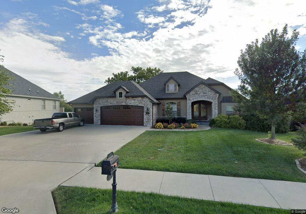
1106 Shallow Ridge Cir Columbia, MO 65201
Old Hawthorne NeighborhoodEstimated Value: $693,000 - $804,000
4
Beds
3
Baths
3,708
Sq Ft
$206/Sq Ft
Est. Value
About This Home
This home is located at 1106 Shallow Ridge Cir, Columbia, MO 65201 and is currently estimated at $764,238, approximately $206 per square foot. 1106 Shallow Ridge Cir is a home with nearby schools including Cedar Ridge Elementary School, Oakland Middle School, and Muriel W. Battle High School.
Ownership History
Date
Name
Owned For
Owner Type
Purchase Details
Closed on
Apr 1, 2015
Sold by
Old Hawthorne Development Llc
Bought by
Keeney James A and Kenney Connie S
Current Estimated Value
Home Financials for this Owner
Home Financials are based on the most recent Mortgage that was taken out on this home.
Original Mortgage
$443,860
Outstanding Balance
$341,816
Interest Rate
3.75%
Mortgage Type
Adjustable Rate Mortgage/ARM
Estimated Equity
$422,422
Purchase Details
Closed on
Jan 28, 2014
Sold by
Jost Matthew and Nix Michele
Bought by
Old Hawthorne Development Llc
Create a Home Valuation Report for This Property
The Home Valuation Report is an in-depth analysis detailing your home's value as well as a comparison with similar homes in the area
Home Values in the Area
Average Home Value in this Area
Purchase History
| Date | Buyer | Sale Price | Title Company |
|---|---|---|---|
| Keeney James A | -- | None Available | |
| Old Hawthorne Development Llc | -- | Boone Central Title Company |
Source: Public Records
Mortgage History
| Date | Status | Borrower | Loan Amount |
|---|---|---|---|
| Open | Keeney James A | $443,860 |
Source: Public Records
Tax History Compared to Growth
Tax History
| Year | Tax Paid | Tax Assessment Tax Assessment Total Assessment is a certain percentage of the fair market value that is determined by local assessors to be the total taxable value of land and additions on the property. | Land | Improvement |
|---|---|---|---|---|
| 2025 | $6,519 | $110,637 | $22,800 | $87,837 |
| 2024 | $6,519 | $96,634 | $22,800 | $73,834 |
| 2023 | $6,465 | $96,634 | $22,800 | $73,834 |
| 2022 | $6,210 | $92,910 | $22,800 | $70,110 |
| 2021 | $6,221 | $92,910 | $22,800 | $70,110 |
| 2020 | $6,621 | $92,910 | $22,800 | $70,110 |
| 2019 | $6,621 | $92,910 | $22,800 | $70,110 |
| 2018 | $6,667 | $0 | $0 | $0 |
| 2017 | $6,587 | $92,910 | $22,800 | $70,110 |
| 2016 | $6,575 | $92,910 | $22,800 | $70,110 |
| 2015 | $593 | $9,120 | $9,120 | $0 |
| 2014 | $595 | $9,120 | $9,120 | $0 |
Source: Public Records
Map
Nearby Homes
- 1303 Morning Dove Dr
- 1209 Marcassin Dr
- 1301 Morning Dove Dr
- 5402 Wild Horse Ct
- 1104 Caymus Ct
- 1108 Shore Acres Loop
- 1050 Shore Acres Loop
- 5012 Kenora Dr
- 5703 Bower Ln
- 4917 Longbow Dr
- 4801 Hoylake Cir
- 1811 Trellis Ln
- 4805 Hoylake Cir
- 613 Sahalee Ct
- 506 Bandon Dunes Ct
- 4813 Hoylake Cir
- 505 Bandon Dunes Ct
- 602 Old Hawthorne Dr E
- 1104 Shadow Hawk Ct
- 1108 Shadow Hawk Ct
- 1108 Shallow Ridge Cir
- 1104 Shallow Ridge Cir
- 1105 Shallow Ridge Cir
- 1103 Shallow Ridge Cir
- 1102 Shallow Ridge Cir
- 1107 Shallow Ridge Cir
- 1101 Shallow Ridge Cir
- LOT 717 Shallow Ridge Cir
- 1201 Shallow Ridge Cir
- 1100 Shallow Ridge Cir
- 5610 Lightpost Dr
- 5612 Lightpost Dr
- 1204 Shallow Ridge Cir
- 1205 Shallow Ridge Cir
- LOT 717 Old Hawthorne-Shallow Ridge
- 2023 Random Ridge
- 2027 Random Ridge
- 2031 Random Ridge
- 4429 Stone Mountain Pkwy
- 2104 Random Ridge