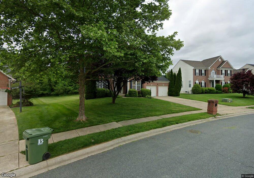
1106 Sparrow Mill Way Bel Air, MD 21015
Estimated Value: $703,606 - $831,000
--
Bed
4
Baths
2,653
Sq Ft
$293/Sq Ft
Est. Value
About This Home
This home is located at 1106 Sparrow Mill Way, Bel Air, MD 21015 and is currently estimated at $776,652, approximately $292 per square foot. 1106 Sparrow Mill Way is a home located in Harford County with nearby schools including Fountain Green Elementary School, Southampton Middle School, and C. Milton Wright High School.
Ownership History
Date
Name
Owned For
Owner Type
Purchase Details
Closed on
Jun 16, 2004
Sold by
Keiner Martin
Bought by
Spatz Glenn B and Spatz Michelle E
Current Estimated Value
Purchase Details
Closed on
Jun 4, 2004
Sold by
Keiner Martin
Bought by
Spatz Glenn B and Spatz Michelle E
Purchase Details
Closed on
Dec 26, 2002
Sold by
Ryland Group Inc The
Bought by
Keiner Martin and Keiner Betty
Purchase Details
Closed on
Aug 2, 2002
Sold by
1022 South Fountain Green Road Llc
Bought by
Ryland Group Inc The
Create a Home Valuation Report for This Property
The Home Valuation Report is an in-depth analysis detailing your home's value as well as a comparison with similar homes in the area
Home Values in the Area
Average Home Value in this Area
Purchase History
| Date | Buyer | Sale Price | Title Company |
|---|---|---|---|
| Spatz Glenn B | $440,000 | -- | |
| Spatz Glenn B | $440,000 | -- | |
| Keiner Martin | $338,427 | -- | |
| Ryland Group Inc The | $75,000 | -- |
Source: Public Records
Mortgage History
| Date | Status | Borrower | Loan Amount |
|---|---|---|---|
| Closed | Spatz Glenn B | -- |
Source: Public Records
Tax History Compared to Growth
Tax History
| Year | Tax Paid | Tax Assessment Tax Assessment Total Assessment is a certain percentage of the fair market value that is determined by local assessors to be the total taxable value of land and additions on the property. | Land | Improvement |
|---|---|---|---|---|
| 2025 | $5,527 | $530,200 | $163,900 | $366,300 |
| 2024 | $5,527 | $507,067 | $0 | $0 |
| 2023 | $5,273 | $483,933 | $0 | $0 |
| 2022 | $5,022 | $460,800 | $163,900 | $296,900 |
| 2021 | $5,278 | $459,067 | $0 | $0 |
| 2020 | $5,278 | $457,333 | $0 | $0 |
| 2019 | $5,258 | $455,600 | $144,900 | $310,700 |
| 2018 | $5,141 | $449,567 | $0 | $0 |
| 2017 | $5,072 | $455,600 | $0 | $0 |
| 2016 | $140 | $437,500 | $0 | $0 |
| 2015 | $5,403 | $437,500 | $0 | $0 |
| 2014 | $5,403 | $437,500 | $0 | $0 |
Source: Public Records
Map
Nearby Homes
- 1431 Valbrook Ct S
- 1358 Merry Hill Ct
- 1502 Brierhill Estates Dr
- Yorktown Plan at Roberts Crossing
- Coronado Plan at Roberts Crossing
- Hemingway Plan at Roberts Crossing
- 1705 Stone Ridge Ct
- 1605 Shady Tree Ct
- 1607 Shady Tree Ct
- 1609 Shady Tree Ct
- 1453 Redfield Rd
- 1612 Shady Tree Ct
- 1613 Shady Tree Ct
- 1518 Windwood Rd
- 1614 Shady Tree Ct
- 1617 Shady Tree Ct
- 1618 Shady Tree Ct
- 1619 Shady Tree Ct
- 1620 Shady Tree Ct
- 1622 Shady Tree Ct
- 1108 Sparrow Mill Way
- 1104 Sparrow Mill Way
- 1102 Sparrow Mill Way
- 1110 Sparrow Mill Way
- 1103 Sparrow Mill Way
- 1112 Sparrow Mill Way
- 1159 Sparrow Mill Way
- 1161 Sparrow Mill Way
- 1115 Sparrow Mill Way
- 1155 Sparrow Mill Way
- 1114 Sparrow Mill Way
- 1433 Landis Cir
- 1431 Landis Cir
- 1435 Landis Cir
- 1429 Landis Cir
- 1437 Landis Cir
- 1439 Landis Cir
- 1427 Landis Cir
- 1704 Kendall Gate Way
- 1702 Kendall Gate Way