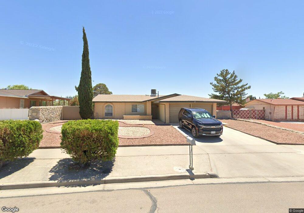
11060 Sam Snead Dr Unit 1 El Paso, TX 79936
Glen Cove NeighborhoodEstimated Value: $219,539 - $257,000
3
Beds
2
Baths
1,612
Sq Ft
$143/Sq Ft
Est. Value
About This Home
This home is located at 11060 Sam Snead Dr Unit 1, El Paso, TX 79936 and is currently estimated at $230,135, approximately $142 per square foot. 11060 Sam Snead Dr Unit 1 is a home located in El Paso County with nearby schools including Glen Cove Elementary School, J.M. Hanks Middle School, and J M Hanks High School.
Ownership History
Date
Name
Owned For
Owner Type
Purchase Details
Closed on
Jul 26, 2016
Sold by
Homes Joyce and Homes James L
Bought by
Alshouse Laura
Current Estimated Value
Home Financials for this Owner
Home Financials are based on the most recent Mortgage that was taken out on this home.
Original Mortgage
$75,194
Outstanding Balance
$60,112
Interest Rate
3.54%
Estimated Equity
$170,023
Purchase Details
Closed on
Aug 24, 2015
Sold by
Gacke Carmela
Bought by
Holmes Joyce and Holmes James L
Purchase Details
Closed on
Aug 11, 1994
Sold by
Gacke Roger Lee
Bought by
Gacke Carmela
Create a Home Valuation Report for This Property
The Home Valuation Report is an in-depth analysis detailing your home's value as well as a comparison with similar homes in the area
Home Values in the Area
Average Home Value in this Area
Purchase History
| Date | Buyer | Sale Price | Title Company |
|---|---|---|---|
| Alshouse Laura | -- | None Available | |
| Holmes Joyce | -- | None Available | |
| Gacke Carmela | -- | -- |
Source: Public Records
Mortgage History
| Date | Status | Borrower | Loan Amount |
|---|---|---|---|
| Open | Alshouse Laura | $75,194 |
Source: Public Records
Tax History Compared to Growth
Tax History
| Year | Tax Paid | Tax Assessment Tax Assessment Total Assessment is a certain percentage of the fair market value that is determined by local assessors to be the total taxable value of land and additions on the property. | Land | Improvement |
|---|---|---|---|---|
| 2025 | $5,309 | $209,190 | $43,991 | $165,199 |
| 2024 | $5,309 | $193,285 | $28,086 | $165,199 |
| 2023 | $5,385 | $185,025 | $28,086 | $156,939 |
| 2022 | $5,393 | $173,683 | $28,086 | $145,597 |
| 2021 | $4,556 | $140,160 | $28,086 | $112,074 |
| 2020 | $3,877 | $122,739 | $20,838 | $101,901 |
| 2018 | $3,788 | $121,798 | $20,838 | $100,960 |
| 2017 | $3,414 | $111,693 | $20,838 | $90,855 |
| 2016 | $3,414 | $111,693 | $20,838 | $90,855 |
| 2015 | $1,672 | $111,693 | $20,838 | $90,855 |
| 2014 | $1,672 | $111,928 | $20,838 | $91,090 |
Source: Public Records
Map
Nearby Homes
- 2308 Tom Watson Ct
- 11008 Johnny Miller Dr
- 11013 Bob Stone Dr
- 2604 Anise Dr
- 11016 Bob Stone Dr
- 11012 Bob Stone Dr
- 2348 Sea Side Dr
- 2009 Bobby Jones Dr Unit B
- 2001 Bobby Jones Dr Unit A
- 1913 Seagull Dr
- 2325 Ken Venturi Ln
- 11132 Wharf Cove Dr
- 2825 Wong Place Unit A/D
- 1868 Tom Bolt Dr
- 2820 Beachcomber Dr
- 1901 Bobby Jones Dr
- 1817 Hugh Royer Place
- 10916 Miller Barber Dr
- 11201 Skipper Dr
- 11276 Skipper Dr
- 11060 Sam Snead Dr
- 11064 Sam Snead Dr
- 11056 Sam Snead Dr
- 11065 Johnny Miller Dr
- 11059 Johnny Miller Dr
- 11069 Johnny Miller Dr
- 11055 Johnny Miller Dr
- 11055 Johnny Miller Dr Unit 1
- 11052 Sam Snead Dr
- 11065 Sam Snead Dr
- 11055 Sam Snead Dr
- 11051 Johnny Miller Dr
- 2224 Lee Elder Dr
- 11069 Sam Snead Dr
- 11048 Sam Snead Dr
- 2220 Lee Elder Dr
- 11051 Sam Snead Dr
- 11047 Johnny Miller Dr
- 11062 Johnny Miller Dr
- 11058 Johnny Miller Dr