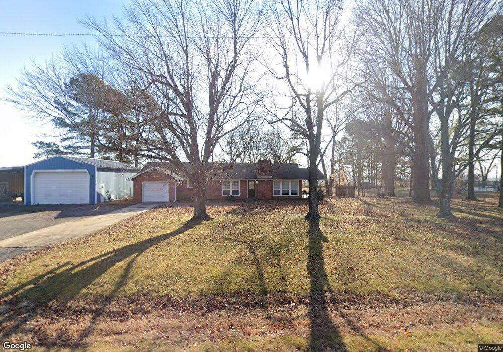
11060 State Highway 25 Dexter, MO 63841
Estimated Value: $179,845 - $204,000
3
Beds
1
Bath
1,363
Sq Ft
$143/Sq Ft
Est. Value
About This Home
This home is located at 11060 State Highway 25, Dexter, MO 63841 and is currently estimated at $195,461, approximately $143 per square foot. 11060 State Highway 25 is a home located in Stoddard County with nearby schools including Southwest Elementary School, Central Elementary School, and T.S. Hill Middle School.
Ownership History
Date
Name
Owned For
Owner Type
Purchase Details
Closed on
May 29, 2020
Sold by
Alsup and Brittany
Bought by
Robey Daniel R
Current Estimated Value
Home Financials for this Owner
Home Financials are based on the most recent Mortgage that was taken out on this home.
Original Mortgage
$130,150
Outstanding Balance
$115,583
Interest Rate
3.3%
Mortgage Type
Construction
Estimated Equity
$79,878
Purchase Details
Closed on
Nov 7, 2014
Sold by
Virginia Sherfield
Bought by
Alsup Jared and Alsup Brittany
Home Financials for this Owner
Home Financials are based on the most recent Mortgage that was taken out on this home.
Original Mortgage
$98,100
Interest Rate
4.23%
Mortgage Type
New Conventional
Create a Home Valuation Report for This Property
The Home Valuation Report is an in-depth analysis detailing your home's value as well as a comparison with similar homes in the area
Home Values in the Area
Average Home Value in this Area
Purchase History
| Date | Buyer | Sale Price | Title Company |
|---|---|---|---|
| Robey Daniel R | $162,687 | National Title & Escrow Inc | |
| Alsup Jared | $122,625 | Countywide Abstract Lp |
Source: Public Records
Mortgage History
| Date | Status | Borrower | Loan Amount |
|---|---|---|---|
| Open | Robey Daniel R | $130,150 | |
| Previous Owner | Alsup Jared | $98,100 |
Source: Public Records
Tax History Compared to Growth
Tax History
| Year | Tax Paid | Tax Assessment Tax Assessment Total Assessment is a certain percentage of the fair market value that is determined by local assessors to be the total taxable value of land and additions on the property. | Land | Improvement |
|---|---|---|---|---|
| 2025 | $882 | $20,178 | $0 | $0 |
| 2024 | $882 | $19,057 | $0 | $0 |
| 2023 | $881 | $19,057 | $0 | $0 |
| 2022 | $844 | $18,297 | $0 | $0 |
| 2021 | $844 | $18,297 | $0 | $0 |
| 2020 | $811 | $17,157 | $0 | $0 |
| 2019 | $810 | $17,480 | $0 | $0 |
| 2018 | $790 | $17,157 | $0 | $0 |
| 2016 | $754 | $16,891 | $0 | $0 |
| 2015 | -- | $16,891 | $0 | $0 |
| 2014 | -- | $16,853 | $0 | $0 |
| 2013 | -- | $0 | $0 | $0 |
Source: Public Records
Map
Nearby Homes
- 11289 S Business Highway 25
- 427 State Highway Af
- 1001 S One Mile Rd
- 0 Lewis & Albert St Unit MAR25013843
- 0 Glenwood Hills Est Lot 5 Blk 2 Unit MAR25015299
- 828 S Lewis St
- 908 E Cottonwood Ln
- 103 Boucher St
- 909 Saddle Spur Rd
- 106 W Grant St
- 322 S Locust St
- 213 S Sassafras
- 727 W Fannetta St
- 1407 Birch Creek Ct
- 725 W Bain St
- 805 W Bain St
- 324 Vine St
- 502 Chautauqua Ln
- 802 Chautauqua Ln
- 121 S Poplar St
- 11060 Missouri 25
- 10998 State Highway 25
- 10974 State Highway 25
- 11003 State Highway 25
- 10926 State Highway 25
- 10951 State Highway 25
- 10820 Robin Ln
- 10912 State Highway 25
- 11123 Business Highway 25
- 11067 Business Highway 25
- 10894 State Highway 25
- 10829 Robin Ln
- 11099 Business Highway 25
- 10837 Robin Ln
- 10862 State Highway 25
- 17334 Oakwood Dr
- 11186 Business Highway 25
- 10843 Robin Ln
- 17449 Oakwood Dr
- 10844 State Highway 25