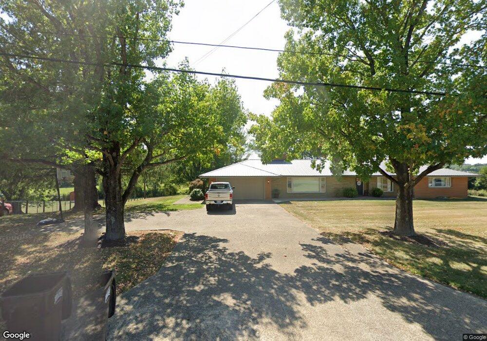
11063 State Route 93 Jackson, OH 45640
Estimated Value: $329,667 - $408,000
4
Beds
2
Baths
2,385
Sq Ft
$154/Sq Ft
Est. Value
About This Home
This home is located at 11063 State Route 93, Jackson, OH 45640 and is currently estimated at $368,417, approximately $154 per square foot. 11063 State Route 93 is a home located in Jackson County with nearby schools including Jackson High School.
Ownership History
Date
Name
Owned For
Owner Type
Purchase Details
Closed on
Dec 1, 2020
Sold by
Workman Kevin S
Bought by
Workman Kevin S and Workman Tara
Current Estimated Value
Home Financials for this Owner
Home Financials are based on the most recent Mortgage that was taken out on this home.
Original Mortgage
$160,000
Outstanding Balance
$141,399
Interest Rate
2.8%
Mortgage Type
New Conventional
Estimated Equity
$227,018
Purchase Details
Closed on
Apr 13, 2017
Sold by
Sheets Scott W and Rickard Edan Louise
Bought by
Workman Kevin S
Home Financials for this Owner
Home Financials are based on the most recent Mortgage that was taken out on this home.
Original Mortgage
$143,200
Interest Rate
4.5%
Mortgage Type
Adjustable Rate Mortgage/ARM
Create a Home Valuation Report for This Property
The Home Valuation Report is an in-depth analysis detailing your home's value as well as a comparison with similar homes in the area
Purchase History
| Date | Buyer | Sale Price | Title Company |
|---|---|---|---|
| Workman Kevin S | -- | Northwest Title | |
| Workman Kevin S | $179,000 | None Available |
Source: Public Records
Mortgage History
| Date | Status | Borrower | Loan Amount |
|---|---|---|---|
| Open | Workman Kevin S | $160,000 | |
| Previous Owner | Workman Kevin S | $143,200 |
Source: Public Records
Tax History
| Year | Tax Paid | Tax Assessment Tax Assessment Total Assessment is a certain percentage of the fair market value that is determined by local assessors to be the total taxable value of land and additions on the property. | Land | Improvement |
|---|---|---|---|---|
| 2024 | $3,250 | $94,490 | $8,180 | $86,310 |
| 2023 | $3,310 | $94,490 | $8,180 | $86,310 |
| 2022 | $3,332 | $69,550 | $7,010 | $62,540 |
| 2021 | $2,622 | $69,550 | $7,010 | $62,540 |
| 2020 | $2,637 | $69,550 | $7,010 | $62,540 |
| 2019 | $2,435 | $63,230 | $6,380 | $56,850 |
| 2018 | $2,341 | $63,230 | $6,380 | $56,850 |
| 2017 | $1,958 | $63,230 | $6,380 | $56,850 |
| 2016 | $1,611 | $53,820 | $6,480 | $47,340 |
| 2015 | $811 | $53,820 | $6,480 | $47,340 |
| 2013 | $1,526 | $51,560 | $6,480 | $45,080 |
| 2012 | $1,549 | $51,560 | $6,480 | $45,080 |
Source: Public Records
Map
Nearby Homes
- 1610 Erwin Rd
- 385 Gleandonshire Ln
- 992 Sternberger Rd
- 0 Four Mile Rd Unit 226002566
- 0 Four Mile Rd Unit 2434442
- 8954 Ch&d Rd
- 1656 Dever Rd
- 0 Roscoe Rd
- 1701 Dixon Run Rd
- 627 Russ Rd
- 1951 Mayhew Rd
- 101 Florence Ave
- 0 Keystone Furnace Rd Unit 11604343
- 0 Acy Ave
- 600 Acy Ave
- 129 Florence Ave
- 366 Lewis Rd
- 0 Industry Dr
- 2246 Cutlip Rd
- 563 Lewis Rd
- 11045 State Route 93
- 11062 State Route 93
- 201 Airport Ln
- 93 East St
- 200 Airport Ln
- 10 Airport Ln
- 100 Airport Ln
- 1010 Keystone Station Rd
- 300 Airport Ln
- 10948 State Route 93
- 310 Airport Ln
- 1282 Keystone Station Rd
- 961 Keystone Station Rd
- 1281 Keystone Station Rd
- 0 Keystone Station Rd
- 10744 State Route 93
- 1404 Keystone Station Rd
- 11248 State Route 93
- 704 Keystone Station Rd
- 10597 State Route 93
Your Personal Tour Guide
Ask me questions while you tour the home.
