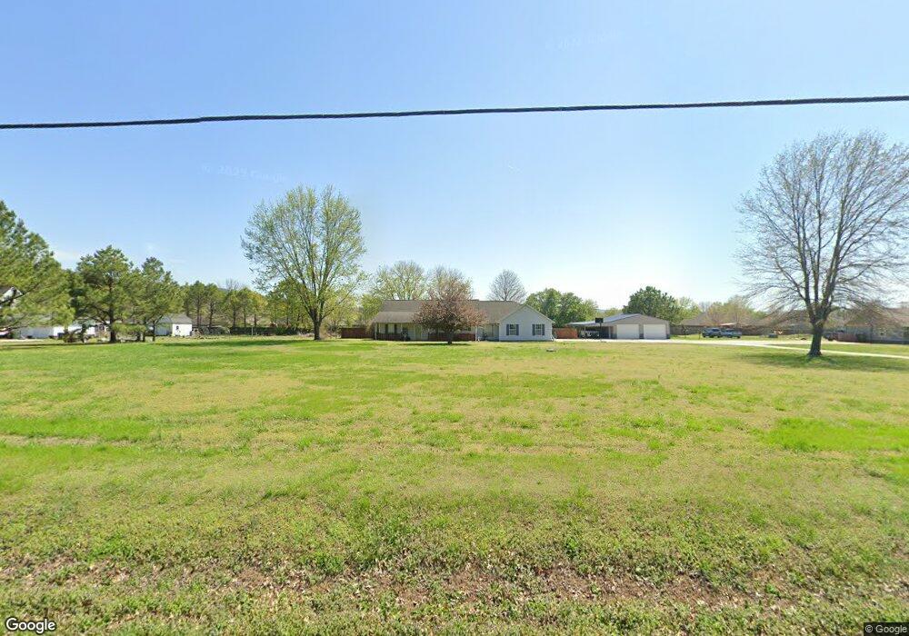
11066 N Highway 170 Farmington, AR 72730
Estimated Value: $401,205 - $460,000
--
Bed
3
Baths
2,168
Sq Ft
$193/Sq Ft
Est. Value
About This Home
This home is located at 11066 N Highway 170, Farmington, AR 72730 and is currently estimated at $418,301, approximately $192 per square foot. 11066 N Highway 170 is a home located in Washington County with nearby schools including Prairie Grove Elementary School, Prairie Grove Middle School, and Prairie Grove Junior High School.
Ownership History
Date
Name
Owned For
Owner Type
Purchase Details
Closed on
Nov 30, 2004
Sold by
Thomas Russell A
Bought by
Sanders Dennis E and Sanders Patricia S
Current Estimated Value
Home Financials for this Owner
Home Financials are based on the most recent Mortgage that was taken out on this home.
Original Mortgage
$193,800
Outstanding Balance
$96,067
Interest Rate
5.68%
Mortgage Type
Purchase Money Mortgage
Estimated Equity
$322,234
Purchase Details
Closed on
Jul 26, 2004
Sold by
Thomas Lisa Lee
Bought by
Thomas Russell Alan
Home Financials for this Owner
Home Financials are based on the most recent Mortgage that was taken out on this home.
Original Mortgage
$160,000
Interest Rate
5%
Mortgage Type
New Conventional
Purchase Details
Closed on
Jul 15, 1994
Bought by
Thomas Russell A and Thomas Lisa L
Purchase Details
Closed on
Sep 9, 1993
Bought by
Robbins Investments Inc
Create a Home Valuation Report for This Property
The Home Valuation Report is an in-depth analysis detailing your home's value as well as a comparison with similar homes in the area
Home Values in the Area
Average Home Value in this Area
Purchase History
| Date | Buyer | Sale Price | Title Company |
|---|---|---|---|
| Sanders Dennis E | $204,000 | Waco Title Company | |
| Thomas Russell Alan | -- | Waco | |
| Thomas Russell A | $95,000 | -- | |
| Robbins Investments Inc | -- | -- |
Source: Public Records
Mortgage History
| Date | Status | Borrower | Loan Amount |
|---|---|---|---|
| Open | Sanders Dennis E | $193,800 | |
| Previous Owner | Thomas Russell Alan | $160,000 |
Source: Public Records
Tax History Compared to Growth
Tax History
| Year | Tax Paid | Tax Assessment Tax Assessment Total Assessment is a certain percentage of the fair market value that is determined by local assessors to be the total taxable value of land and additions on the property. | Land | Improvement |
|---|---|---|---|---|
| 2025 | $1,998 | $67,460 | $20,750 | $46,710 |
| 2024 | $2,019 | $67,460 | $20,750 | $46,710 |
| 2023 | $2,067 | $67,460 | $20,750 | $46,710 |
| 2022 | $1,999 | $52,270 | $14,730 | $37,540 |
| 2021 | $1,902 | $52,270 | $14,730 | $37,540 |
| 2020 | $1,805 | $52,270 | $14,730 | $37,540 |
| 2019 | $1,577 | $35,890 | $8,650 | $27,240 |
| 2018 | $1,602 | $35,890 | $8,650 | $27,240 |
| 2017 | $1,584 | $35,890 | $8,650 | $27,240 |
| 2016 | $1,584 | $35,890 | $8,650 | $27,240 |
| 2015 | $1,584 | $35,890 | $8,650 | $27,240 |
| 2014 | $1,555 | $35,340 | $8,650 | $26,690 |
Source: Public Records
Map
Nearby Homes
- 11093 Waterleaf Ln
- 11082 Meadowsweet Dr
- 12017 Riviera Place
- 12048 Riviera Place
- 10891 Foxglove Ln
- 10715 N Garland McKee Rd
- 1031 Hillcrest Dr
- 1009 Hillcrest Dr
- 1062 Hillcrest Dr
- 1032 Hillcrest Dr
- 2213 Overlook Way
- 2230 Overlook Way
- 2193 Harvest Falls Ln
- 2223 Harvest Falls Ln
- 2239 Harvest Falls Ln
- 2255 Harvest Falls Ln
- 2256 Harvest Falls Ln
- 2271 Harvest Falls Ln
- 2272 Harvest Falls Ln
- 3000 Plan at Hillcrest Subdivision
- 7.92 Ac Hwy 170
- TBD Hwy 170
- 11088 N Highway 170
- 11052 N Highway 170
- 11124 Waterleaf Ln
- 11100 Waterleaf Ln
- 11088 Waterleaf Ln
- 11112 Waterleaf Ln
- 11136 Waterleaf Ln
- 11076 Waterleaf Ln
- 11148 Waterleaf Ln
- 0 Garland McKee-tct 2 Unit 1140633
- 0 Garland McKee-tct 2 Unit 1159654
- 11064 Waterleaf Ln
- 11160 Waterleaf Ln
- 12007 Riviera Place
- 11107 Waterleaf Ln
- 11119 Waterleaf Ln
- 12001 Riviera Place
- 10907 Stonecrop Ln