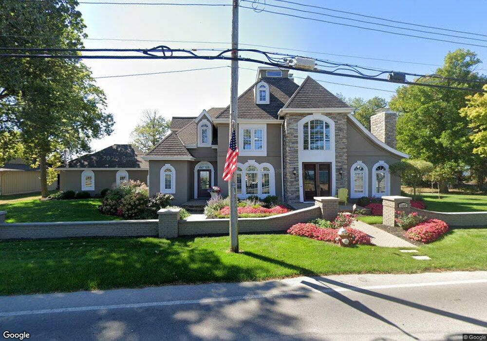
1107 Cedar Point Rd Sandusky, OH 44870
Estimated Value: $1,110,584 - $1,291,000
4
Beds
4
Baths
4,346
Sq Ft
$283/Sq Ft
Est. Value
About This Home
This home is located at 1107 Cedar Point Rd, Sandusky, OH 44870 and is currently estimated at $1,230,528, approximately $283 per square foot. 1107 Cedar Point Rd is a home located in Erie County with nearby schools including Sandusky High School.
Ownership History
Date
Name
Owned For
Owner Type
Purchase Details
Closed on
Sep 14, 2005
Sold by
Harkelroad Eugene N and Harkelroad Judith A
Bought by
Jesse Norma J and Jesse David A
Current Estimated Value
Home Financials for this Owner
Home Financials are based on the most recent Mortgage that was taken out on this home.
Original Mortgage
$580,000
Outstanding Balance
$311,860
Interest Rate
5.93%
Mortgage Type
Purchase Money Mortgage
Estimated Equity
$918,668
Create a Home Valuation Report for This Property
The Home Valuation Report is an in-depth analysis detailing your home's value as well as a comparison with similar homes in the area
Purchase History
| Date | Buyer | Sale Price | Title Company |
|---|---|---|---|
| Jesse Norma J | $362,500 | Lawyers Title Ins Corp | |
| Oney Cynthia A | $362,500 | Lawyers Title Ins Corp |
Source: Public Records
Mortgage History
| Date | Status | Borrower | Loan Amount |
|---|---|---|---|
| Open | Oney Cynthia A | $580,000 | |
| Closed | Jesse Norma J | $580,000 |
Source: Public Records
Tax History
| Year | Tax Paid | Tax Assessment Tax Assessment Total Assessment is a certain percentage of the fair market value that is determined by local assessors to be the total taxable value of land and additions on the property. | Land | Improvement |
|---|---|---|---|---|
| 2024 | $11,729 | $315,353 | $160,114 | $155,239 |
| 2023 | $12,132 | $266,741 | $141,277 | $125,464 |
| 2022 | $13,657 | $269,429 | $141,277 | $128,152 |
| 2021 | $13,784 | $269,430 | $141,280 | $128,150 |
| 2020 | $14,248 | $255,980 | $141,280 | $114,700 |
| 2019 | $14,649 | $255,980 | $141,280 | $114,700 |
| 2018 | $14,664 | $255,980 | $141,280 | $114,700 |
| 2017 | $14,713 | $256,010 | $145,990 | $110,020 |
| 2016 | $15,268 | $265,790 | $145,990 | $119,800 |
| 2015 | $13,831 | $265,790 | $145,990 | $119,800 |
| 2014 | $12,522 | $242,070 | $131,860 | $110,210 |
| 2013 | $12,397 | $242,070 | $131,860 | $110,210 |
Source: Public Records
Map
Nearby Homes
- 939 Cedar Point Rd
- 1431 Cedar Point Rd
- 1711 Willow Dr
- 81 Marina Point Dr
- 0 Cleveland Rd W
- 1640 Cleveland Rd W
- 30 Marina Point Dr
- 57 Marina Point Dr
- 49 Marina Point Dr
- 32 Marina Point Dr
- 42 Marina Point Dr
- 2802 N Bayview Ln
- 1999 E Oldgate Rd
- 2707 Highland Dr
- 139 Cedar Point Rd
- 2821 Park Ln
- 2151 Aspen Run Rd
- 2912 Park Ln
- 2501 E Perkins Ave
- 0 E Perkins Ave
- 1101 Cedar Point Rd
- 103 Lurie Ln
- 1115 Cedar Point Rd
- 1035 Cedar Point Rd
- 107 Lurie Ln
- 1119 Cedar Point Rd
- 1031 Cedar Point Rd
- 117 Lurie Ln
- 1123 Cedar Point Rd
- 1025 Cedar Point Rd
- 1133 Cedar Point Rd
- 1021 Cedar Point Rd
- 1017 Cedar Point Rd
- 1137 Cedar Point Rd
- 1137 Cedar Point Rd
- 1015 Cedar Point Rd
- 1013 Cedar Point Rd
- 1011 Cedar Point Rd
- 1007 Cedar Point Rd
- 1205 Cedar Point Rd
Your Personal Tour Guide
Ask me questions while you tour the home.