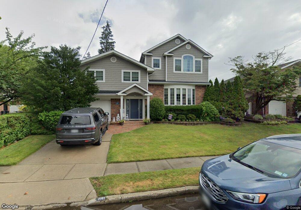
1107 Crest Rd W Merrick, NY 11566
Estimated Value: $809,903 - $956,000
--
Bed
3
Baths
1,810
Sq Ft
$488/Sq Ft
Est. Value
About This Home
This home is located at 1107 Crest Rd W, Merrick, NY 11566 and is currently estimated at $882,952, approximately $487 per square foot. 1107 Crest Rd W is a home located in Nassau County with nearby schools including Grand Avenue Middle School, Wellington C Mepham High School, and Sacred Heart School.
Ownership History
Date
Name
Owned For
Owner Type
Purchase Details
Closed on
Jul 6, 2012
Sold by
Austin Jaime
Bought by
Assortato Michael J
Current Estimated Value
Home Financials for this Owner
Home Financials are based on the most recent Mortgage that was taken out on this home.
Original Mortgage
$388,000
Outstanding Balance
$59,724
Interest Rate
3.7%
Mortgage Type
New Conventional
Estimated Equity
$823,228
Create a Home Valuation Report for This Property
The Home Valuation Report is an in-depth analysis detailing your home's value as well as a comparison with similar homes in the area
Home Values in the Area
Average Home Value in this Area
Purchase History
| Date | Buyer | Sale Price | Title Company |
|---|---|---|---|
| Assortato Michael J | -- | -- |
Source: Public Records
Mortgage History
| Date | Status | Borrower | Loan Amount |
|---|---|---|---|
| Open | Assortato Michael J | $388,000 |
Source: Public Records
Tax History Compared to Growth
Tax History
| Year | Tax Paid | Tax Assessment Tax Assessment Total Assessment is a certain percentage of the fair market value that is determined by local assessors to be the total taxable value of land and additions on the property. | Land | Improvement |
|---|---|---|---|---|
| 2025 | $16,138 | $563 | $182 | $381 |
| 2024 | $4,279 | $590 | $191 | $399 |
| 2023 | $15,778 | $623 | $202 | $421 |
| 2022 | $15,778 | $611 | $198 | $413 |
| 2021 | $20,196 | $595 | $193 | $402 |
| 2020 | $14,167 | $731 | $681 | $50 |
| 2019 | $13,509 | $783 | $524 | $259 |
| 2018 | $12,238 | $1,090 | $0 | $0 |
| 2017 | $8,616 | $918 | $590 | $328 |
| 2016 | $12,879 | $918 | $590 | $328 |
| 2015 | $4,900 | $1,134 | $729 | $405 |
| 2014 | $4,900 | $1,134 | $729 | $405 |
| 2013 | $4,564 | $1,134 | $729 | $405 |
Source: Public Records
Map
Nearby Homes
- 1855 Zana Ct
- 1974 Monroe Ave
- 929 Oakland Ct
- 854 Oakland Ct
- 614 Bond Ct
- 985 Merrick Ave
- 776 Blackstone Ave
- 1064 Barbara Ct
- 1267 Taft Ave
- 1016 Tyrus Ct
- 734 Wenwood Dr
- 59 Winifred Dr
- 1425 Jerusalem Ave Unit 27
- 1963 Central Dr N
- 2166 Isabelle Ct
- 1963 Longfellow Ave
- 1317 Taft Ave
- 935 Winthrop Dr
- 1450 Tadmor St
- 2013 Central Dr N
- 1117 Crest Rd W
- 1840 Decatur Ave
- 1850 Decatur Ave
- 20 Decatur Ave
- 1116 Crest Rd W
- 1108 Crest Rd W
- 1872 Decatur Ave
- 1832 Decatur Ave
- 1122 Crest Rd W
- 1121 Crest Rd W
- 1847 Decatur Ave
- 1835 Decatur Ave
- 1853 Decatur Ave
- 1876 Decatur Ave
- 1827 Decatur Ave
- 97 Crest Rd W
- 1824 Decatur Ave
- 1859 Decatur Ave
- 47 Roydon Dr N
- 49 Roydon Dr E