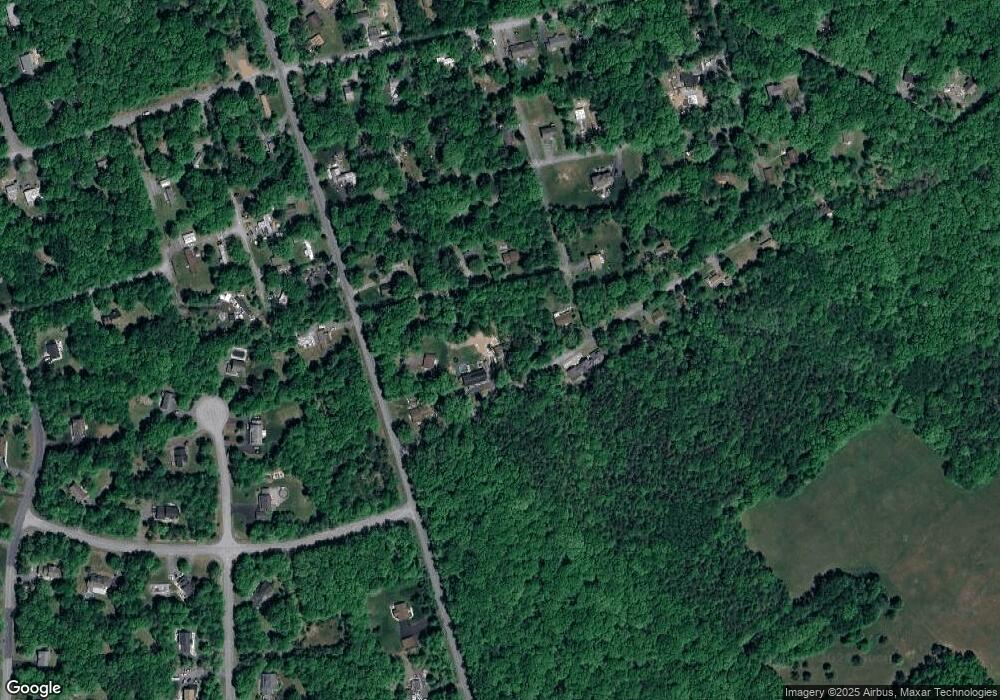
1107 Red Pine Rd Effort, PA 18330
Estimated Value: $113,398 - $181,000
1
Bed
1
Bath
640
Sq Ft
$207/Sq Ft
Est. Value
About This Home
This home is located at 1107 Red Pine Rd, Effort, PA 18330 and is currently estimated at $132,350, approximately $206 per square foot. 1107 Red Pine Rd is a home with nearby schools including Pleasant Valley Elementary School, Pleasant Valley Intermediate School, and Pleasant Valley Middle School.
Ownership History
Date
Name
Owned For
Owner Type
Purchase Details
Closed on
Jul 14, 2017
Sold by
Plocic Elsie
Bought by
Slater Frank C and Slater Amanda
Current Estimated Value
Home Financials for this Owner
Home Financials are based on the most recent Mortgage that was taken out on this home.
Original Mortgage
$23,760
Interest Rate
3.96%
Mortgage Type
New Conventional
Purchase Details
Closed on
Mar 19, 2012
Sold by
Plocic Darrin and Plocic Elsie
Bought by
Plocic Elsie
Purchase Details
Closed on
Feb 7, 2005
Sold by
Johnson Howard E and Johnson Catherine M
Bought by
Plocic Darrin and Plocic Elsie
Home Financials for this Owner
Home Financials are based on the most recent Mortgage that was taken out on this home.
Original Mortgage
$50,400
Interest Rate
5.83%
Mortgage Type
Seller Take Back
Create a Home Valuation Report for This Property
The Home Valuation Report is an in-depth analysis detailing your home's value as well as a comparison with similar homes in the area
Home Values in the Area
Average Home Value in this Area
Purchase History
| Date | Buyer | Sale Price | Title Company |
|---|---|---|---|
| Slater Frank C | $26,400 | None Available | |
| Plocic Elsie | -- | None Available | |
| Plocic Darrin | $57,000 | Effort Abstract |
Source: Public Records
Mortgage History
| Date | Status | Borrower | Loan Amount |
|---|---|---|---|
| Previous Owner | Slater Frank C | $23,760 | |
| Previous Owner | Plocic Darrin | $50,400 |
Source: Public Records
Tax History Compared to Growth
Tax History
| Year | Tax Paid | Tax Assessment Tax Assessment Total Assessment is a certain percentage of the fair market value that is determined by local assessors to be the total taxable value of land and additions on the property. | Land | Improvement |
|---|---|---|---|---|
| 2025 | $416 | $51,070 | $13,190 | $37,880 |
| 2024 | $339 | $51,070 | $13,190 | $37,880 |
| 2023 | $1,547 | $51,070 | $13,190 | $37,880 |
| 2022 | $1,504 | $51,070 | $13,190 | $37,880 |
| 2021 | $1,434 | $51,070 | $13,190 | $37,880 |
| 2019 | $1,499 | $8,410 | $1,000 | $7,410 |
| 2018 | $1,482 | $8,410 | $1,000 | $7,410 |
| 2017 | $1,465 | $8,410 | $1,000 | $7,410 |
| 2016 | $233 | $8,410 | $1,000 | $7,410 |
| 2015 | -- | $8,410 | $1,000 | $7,410 |
| 2014 | -- | $8,410 | $1,000 | $7,410 |
Source: Public Records
Map
Nearby Homes
- 752 Toll Rd
- 841 Toll Rd
- 1555 Longleaf Dr
- Lot 154 Little Twig Rd
- 869 Toll Rd
- lot 37 Lakeside Dr
- 341 Donalds Rd
- 1405 Donalds Rd
- 0 Johns Rd Unit PM-136428
- 7 Gooseberry Dr
- 692 Watercrest Ave
- 899 Lower Mountain Dr
- 1670 Erie Ct
- 317 Valley View Dr
- 141 Long View Dr
- 117 Aldean Dr
- lot 253 Service Rd
- 1392 Whispering Hills Ct
- 704 Rainbow Terrace
- 518 Timothy Dr
