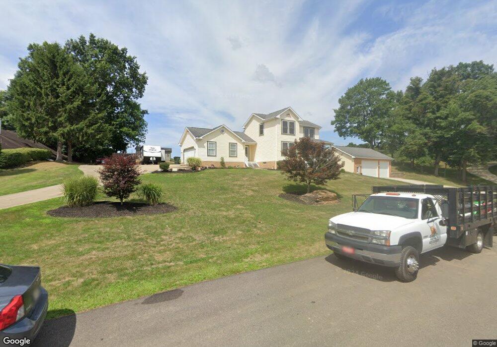
11073 Jan Cir NW Uniontown, OH 44685
Estimated Value: $334,000 - $367,897
3
Beds
2
Baths
1,928
Sq Ft
$180/Sq Ft
Est. Value
About This Home
This home is located at 11073 Jan Cir NW, Uniontown, OH 44685 and is currently estimated at $347,724, approximately $180 per square foot. 11073 Jan Cir NW is a home located in Stark County with nearby schools including Lake Middle/High School and Lake Center Christian School.
Ownership History
Date
Name
Owned For
Owner Type
Purchase Details
Closed on
Jun 6, 1994
Sold by
Erb Ellis G
Bought by
Reese Robert L and Reese Kim
Current Estimated Value
Home Financials for this Owner
Home Financials are based on the most recent Mortgage that was taken out on this home.
Original Mortgage
$90,000
Interest Rate
8.48%
Mortgage Type
New Conventional
Create a Home Valuation Report for This Property
The Home Valuation Report is an in-depth analysis detailing your home's value as well as a comparison with similar homes in the area
Home Values in the Area
Average Home Value in this Area
Purchase History
| Date | Buyer | Sale Price | Title Company |
|---|---|---|---|
| Reese Robert L | $18,000 | -- |
Source: Public Records
Mortgage History
| Date | Status | Borrower | Loan Amount |
|---|---|---|---|
| Closed | Reese Robert L | $90,000 |
Source: Public Records
Tax History Compared to Growth
Tax History
| Year | Tax Paid | Tax Assessment Tax Assessment Total Assessment is a certain percentage of the fair market value that is determined by local assessors to be the total taxable value of land and additions on the property. | Land | Improvement |
|---|---|---|---|---|
| 2025 | -- | $125,760 | $27,130 | $98,630 |
| 2024 | -- | $125,760 | $27,130 | $98,630 |
| 2023 | $3,847 | $82,320 | $16,940 | $65,380 |
| 2022 | $3,860 | $82,320 | $16,940 | $65,380 |
| 2021 | $3,904 | $82,320 | $16,940 | $65,380 |
| 2020 | $3,768 | $71,200 | $14,600 | $56,600 |
| 2019 | $3,734 | $71,200 | $14,600 | $56,600 |
| 2018 | $3,735 | $71,200 | $14,600 | $56,600 |
| 2017 | $3,697 | $65,420 | $15,580 | $49,840 |
| 2016 | $3,703 | $65,420 | $15,580 | $49,840 |
| 2015 | $3,701 | $65,420 | $15,580 | $49,840 |
| 2014 | $1,194 | $58,730 | $14,000 | $44,730 |
| 2013 | $1,597 | $58,730 | $14,000 | $44,730 |
Source: Public Records
Map
Nearby Homes
- 1037 Canyon St NE
- 1771 Midway St NW
- 12055 King Church Ave NW
- 12201 King Church Ave NW
- 786 Fair Vista Cir SW
- 747 Grandview Cir
- 778 Fair Vista Cir SW
- 531 Gentlebrook Blvd SW
- 525 Gentlebrook Blvd SW
- 550 Woodlands Glen Ave
- 11121 Geib Ave NE
- 510 Meadow Cir SW Unit 11
- 2084 Hazel St NE
- 11900 Geib Ave NE
- 425 Tonawanda Trail SW
- Unit 9 Meadow Trail SW Unit 9
- 9790 Smithdale Ave NE
- 9766 Smithdale Ave NE
- 1975 Eloise Cir NE
- 1180 Tessa Trail Unit 1180
- 11043 Jan Cir NW
- 11068 Jan Cir NW
- 11094 Jan Cir NW
- 11050 Jan Cir NW
- 11082 Jan Cir NW
- 1255 Royce St NW
- 0 Jan Cir NW Unit 4444532
- 10997 Jan Cir NW
- 1267 Royce St NW
- 1179 Canyon St NW
- 10981 Jan Cir NW
- 1188 Canyon St NW
- 1137 Canyon St NW
- 11121 Titus Ave NW
- 11085 Titus Ave NW
- 10961 Jan Cir NW
- 1178 Canyon St NW
- 1109 Canyon St NW
- 11131 Titus Ave NW
- 11105 Titus Ave NW