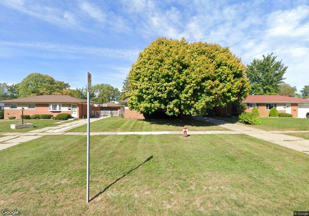
11075 17 Mile Rd Sterling Heights, MI 48313
Estimated Value: $242,053 - $265,000
3
Beds
1
Bath
943
Sq Ft
$269/Sq Ft
Est. Value
About This Home
This home is located at 11075 17 Mile Rd, Sterling Heights, MI 48313 and is currently estimated at $253,763, approximately $269 per square foot. 11075 17 Mile Rd is a home located in Macomb County with nearby schools including Plumbrook Elementary School, Davis Junior High School, and Adlai Stevenson High School.
Ownership History
Date
Name
Owned For
Owner Type
Purchase Details
Closed on
Aug 6, 2011
Sold by
Kapusniak Tomasz and Holowinski Mark
Bought by
Kapusniak Tomasz
Current Estimated Value
Purchase Details
Closed on
Jun 12, 2000
Sold by
Yasoni Michael S
Bought by
Kapusniak Tomasz
Home Financials for this Owner
Home Financials are based on the most recent Mortgage that was taken out on this home.
Original Mortgage
$89,000
Outstanding Balance
$32,113
Interest Rate
8.55%
Mortgage Type
Purchase Money Mortgage
Estimated Equity
$221,650
Create a Home Valuation Report for This Property
The Home Valuation Report is an in-depth analysis detailing your home's value as well as a comparison with similar homes in the area
Home Values in the Area
Average Home Value in this Area
Purchase History
| Date | Buyer | Sale Price | Title Company |
|---|---|---|---|
| Kapusniak Tomasz | -- | None Available | |
| Kapusniak Tomasz | $133,000 | -- |
Source: Public Records
Mortgage History
| Date | Status | Borrower | Loan Amount |
|---|---|---|---|
| Open | Kapusniak Tomasz | $89,000 |
Source: Public Records
Tax History Compared to Growth
Tax History
| Year | Tax Paid | Tax Assessment Tax Assessment Total Assessment is a certain percentage of the fair market value that is determined by local assessors to be the total taxable value of land and additions on the property. | Land | Improvement |
|---|---|---|---|---|
| 2025 | $3,281 | $112,700 | $0 | $0 |
| 2024 | $2,563 | $106,600 | $0 | $0 |
| 2023 | $2,424 | $94,200 | $0 | $0 |
| 2022 | $2,894 | $83,900 | $0 | $0 |
| 2021 | $2,833 | $79,500 | $0 | $0 |
| 2020 | $2,180 | $75,100 | $0 | $0 |
| 2019 | $2,509 | $71,300 | $0 | $0 |
| 2018 | $2,652 | $66,500 | $0 | $0 |
| 2017 | $2,569 | $62,500 | $12,000 | $50,500 |
| 2016 | $2,509 | $62,500 | $0 | $0 |
| 2015 | -- | $57,000 | $0 | $0 |
| 2014 | -- | $45,100 | $0 | $0 |
Source: Public Records
Map
Nearby Homes
- 39517 Balboa Dr
- 38614 Arcola Dr
- 11118 Plumridge Blvd
- 8716 Calvert Dr
- 38567 Trafalgar Way
- 11425 Plumbrook Rd
- 8453 Smethwick Rd
- 11406 Plumridge Blvd
- 8268 Doncaster Dr
- 39846 Karola Dr
- 39123 Boston Dr
- 39044 Dodge Park Rd
- 11025 16 1 2 Mile Rd
- 39856 Parklawn Dr
- 8601 Alwardt Dr
- 8644 Independence Dr
- 8125 Willesdon Square
- 8147 Clay Ct
- 8133 Clay Ct
- 39441 Van Dyke Ave
- 11063 17 Mile Rd
- 11087 17 Mile Rd
- 11051 17 Mile Rd
- 8860 Cherrylawn Dr
- 8846 Cherrylawn Dr
- 11099 17 Mile Rd
- 39049 Poinciana Dr
- 8834 Cherrylawn Dr
- 11037 17 Mile Rd
- 39063 Poinciana Dr
- 8822 Cherrylawn Dr
- 11074 17 Mile Rd
- 11023 17 Mile Rd
- 11062 17 Mile Rd
- 11102 Plumbrook Rd
- 8810 Cherrylawn Dr
- 39026 Poinciana Dr
- 11009 17 Mile Rd
- 8859 Cherrylawn Dr
- 39040 Poinciana Dr