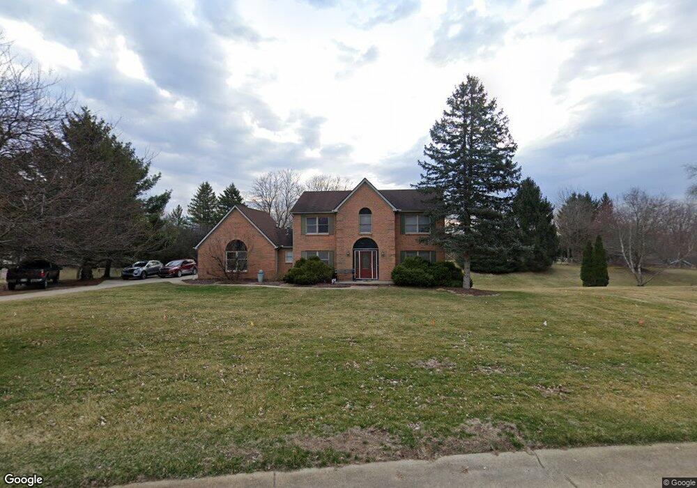
11079 Sand Crane Way South Lyon, MI 48178
Estimated Value: $524,000 - $575,000
4
Beds
3
Baths
2,446
Sq Ft
$220/Sq Ft
Est. Value
About This Home
This home is located at 11079 Sand Crane Way, South Lyon, MI 48178 and is currently estimated at $537,931, approximately $219 per square foot. 11079 Sand Crane Way is a home located in Livingston County with nearby schools including Hawkins Elementary School, Scranton Middle School, and Brighton High School.
Ownership History
Date
Name
Owned For
Owner Type
Purchase Details
Closed on
Jun 26, 2014
Sold by
Lammers Kevin P
Bought by
Lammers D Anna L
Current Estimated Value
Purchase Details
Closed on
Jan 28, 2002
Sold by
Mason Elizabeth and Mason Matt
Bought by
Zimmerman Daniel D and Zimmerman Catherine M
Home Financials for this Owner
Home Financials are based on the most recent Mortgage that was taken out on this home.
Original Mortgage
$212,000
Interest Rate
6.93%
Purchase Details
Closed on
Sep 21, 2000
Sold by
Mayer Michael A and Mayer Cynthia A
Bought by
Mason Matt and Mason Elizabeth
Home Financials for this Owner
Home Financials are based on the most recent Mortgage that was taken out on this home.
Original Mortgage
$216,000
Interest Rate
8.05%
Create a Home Valuation Report for This Property
The Home Valuation Report is an in-depth analysis detailing your home's value as well as a comparison with similar homes in the area
Home Values in the Area
Average Home Value in this Area
Purchase History
| Date | Buyer | Sale Price | Title Company |
|---|---|---|---|
| Lammers D Anna L | -- | -- | |
| Zimmerman Daniel D | $265,000 | Professional Real Estate Tit | |
| Mason Matt | $270,000 | -- |
Source: Public Records
Mortgage History
| Date | Status | Borrower | Loan Amount |
|---|---|---|---|
| Previous Owner | Zimmerman Daniel D | $212,000 | |
| Previous Owner | Mason Matt | $216,000 | |
| Closed | Zimmerman Daniel D | $45,000 |
Source: Public Records
Tax History Compared to Growth
Tax History
| Year | Tax Paid | Tax Assessment Tax Assessment Total Assessment is a certain percentage of the fair market value that is determined by local assessors to be the total taxable value of land and additions on the property. | Land | Improvement |
|---|---|---|---|---|
| 2025 | $4,151 | $263,200 | $0 | $0 |
| 2024 | $1,792 | $223,000 | $0 | $0 |
| 2023 | $1,713 | $212,300 | $0 | $0 |
| 2022 | $3,521 | $178,700 | $0 | $0 |
| 2021 | $3,521 | $192,400 | $0 | $0 |
| 2020 | $3,467 | $179,000 | $0 | $0 |
| 2019 | $3,406 | $178,700 | $0 | $0 |
| 2018 | $3,347 | $167,200 | $0 | $0 |
| 2017 | $3,290 | $168,000 | $0 | $0 |
| 2016 | $3,307 | $152,500 | $0 | $0 |
| 2014 | $2,787 | $123,700 | $0 | $0 |
| 2012 | $2,787 | $109,000 | $0 | $0 |
Source: Public Records
Map
Nearby Homes
- 10820 Bouldercrest Dr
- 10403 Bouldercrest Dr
- 11433 Marshall Rd
- 10593 9 Mile Rd
- 10456 Oak Shore Dr
- 10537 Oak Forest Dr
- 10512 Oak Forest Dr
- 10468 Oak Shore Dr
- 10536 Oak Shore Dr
- 11346 E Shore Dr
- 11108 Wood Run Cir
- 11078 Wood Run Cir
- 10875 Charring Cross Cir
- 10320 Harpers Ferry Ct
- 10324 Greenwood Rd
- 10303 9 Mile Rd
- 11045 Woodland Ridge Ct
- 11090 Stony River Ct
- 10194 Elmcrest Rd
- 9550 Silverside
- 11063 Sand Crane Way
- 11091 Sand Crane Way
- 10924 9 Mile Rd
- 11074 Sand Crane Way
- 11088 Sand Crane Way
- 11051 Sand Crane Way
- 11200 Marshall Rd
- 11060 Sand Crane Way
- 11103 Sand Crane Way
- 11120 Sand Crane Way
- 11046 Sand Crane Way
- 11115 Sand Crane Way
- 11039 Sand Crane Way
- 11131 Wild Turkey Run
- 11153 Wild Turkey Run
- 11109 Wild Turkey Run Unit Bldg-Unit
- 11109 Wild Turkey Run
- 11032 Sand Crane Way
- 11127 Sand Crane Way
- 11175 Wild Turkey Run