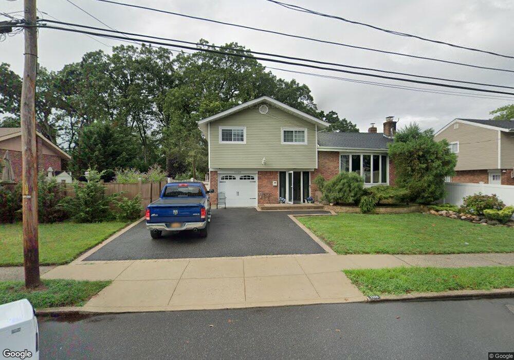
1108 Crest Rd W Merrick, NY 11566
Estimated Value: $858,000 - $867,603
4
Beds
3
Baths
1,236
Sq Ft
$698/Sq Ft
Est. Value
About This Home
This home is located at 1108 Crest Rd W, Merrick, NY 11566 and is currently estimated at $862,802, approximately $698 per square foot. 1108 Crest Rd W is a home located in Nassau County with nearby schools including Grand Avenue Middle School, Wellington C Mepham High School, and Sacred Heart School.
Ownership History
Date
Name
Owned For
Owner Type
Purchase Details
Closed on
Sep 30, 2010
Sold by
Scholl Cathy Costa
Bought by
Teta Cindy
Current Estimated Value
Home Financials for this Owner
Home Financials are based on the most recent Mortgage that was taken out on this home.
Original Mortgage
$357,600
Outstanding Balance
$236,098
Interest Rate
4.36%
Mortgage Type
Purchase Money Mortgage
Estimated Equity
$626,704
Create a Home Valuation Report for This Property
The Home Valuation Report is an in-depth analysis detailing your home's value as well as a comparison with similar homes in the area
Home Values in the Area
Average Home Value in this Area
Purchase History
| Date | Buyer | Sale Price | Title Company |
|---|---|---|---|
| Teta Cindy | $447,000 | -- |
Source: Public Records
Mortgage History
| Date | Status | Borrower | Loan Amount |
|---|---|---|---|
| Open | Teta Cindy | $357,600 |
Source: Public Records
Tax History Compared to Growth
Tax History
| Year | Tax Paid | Tax Assessment Tax Assessment Total Assessment is a certain percentage of the fair market value that is determined by local assessors to be the total taxable value of land and additions on the property. | Land | Improvement |
|---|---|---|---|---|
| 2025 | $14,862 | $550 | $201 | $349 |
| 2024 | $3,799 | $533 | $195 | $338 |
| 2023 | $11,683 | $541 | $197 | $344 |
| 2022 | $11,683 | $550 | $201 | $349 |
| 2021 | $14,952 | $578 | $211 | $367 |
| 2020 | $11,795 | $626 | $583 | $43 |
| 2019 | $10,320 | $671 | $587 | $84 |
| 2018 | $10,429 | $715 | $0 | $0 |
| 2017 | $7,060 | $760 | $591 | $169 |
| 2016 | $10,589 | $804 | $491 | $313 |
| 2015 | $3,669 | $849 | $504 | $345 |
| 2014 | $3,669 | $849 | $504 | $345 |
| 2013 | $4,121 | $1,024 | $625 | $399 |
Source: Public Records
Map
Nearby Homes
- 1855 Zana Ct
- 1974 Monroe Ave
- 929 Oakland Ct
- 854 Oakland Ct
- 614 Bond Ct
- 985 Merrick Ave
- 776 Blackstone Ave
- 1016 Tyrus Ct
- 734 Wenwood Dr
- 1425 Jerusalem Ave Unit 27
- 1064 Barbara Ct
- 1267 Taft Ave
- 1963 Central Dr N
- 59 Winifred Dr
- 1963 Longfellow Ave
- 935 Winthrop Dr
- 2166 Isabelle Ct
- 1450 Tadmor St
- 1317 Taft Ave
- 2013 Central Dr N
- 1832 Decatur Ave
- 1116 Crest Rd W
- 1824 Decatur Ave
- 47 Roydon Dr N
- 49 Roydon Dr E
- 45 Roydon Dr N
- 1122 Crest Rd W
- 1840 Decatur Ave
- 1789 Roydon Dr N
- 1107 Crest Rd W
- 1818 Decatur Ave
- 1827 Decatur Ave
- 1117 Crest Rd W
- 43 Roydon Dr N
- 51 Roydon Dr E
- 97 Crest Rd W
- 1835 Decatur Ave
- 1819 Decatur Ave
- 1850 Decatur Ave
- 1812 Decatur Ave