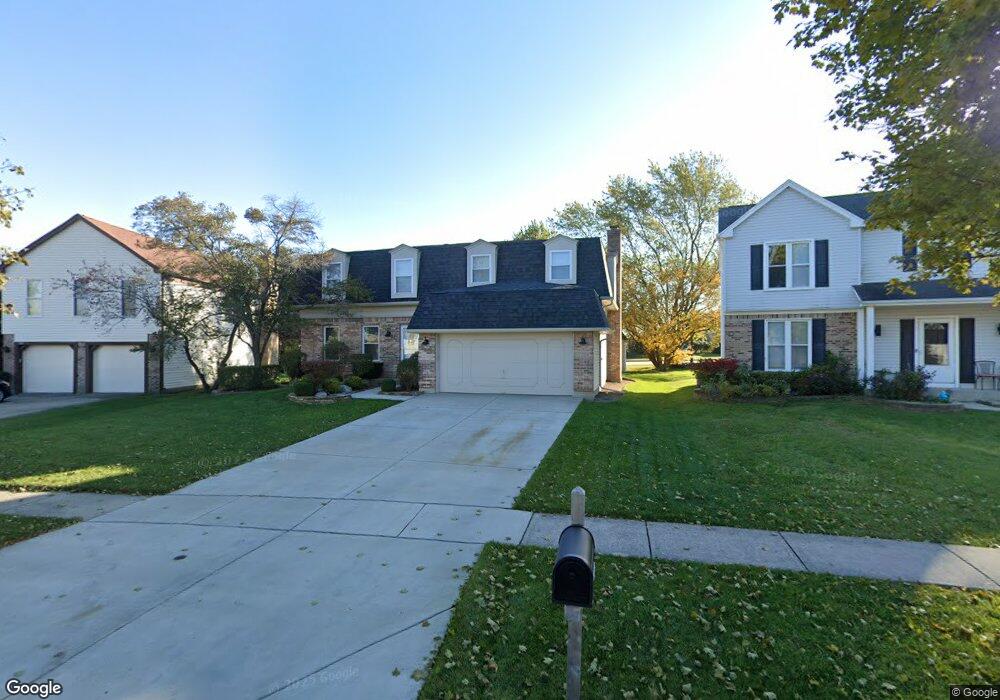
1108 Gail Dr Buffalo Grove, IL 60089
Estimated Value: $586,173 - $648,000
3
Beds
3
Baths
2,264
Sq Ft
$271/Sq Ft
Est. Value
About This Home
This home is located at 1108 Gail Dr, Buffalo Grove, IL 60089 and is currently estimated at $612,543, approximately $270 per square foot. 1108 Gail Dr is a home located in Lake County with nearby schools including Prairie Elementary School, Twin Groves Middle School, and Adlai E Stevenson High School.
Ownership History
Date
Name
Owned For
Owner Type
Purchase Details
Closed on
Aug 13, 2009
Sold by
Holman Marilyn and Marilyn Holman Trust
Bought by
Holman Neil L and Garrett Ryan D
Current Estimated Value
Home Financials for this Owner
Home Financials are based on the most recent Mortgage that was taken out on this home.
Original Mortgage
$292,000
Outstanding Balance
$190,386
Interest Rate
5.21%
Mortgage Type
New Conventional
Estimated Equity
$422,157
Purchase Details
Closed on
Jan 24, 2007
Sold by
Holman Neil L and Holman Marilyn
Bought by
Holman Marilyn and Marilyn Holman Trust Agreement
Create a Home Valuation Report for This Property
The Home Valuation Report is an in-depth analysis detailing your home's value as well as a comparison with similar homes in the area
Home Values in the Area
Average Home Value in this Area
Purchase History
| Date | Buyer | Sale Price | Title Company |
|---|---|---|---|
| Holman Neil L | $365,000 | Attomeys Title Guaranty Fund | |
| Holman Marilyn | -- | None Available |
Source: Public Records
Mortgage History
| Date | Status | Borrower | Loan Amount |
|---|---|---|---|
| Open | Holman Neil L | $292,000 |
Source: Public Records
Tax History Compared to Growth
Tax History
| Year | Tax Paid | Tax Assessment Tax Assessment Total Assessment is a certain percentage of the fair market value that is determined by local assessors to be the total taxable value of land and additions on the property. | Land | Improvement |
|---|---|---|---|---|
| 2024 | $14,556 | $166,815 | $29,212 | $137,603 |
| 2023 | $13,402 | $149,907 | $26,251 | $123,656 |
| 2022 | $13,402 | $134,527 | $23,558 | $110,969 |
| 2021 | $12,894 | $133,076 | $23,304 | $109,772 |
| 2020 | $12,590 | $133,530 | $23,384 | $110,146 |
| 2019 | $12,417 | $133,038 | $23,298 | $109,740 |
| 2018 | $11,691 | $129,422 | $23,028 | $106,394 |
| 2017 | $11,469 | $126,401 | $22,490 | $103,911 |
| 2016 | $11,170 | $121,039 | $21,536 | $99,503 |
| 2015 | $10,873 | $113,194 | $20,140 | $93,054 |
| 2014 | $10,033 | $103,946 | $21,630 | $82,316 |
| 2012 | $9,976 | $104,154 | $21,673 | $82,481 |
Source: Public Records
Map
Nearby Homes
- 1315 Gail Dr
- 810 Silver Rock Ln
- 760 Checker Dr
- 938 Hidden Lake Dr
- 620 Twisted Oak Ln
- 531 Lasalle Ln
- 630 Woodhollow Ln
- 1327 Larchmont Dr
- 12 Cloverdale Ct
- 131 Autumn Ct Unit CT10602
- 1272 Sandhurst Dr
- 5107 N Arlington Heights Rd
- 690 Dunhill Dr
- 1325 Fairfax Ln
- 412 Chateau Dr
- 5135 Bridlewood Ct
- 1117 Franklin Ln Unit C52
- 728 Old Checker Rd Unit C4
- 153 E Fabish Dr
- 746 Old Checker Rd Unit E5