Estimated Value: $352,000 - $384,000
4
Beds
2
Baths
1,918
Sq Ft
$192/Sq Ft
Est. Value
About This Home
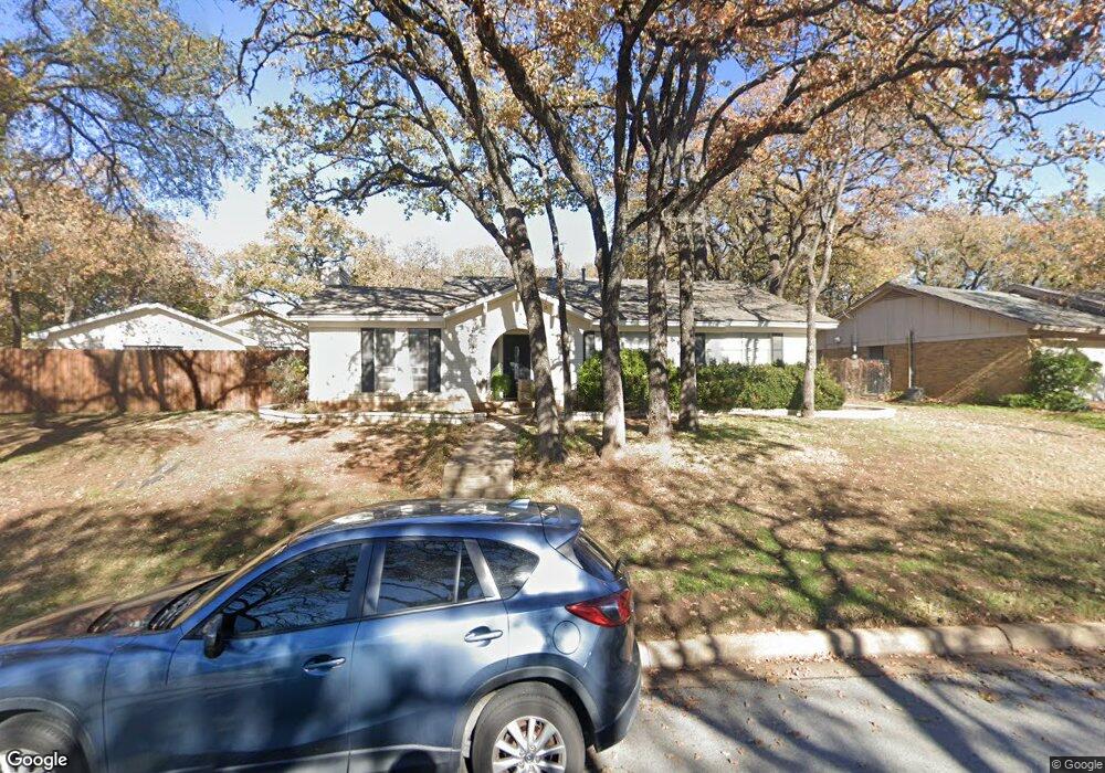
This home is located at 1108 Henson Dr, Hurst, TX 76053 and is currently estimated at $368,813, approximately $192 per square foot. 1108 Henson Dr is a home located in Tarrant County with nearby schools including Hurst Hills Elementary School, Hurst J High School, and L.D. Bell High School.
Ownership History
Date
Name
Owned For
Owner Type
Purchase Details
Closed on
May 25, 2006
Sold by
Lackey Charles S and Lackey Donna L
Bought by
Mccauley Myra Noel
Current Estimated Value
Home Financials for this Owner
Home Financials are based on the most recent Mortgage that was taken out on this home.
Original Mortgage
$159,000
Outstanding Balance
$92,612
Interest Rate
6.5%
Mortgage Type
Fannie Mae Freddie Mac
Estimated Equity
$276,201
Purchase Details
Closed on
Nov 12, 1993
Sold by
Stoker Virgil L and Stoker Betty L
Bought by
Lackey Charles S and Lackey Donna L
Home Financials for this Owner
Home Financials are based on the most recent Mortgage that was taken out on this home.
Original Mortgage
$89,500
Interest Rate
6.86%
Create a Home Valuation Report for This Property
The Home Valuation Report is an in-depth analysis detailing your home's value as well as a comparison with similar homes in the area
Home Values in the Area
Average Home Value in this Area
Purchase History
| Date | Buyer | Sale Price | Title Company |
|---|---|---|---|
| Mccauley Myra Noel | -- | Fidelity National Title Ins | |
| Lackey Charles S | -- | Trinity Western Title Co |
Source: Public Records
Mortgage History
| Date | Status | Borrower | Loan Amount |
|---|---|---|---|
| Open | Mccauley Myra Noel | $159,000 | |
| Previous Owner | Lackey Charles S | $89,500 |
Source: Public Records
Tax History
| Year | Tax Paid | Tax Assessment Tax Assessment Total Assessment is a certain percentage of the fair market value that is determined by local assessors to be the total taxable value of land and additions on the property. | Land | Improvement |
|---|---|---|---|---|
| 2025 | $3,896 | $265,835 | $66,580 | $199,255 |
| 2024 | $3,896 | $265,835 | $66,580 | $199,255 |
| 2023 | $5,411 | $284,662 | $55,264 | $229,398 |
| 2022 | $5,654 | $258,390 | $55,202 | $203,188 |
| 2021 | $5,384 | $223,232 | $50,000 | $173,232 |
| 2020 | $5,495 | $228,386 | $50,000 | $178,386 |
| 2019 | $5,280 | $225,280 | $50,000 | $175,280 |
| 2018 | $4,191 | $196,119 | $25,000 | $171,119 |
| 2017 | $4,890 | $197,891 | $25,000 | $172,891 |
| 2016 | $4,445 | $184,231 | $25,000 | $159,231 |
| 2015 | $3,665 | $159,700 | $20,000 | $139,700 |
| 2014 | $3,665 | $159,700 | $20,000 | $139,700 |
Source: Public Records
Map
Nearby Homes
- 420 Twin Creek Dr
- 1200 Walker Dr
- 512 Billie Ruth Ln
- 1204 Crestview Dr
- 852 W Redbud Dr
- 540 Billie Ruth Ln
- 632 Melbourne Ct
- 324 Moore Creek Rd
- 623 Ridgeline Dr
- 212 Glenn Dr
- 8257 Edgepoint Trail
- 116 Cooper Dr
- 8308 Fall Crest Dr
- 753 Cullum Ave
- 3216 Fountain Pkwy
- 8312 Trinity Vista Trail
- 8105 Winter Falls Trail
- 758 Briarwood Ln
- 756 Briarwood Ln
- 913 Zelda Dr
- 404 Twin Creek Dr
- 1104 Henson Dr
- 408 Twin Creek Dr
- 444 Billy Creek Cir
- 1113 Henson Dr
- 401 Twin Creek Dr
- 1100 Henson Dr
- 405 Twin Creek Dr
- 440 Billy Creek Cir
- 1117 Henson Dr
- 1109 Henson Dr
- 412 Twin Creek Dr
- 409 Twin Creek Dr
- 1121 Henson Dr
- 436 Billy Creek Cir
- 1105 Henson Dr
- 1101 Henson Dr
- 413 Twin Creek Dr
- 1125 Henson Dr
- 416 Twin Creek Dr