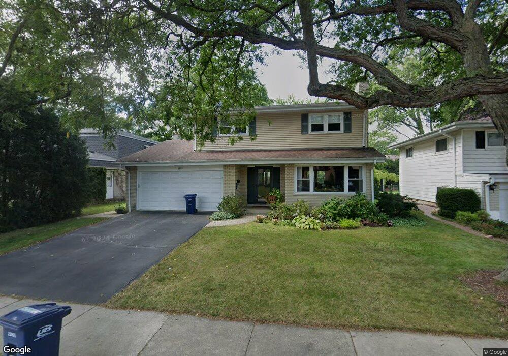
1108 Wayne Ave Deerfield, IL 60015
Estimated Value: $606,000 - $694,000
4
Beds
3
Baths
2,118
Sq Ft
$310/Sq Ft
Est. Value
About This Home
This home is located at 1108 Wayne Ave, Deerfield, IL 60015 and is currently estimated at $657,577, approximately $310 per square foot. 1108 Wayne Ave is a home located in Lake County with nearby schools including Wilmot Elementary School, Charles J Caruso Middle School, and Deerfield High School.
Ownership History
Date
Name
Owned For
Owner Type
Purchase Details
Closed on
Aug 10, 2019
Sold by
Houg Dale A and Houg Gayle A
Bought by
Houg Dale A and Houg Gayle A
Current Estimated Value
Purchase Details
Closed on
Sep 18, 2008
Sold by
Houg Dale A and Houg Gayle A
Bought by
Houg Trust #1
Purchase Details
Closed on
Oct 15, 1993
Sold by
Anderson Roy T and Anderson Nancy L
Bought by
Houg Dale A and Houg Gayle A
Home Financials for this Owner
Home Financials are based on the most recent Mortgage that was taken out on this home.
Original Mortgage
$65,000
Interest Rate
3.75%
Create a Home Valuation Report for This Property
The Home Valuation Report is an in-depth analysis detailing your home's value as well as a comparison with similar homes in the area
Home Values in the Area
Average Home Value in this Area
Purchase History
| Date | Buyer | Sale Price | Title Company |
|---|---|---|---|
| Houg Dale A | -- | None Available | |
| Houg Trust #1 | -- | None Available | |
| Houg Dale A | $156,666 | First American Title |
Source: Public Records
Mortgage History
| Date | Status | Borrower | Loan Amount |
|---|---|---|---|
| Previous Owner | Houg Dale A | $65,000 |
Source: Public Records
Tax History
| Year | Tax Paid | Tax Assessment Tax Assessment Total Assessment is a certain percentage of the fair market value that is determined by local assessors to be the total taxable value of land and additions on the property. | Land | Improvement |
|---|---|---|---|---|
| 2024 | $12,280 | $152,609 | $41,438 | $111,171 |
| 2023 | $13,210 | $146,458 | $39,768 | $106,690 |
| 2022 | $13,210 | $150,404 | $42,715 | $107,689 |
| 2021 | $12,442 | $145,010 | $41,183 | $103,827 |
| 2020 | $11,967 | $145,315 | $41,270 | $104,045 |
| 2019 | $11,699 | $145,068 | $41,200 | $103,868 |
| 2018 | $5,905 | $134,024 | $43,668 | $90,356 |
| 2017 | $10,215 | $133,597 | $43,529 | $90,068 |
| 2016 | $9,912 | $128,545 | $41,883 | $86,662 |
| 2015 | $9,670 | $120,779 | $39,353 | $81,426 |
| 2014 | $9,113 | $107,993 | $39,634 | $68,359 |
| 2012 | $8,898 | $107,040 | $39,284 | $67,756 |
Source: Public Records
Map
Nearby Homes
- 1302 Hazel Ave
- 938 Hemlock St
- 1054 Broadmoor Place
- 1004 Broadmoor Place
- 1165 Linden Ave
- 926 Cedar St
- 1030 Chestnut St
- 1420 Crowe Ave
- 1106 Waukegan Rd
- 834 Chestnut St
- 826 Chestnut St
- 1335 Wilmot Rd
- 1525 Hawthorne Place
- 1632 Village Green Ct
- 1423 Northwoods Rd
- 954 Osterman Ave
- 1151 Walden Ln
- 1625 Marcie Ct Unit 5
- 525 Mallard Ln
- 930 King Richards Ct
- 1206 Somerset Ave
- 1114 Wayne Ave
- 1214 Somerset Ave
- 1120 Wayne Ave
- 1115 Stratford Rd
- 1115 Wayne Ave
- 1105 Stratford Rd
- 1182 Somerset Ave
- 1126 Wayne Ave
- 1123 Wayne Ave
- 1121 Stratford Rd
- 1054 Wayne Ave
- 1211 Somerset Ave
- 1217 Somerset Ave
- 1132 Wayne Ave
- 1193 Robbie Ct
- 1127 Stratford Rd
- 1195 Somerset Ave
- 1051 Stratford Rd
- 1166 Somerset Ave
Your Personal Tour Guide
Ask me questions while you tour the home.