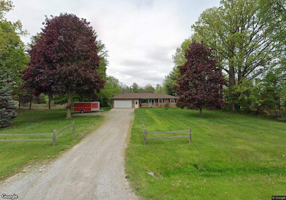
11080 Potter Rd Unit Bldg-Unit Flushing, MI 48433
Estimated Value: $233,000 - $265,178
--
Bed
2
Baths
1,380
Sq Ft
$184/Sq Ft
Est. Value
About This Home
This home is located at 11080 Potter Rd Unit Bldg-Unit, Flushing, MI 48433 and is currently estimated at $254,545, approximately $184 per square foot. 11080 Potter Rd Unit Bldg-Unit is a home located in Genesee County with nearby schools including Seymour Elementary School, Flushing Middle School, and Flushing High School.
Ownership History
Date
Name
Owned For
Owner Type
Purchase Details
Closed on
Oct 11, 2018
Sold by
Johnson Jeffrey H
Bought by
Johnson Jefrey H and Bruner Diane M
Current Estimated Value
Home Financials for this Owner
Home Financials are based on the most recent Mortgage that was taken out on this home.
Original Mortgage
$78,500
Outstanding Balance
$48,756
Interest Rate
4.5%
Mortgage Type
New Conventional
Estimated Equity
$205,789
Purchase Details
Closed on
Jun 8, 2018
Sold by
Bums Ronald R and Bums Jancie R
Bought by
Johnson Jeffery H
Create a Home Valuation Report for This Property
The Home Valuation Report is an in-depth analysis detailing your home's value as well as a comparison with similar homes in the area
Home Values in the Area
Average Home Value in this Area
Purchase History
| Date | Buyer | Sale Price | Title Company |
|---|---|---|---|
| Johnson Jefrey H | -- | Sargents Title Co | |
| Johnson Jeffery H | $157,000 | Bell Title Agency |
Source: Public Records
Mortgage History
| Date | Status | Borrower | Loan Amount |
|---|---|---|---|
| Open | Johnson Jefrey H | $78,500 |
Source: Public Records
Tax History Compared to Growth
Tax History
| Year | Tax Paid | Tax Assessment Tax Assessment Total Assessment is a certain percentage of the fair market value that is determined by local assessors to be the total taxable value of land and additions on the property. | Land | Improvement |
|---|---|---|---|---|
| 2025 | $2,991 | $109,900 | $0 | $0 |
| 2024 | $1,613 | $107,500 | $0 | $0 |
| 2023 | $1,540 | $97,400 | $0 | $0 |
| 2022 | $2,697 | $87,500 | $0 | $0 |
| 2021 | $2,642 | $82,000 | $0 | $0 |
| 2020 | $1,432 | $78,200 | $0 | $0 |
| 2019 | $1,417 | $71,600 | $0 | $0 |
| 2018 | $2,239 | $65,900 | $0 | $0 |
| 2017 | $1,129 | $65,900 | $0 | $0 |
| 2016 | $2,049 | $65,100 | $0 | $0 |
| 2015 | $1,901 | $64,400 | $0 | $0 |
| 2014 | $1,111 | $61,500 | $0 | $0 |
| 2012 | -- | $58,200 | $58,200 | $0 |
Source: Public Records
Map
Nearby Homes
- 10525 W Pierson Rd
- 10167 W Pierson Rd
- 3372 Woodridge Dr
- 3462 Woodridge Dr
- 3330 Sheridan Rd
- 219 Primrose Ln
- 000 Potter Rd
- 9298 Hilda Ln
- 309 Arthur St
- 199 Brookside Dr
- 4121 Sheridan Rd
- 0 Winters Eave Dr Unit 50117986
- 1513 N Seymour Rd
- 11358 W Carpenter Rd Rd
- 1445 N Seymour Rd
- 308 N Seymour Rd
- 10101 Carpenter Rd
- 6289 W River Rd
- 4471 Duffield Rd
- 0 E River Rd Unit 50180952
- 11080 Potter Rd
- 11108 Potter Rd
- 11050 Potter Rd
- 3036 Dillon Rd
- 3016 Dillon Rd
- 11072 Potter Rd
- 3066 Dillon Rd
- 11081 Potter Rd
- 11065 Potter Rd
- 11030 Potter Rd
- 11021 Potter Rd
- 11014 Potter Rd
- 3106 Dillon Rd
- 2533 Nichols Rd
- 3073 Dillon Rd
- 3079 Dillon Rd
- 3114 Dillon Rd
- 3089 Dillon Rd
- 2473 Nichols Rd
- 11113 Potter Rd