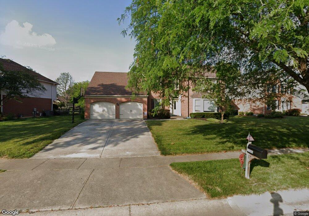
11082 Allenhurst Blvd E Cincinnati, OH 45241
Estimated Value: $385,724 - $487,000
4
Beds
3
Baths
2,103
Sq Ft
$207/Sq Ft
Est. Value
About This Home
This home is located at 11082 Allenhurst Blvd E, Cincinnati, OH 45241 and is currently estimated at $435,931, approximately $207 per square foot. 11082 Allenhurst Blvd E is a home located in Hamilton County with nearby schools including Sharonville Elementary School, Princeton Community Middle School, and Princeton High School.
Ownership History
Date
Name
Owned For
Owner Type
Purchase Details
Closed on
Aug 27, 2003
Sold by
Gwin Kevin M and Gwin Brenda J
Bought by
Schindler Robert and Schindler Susan
Current Estimated Value
Home Financials for this Owner
Home Financials are based on the most recent Mortgage that was taken out on this home.
Original Mortgage
$130,000
Interest Rate
6.18%
Mortgage Type
Unknown
Create a Home Valuation Report for This Property
The Home Valuation Report is an in-depth analysis detailing your home's value as well as a comparison with similar homes in the area
Home Values in the Area
Average Home Value in this Area
Purchase History
| Date | Buyer | Sale Price | Title Company |
|---|---|---|---|
| Schindler Robert | $210,000 | Old National Title Llc |
Source: Public Records
Mortgage History
| Date | Status | Borrower | Loan Amount |
|---|---|---|---|
| Previous Owner | Schindler Robert | $130,000 |
Source: Public Records
Tax History
| Year | Tax Paid | Tax Assessment Tax Assessment Total Assessment is a certain percentage of the fair market value that is determined by local assessors to be the total taxable value of land and additions on the property. | Land | Improvement |
|---|---|---|---|---|
| 2025 | $4,873 | $102,463 | $19,075 | $83,388 |
| 2024 | $4,159 | $102,463 | $19,075 | $83,388 |
| 2023 | $4,163 | $102,463 | $19,075 | $83,388 |
| 2022 | $4,041 | $79,923 | $18,886 | $61,037 |
| 2021 | $3,928 | $79,923 | $18,886 | $61,037 |
| 2020 | $3,974 | $79,923 | $18,886 | $61,037 |
| 2019 | $3,963 | $73,322 | $17,325 | $55,997 |
| 2018 | $3,718 | $73,322 | $17,325 | $55,997 |
| 2017 | $3,481 | $73,322 | $17,325 | $55,997 |
| 2016 | $3,557 | $74,313 | $16,853 | $57,460 |
| 2015 | $3,592 | $74,313 | $16,853 | $57,460 |
| 2014 | $3,604 | $74,313 | $16,853 | $57,460 |
| 2013 | $3,290 | $69,451 | $15,750 | $53,701 |
Source: Public Records
Map
Nearby Homes
- 11108 Huntwicke Place
- 4051 Falling Creek Ct
- 4170 Cornell Rd
- 4036 Haverstraw Dr
- 4365 Classic Dr
- 4071 E Kemper Rd
- 10514 Thornview Dr
- 4254 Fox Hollow Dr
- 3380 Spurrier Ln
- 5930 Carpol St
- 3703 Moorhill Dr
- 3319 Mcgrew St
- 3590 Glendale Milford Rd
- 4195 Crystal View Ct
- 10561 Plainfield Rd
- 10301 Giverny Blvd
- 10432 Hickory Point Dr
- 4204 Magnolia Aly
- 3875 Hauck Rd
- 4270 Parkview Dr
- 11088 Allenhurst Blvd E
- 11076 Allenhurst Blvd E
- 4211 Allenhurst Close Ct
- 4205 Allenhurst Close
- 4211 Allenhurst Close
- 11094 Allenhurst Blvd E
- 11070 Allenhurst Blvd E
- 4144 Malaer Dr
- 4139 Benkert Dr
- 11077 Allenhurst Blvd E
- 4199 Allenhurst Close
- 11100 Allenhurst Blvd E
- 4210 Allenhurst Close Ct
- 11064 Allenhurst Blvd E
- 4210 Allenhurst Close
- 4114 Benkert Dr
- 11071 Allenhurst Blvd E
- 4138 Malaer Dr
- 4133 Benkert Dr
- 4169 Malaer Dr
Your Personal Tour Guide
Ask me questions while you tour the home.