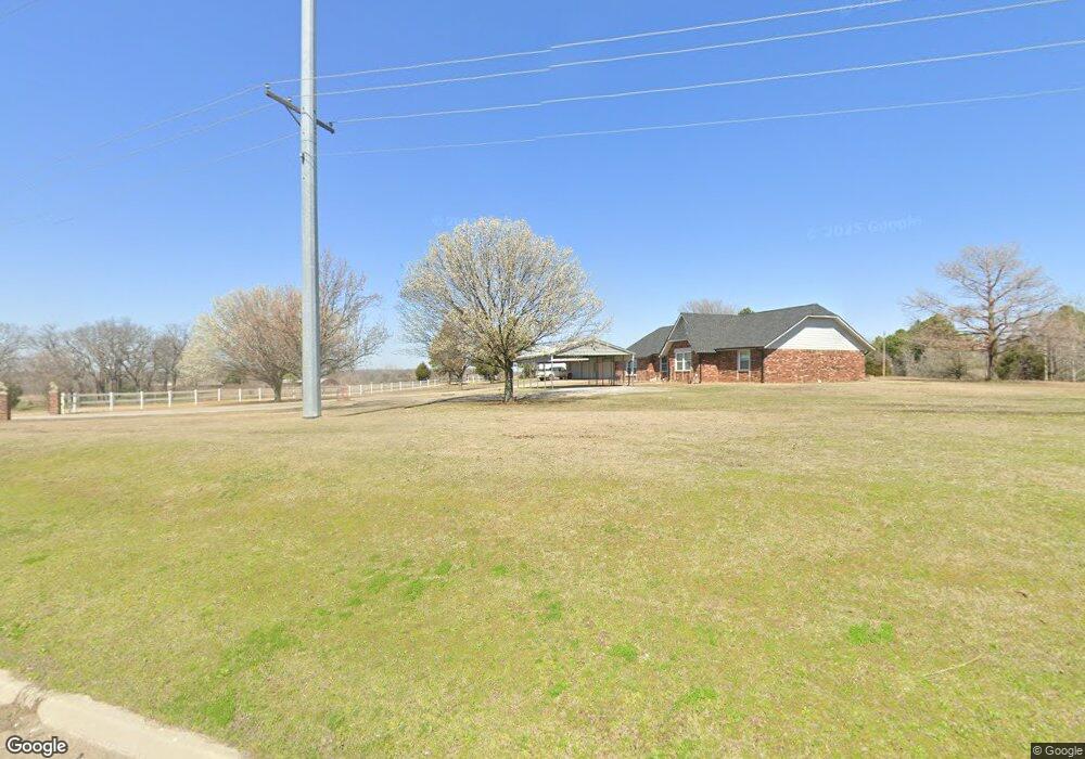
11085 W 81st St S Sapulpa, OK 74066
Estimated Value: $333,000 - $512,000
3
Beds
2
Baths
2,344
Sq Ft
$170/Sq Ft
Est. Value
About This Home
This home is located at 11085 W 81st St S, Sapulpa, OK 74066 and is currently estimated at $399,432, approximately $170 per square foot. 11085 W 81st St S is a home located in Creek County with nearby schools including Allen-Bowden Public School and Eagle Point Christian Academy.
Ownership History
Date
Name
Owned For
Owner Type
Purchase Details
Closed on
Sep 1, 2015
Sold by
The Harold Campbell Revocable Trust
Bought by
Legrand Dalbert D and Legrand Myrtle L
Current Estimated Value
Purchase Details
Closed on
Mar 9, 1998
Sold by
Blair Buddy and Blair Barbara
Create a Home Valuation Report for This Property
The Home Valuation Report is an in-depth analysis detailing your home's value as well as a comparison with similar homes in the area
Home Values in the Area
Average Home Value in this Area
Purchase History
| Date | Buyer | Sale Price | Title Company |
|---|---|---|---|
| Legrand Dalbert D | $243,500 | Creek County Abstract Co Inc | |
| -- | $105,000 | -- |
Source: Public Records
Tax History Compared to Growth
Tax History
| Year | Tax Paid | Tax Assessment Tax Assessment Total Assessment is a certain percentage of the fair market value that is determined by local assessors to be the total taxable value of land and additions on the property. | Land | Improvement |
|---|---|---|---|---|
| 2025 | $2,229 | $28,158 | $1,673 | $26,485 |
| 2024 | $2,229 | $28,158 | $1,598 | $26,560 |
| 2023 | $2,229 | $28,158 | $1,806 | $26,352 |
| 2022 | $2,266 | $28,158 | $1,920 | $26,238 |
| 2021 | $2,272 | $28,158 | $2,241 | $25,917 |
| 2020 | $2,253 | $28,158 | $2,250 | $25,908 |
| 2019 | $2,341 | $29,249 | $2,241 | $27,008 |
| 2018 | $2,372 | $29,249 | $2,241 | $27,008 |
| 2017 | $2,388 | $29,249 | $2,230 | $27,019 |
| 2016 | $1,237 | $15,385 | $1,128 | $14,257 |
| 2015 | -- | $14,937 | $1,128 | $13,809 |
| 2014 | -- | $14,502 | $1,151 | $13,351 |
Source: Public Records
Map
Nearby Homes
- 0 S 113th West Ave
- 114 Sherlyn Ln
- 0 Tracie Ln
- 11205 W Tiger Ln
- 12466 W 91st Place S
- 6872 S 97th West Ave
- 8 E Carriage Rd
- 6 E Carriage Rd
- 0 S 97th West Ave
- 6250 S 97th West Ave
- 31 S 241st West Ave
- 8228 S 145th Ave W Unit Tract 2
- 8228 S 145th Ave W
- 8420 S 145th West Ave
- 9201 Freedom Ave
- 1124 N 9th St
- 10901 W 57th St S
- 912 N Linden St
- 0 S 102nd Ave W Unit 2542522
- 0 Gary Dr Unit 2541753
- 10905 W 81st St S
- 10987 W 81st St S
- 11089 W 81st St S
- 7873 S Highway 97
- 10980 W 81st St S
- 10980 W 81st St S
- 8225 S 113th West Ave
- 11130 W 81st St S
- 8189 S 113th West Ave
- 8251 S 113th West Ave
- 3203 North Park
- 11200 W 81st St S
- 7861 S Highway 97
- 8281 S 113th West Ave
- 8128 S Highway 97
- 8138 S Highway 97
- 9 Gail Ln
- 15 Gail Ln
- 21 Gail Ln
- 27 Gail Ln