Estimated Value: $481,000 - $760,000
3
Beds
3
Baths
1,674
Sq Ft
$375/Sq Ft
Est. Value
About This Home
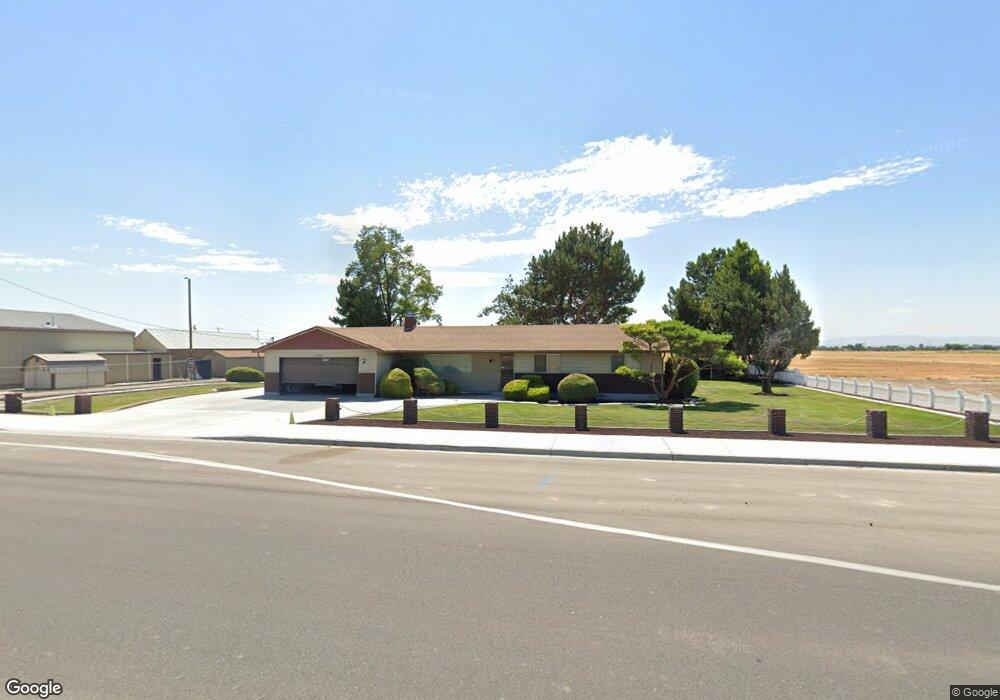
This home is located at 11089 Ustick Rd, Nampa, ID 83687 and is currently estimated at $628,101, approximately $375 per square foot. 11089 Ustick Rd is a home located in Canyon County with nearby schools including Skyway Elementary, Ridgevue High School, and Vision Charter School.
Ownership History
Date
Name
Owned For
Owner Type
Purchase Details
Closed on
Sep 26, 2022
Sold by
Niblett Brian Scott and Christy Jean
Bought by
Utchi Llc
Current Estimated Value
Purchase Details
Closed on
Jun 8, 2022
Sold by
Sparks Leslie B
Bought by
City Of Caldwell
Purchase Details
Closed on
Aug 28, 2020
Sold by
Sparks Leslie B
Bought by
Sparks Leslie B
Purchase Details
Closed on
Feb 17, 2006
Sold by
Anderson Phoebe H and Anderson Phoebe G
Bought by
Sparks Leslie B
Create a Home Valuation Report for This Property
The Home Valuation Report is an in-depth analysis detailing your home's value as well as a comparison with similar homes in the area
Home Values in the Area
Average Home Value in this Area
Purchase History
| Date | Buyer | Sale Price | Title Company |
|---|---|---|---|
| Utchi Llc | -- | -- | |
| City Of Caldwell | -- | -- | |
| Sparks Leslie B | -- | None Available | |
| Sparks Leslie B | -- | Title One |
Source: Public Records
Tax History Compared to Growth
Tax History
| Year | Tax Paid | Tax Assessment Tax Assessment Total Assessment is a certain percentage of the fair market value that is determined by local assessors to be the total taxable value of land and additions on the property. | Land | Improvement |
|---|---|---|---|---|
| 2025 | -- | $509,000 | $182,700 | $326,300 |
| 2024 | $2,584 | $516,300 | $182,700 | $333,600 |
| 2023 | $2,584 | $517,600 | $182,700 | $334,900 |
| 2022 | $3,667 | $567,320 | $220,820 | $346,500 |
| 2021 | $2,498 | $414,950 | $130,250 | $284,700 |
| 2020 | $2,677 | $356,290 | $101,990 | $254,300 |
| 2019 | $2,646 | $326,010 | $82,010 | $244,000 |
| 2018 | $2,573 | $0 | $0 | $0 |
| 2017 | $2,477 | $0 | $0 | $0 |
| 2016 | $2,296 | $0 | $0 | $0 |
| 2015 | $2,262 | $0 | $0 | $0 |
| 2014 | $1,732 | $193,960 | $51,860 | $142,100 |
Source: Public Records
Map
Nearby Homes
- 18177 Royal Way
- 10925 Quail Cove Ct
- 17637 Mason Ridge Way
- 10790 Saffron Dr
- 10848 Pixie St
- 17798 Mesa Springs Ave
- 18295 Spicebush Ave
- 18376 Spicebush Ave
- 10623 Avalon St
- 17742 Mountain Springs Ave
- 10601 Alpine St
- 10390 Scout Ridge St
- 10439 Stony Oak St
- The Bruneau Plan at Arbor
- The Hawley Plan at Arbor
- The Sawtooth Plan at Arbor
- The Chelsea Plan at Arbor
- 10427 Stony Oak St
- 10444 Stony Oak St
- 10415 Stony Oak St
- 11021 Ustick Rd
- 10952 Ustick Rd
- 0 Middleton Rd Unit 98486414
- 0 Middleton Rd Unit 98640491
- 18036 Middleton Rd
- 10958 Rocky Mountain Ln
- 18245 Hush Creek Way
- 10932 Rocky Mountain Ln
- TBD Middleton Rd
- 17989 Monarch Way
- 17989 Monarch Way
- 17965 Monarch Way
- 17953 Monarch Way
- 17949 Monarch Way
- 17937 Monarch Way
- 17937 Monarch Way Unit Way
- 17925 Monarch Way
- 10850 Ustick Rd
- 17917 Monarch Way
- 10840 Rocky Mountain Ln