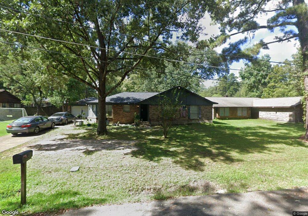
1109 Billingsley St Lufkin, TX 75901
Estimated Value: $146,000 - $209,000
--
Bed
8
Baths
1,461
Sq Ft
$116/Sq Ft
Est. Value
About This Home
This home is located at 1109 Billingsley St, Lufkin, TX 75901 and is currently estimated at $168,835, approximately $115 per square foot. 1109 Billingsley St is a home located in Angelina County with nearby schools including Herty Primary School, Coston Elementary School, and Lufkin Middle School.
Ownership History
Date
Name
Owned For
Owner Type
Purchase Details
Closed on
Jul 3, 2006
Sold by
Winston Land & Cattle I Ltd
Bought by
Perez Jesus
Current Estimated Value
Home Financials for this Owner
Home Financials are based on the most recent Mortgage that was taken out on this home.
Original Mortgage
$68,000
Interest Rate
6.63%
Mortgage Type
New Conventional
Create a Home Valuation Report for This Property
The Home Valuation Report is an in-depth analysis detailing your home's value as well as a comparison with similar homes in the area
Home Values in the Area
Average Home Value in this Area
Purchase History
| Date | Buyer | Sale Price | Title Company |
|---|---|---|---|
| Perez Jesus | $68,000 | None Available |
Source: Public Records
Mortgage History
| Date | Status | Borrower | Loan Amount |
|---|---|---|---|
| Closed | Perez Jesus | $68,000 |
Source: Public Records
Tax History Compared to Growth
Tax History
| Year | Tax Paid | Tax Assessment Tax Assessment Total Assessment is a certain percentage of the fair market value that is determined by local assessors to be the total taxable value of land and additions on the property. | Land | Improvement |
|---|---|---|---|---|
| 2025 | $2,426 | $116,090 | $16,360 | $99,730 |
| 2024 | $2,414 | $115,530 | $16,360 | $99,170 |
| 2023 | $2,266 | $114,020 | $16,360 | $97,660 |
| 2022 | $2,536 | $111,360 | $8,310 | $103,050 |
| 2021 | $2,796 | $113,510 | $8,310 | $105,200 |
| 2020 | $2,120 | $96,640 | $8,310 | $88,330 |
| 2019 | $2,039 | $98,120 | $8,310 | $89,810 |
| 2018 | $1,314 | $71,310 | $6,230 | $65,080 |
| 2017 | $1,314 | $67,860 | $6,230 | $61,630 |
| 2016 | $2,075 | $87,060 | $8,310 | $78,750 |
| 2015 | $1,627 | $82,470 | $8,310 | $74,160 |
| 2014 | $1,627 | $83,980 | $8,310 | $75,670 |
Source: Public Records
Map
Nearby Homes
- 607 Humason Ave
- 329 Humason Ave
- 916 Circle Dr
- 333 Humason Ave
- 2404 Davisville Rd
- 505 Brasell St
- 2504 Davisville Rd
- TBD State Highway 103
- 1518 Phelps St
- 233 N Banks St
- 223 Stoney Ridge
- 1902 Pine Burr St
- 4795 LEWIS & PO Norwood Dr
- 1706 approx. Norwood Dr
- 1911 Paul Ave
- 408 Bob St
- 2105 Paul Ave
- 201 Silver Spur Dr
- 217 Derek Rd
- 1618 Paul Ave
- 1105 Billingsley St
- 1111 Billingsley St
- 1106 Mayberry St
- 1110 Mayberry St
- 1103 Billingsley St
- 1104 Mayberry St
- 1104 Maberry St
- 1113 Billingsley St
- 1114 Mayberry St
- 1102 Mayberry St
- 1114 Maberry St
- 1105 Mayberry St
- 1109 Mayberry St
- 706 Clay Ave
- 1111 Mayberry St
- 708 Clay Ave
- 1109 Maberry St
- 702 Clay Ave
- 704 Clay Ave
- 1113 Maberry St