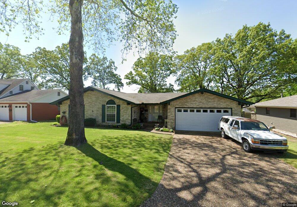
1109 Coulter Rd Sherwood, AR 72120
Estimated Value: $210,329 - $225,000
--
Bed
3
Baths
1,742
Sq Ft
$126/Sq Ft
Est. Value
About This Home
This home is located at 1109 Coulter Rd, Sherwood, AR 72120 and is currently estimated at $220,082, approximately $126 per square foot. 1109 Coulter Rd is a home located in Pulaski County with nearby schools including Sherwood Elementary School, Sylvan Hills Middle School, and Sylvan Hills High School.
Ownership History
Date
Name
Owned For
Owner Type
Purchase Details
Closed on
Feb 24, 2005
Sold by
Lowe Robert G
Bought by
Lowe Tammy L
Current Estimated Value
Purchase Details
Closed on
Sep 15, 2000
Sold by
Cooper Max and Cooper Linda
Bought by
Lowe Robert G and Lowe Tammy L
Home Financials for this Owner
Home Financials are based on the most recent Mortgage that was taken out on this home.
Original Mortgage
$102,000
Interest Rate
8.01%
Mortgage Type
VA
Create a Home Valuation Report for This Property
The Home Valuation Report is an in-depth analysis detailing your home's value as well as a comparison with similar homes in the area
Home Values in the Area
Average Home Value in this Area
Purchase History
| Date | Buyer | Sale Price | Title Company |
|---|---|---|---|
| Lowe Tammy L | $10,000 | -- | |
| Lowe Robert G | $100,000 | American Abstract & Title Co |
Source: Public Records
Mortgage History
| Date | Status | Borrower | Loan Amount |
|---|---|---|---|
| Previous Owner | Lowe Robert G | $102,000 |
Source: Public Records
Tax History Compared to Growth
Tax History
| Year | Tax Paid | Tax Assessment Tax Assessment Total Assessment is a certain percentage of the fair market value that is determined by local assessors to be the total taxable value of land and additions on the property. | Land | Improvement |
|---|---|---|---|---|
| 2025 | $2,072 | $40,518 | $6,200 | $34,318 |
| 2024 | $1,899 | $40,518 | $6,200 | $34,318 |
| 2023 | $1,899 | $40,518 | $6,200 | $34,318 |
| 2022 | $2,020 | $40,518 | $6,200 | $34,318 |
| 2021 | $1,890 | $33,120 | $4,800 | $28,320 |
| 2020 | $1,507 | $33,120 | $4,800 | $28,320 |
| 2019 | $1,507 | $33,120 | $4,800 | $28,320 |
| 2018 | $1,472 | $33,120 | $4,800 | $28,320 |
| 2017 | $1,373 | $33,120 | $4,800 | $28,320 |
| 2016 | $1,297 | $29,080 | $4,400 | $24,680 |
| 2015 | $1,450 | $28,552 | $4,400 | $24,152 |
| 2014 | $1,450 | $26,172 | $4,400 | $21,772 |
Source: Public Records
Map
Nearby Homes
- 613 Beaconsfield Rd
- 614 Beaconsfield Rd
- 926 Karla Cir
- 901 Coulter Rd
- 301 E Devon Ave
- 503 Brent Dr
- 604 Beverly Ave E
- 304 Verona Ave
- 300 Burntwood Rd
- 10 Campden Hill Rd
- 3305 Seminole Trail
- 4425 Valley Brook Dr
- 205 Spring River Rd
- 5101 Burrow Dr
- 400 Fork River Rd
- 5201 Fairway Dr
- 5009 Burrow Dr
- 5317 Fairway Ave
- 4524 Dawson Dr
- 1406 Coolhurst Ave
- 1111 Coulter Rd
- 1107 Coulter Rd
- 1200 Dyson Dr
- 1201 Coulter Rd
- 1105 Coulter Rd
- 1106 Dyson Dr
- 1110 Coulter Rd
- 1202 Dyson Dr
- 1108 Coulter Rd
- 1104 Dyson Dr
- 616 S Longfield Ave
- 1203 Coulter Rd
- 1204 Dyson Dr
- 1103 Coulter Rd
- 1106 Coulter Rd
- 1102 Dyson Dr
- 611 S Longfield Ave
- 1204 Coulter Rd
- 1206 Dyson Dr
- 1104 Coulter Rd