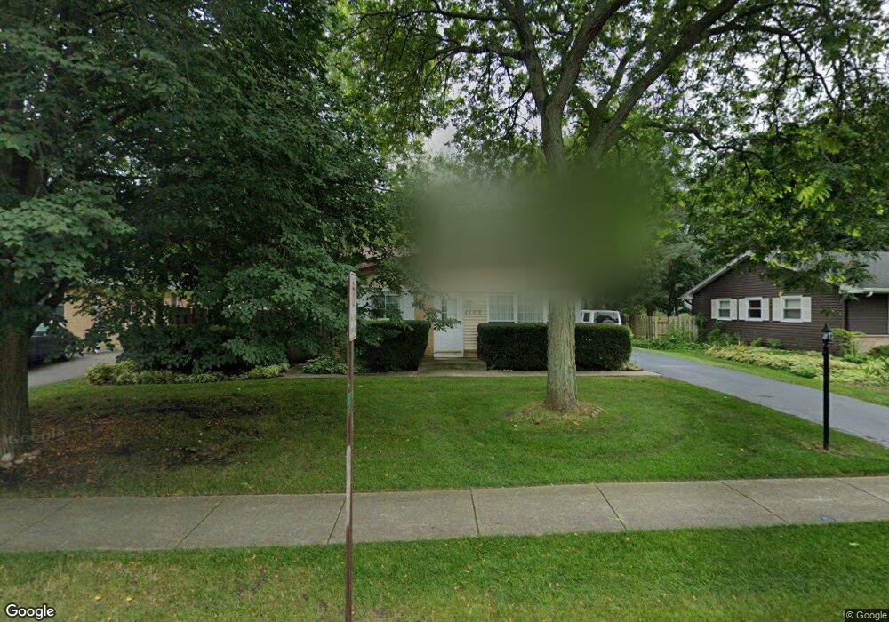
1109 Harms Ave Libertyville, IL 60048
South Libertyville NeighborhoodEstimated Value: $377,741 - $481,000
--
Bed
2
Baths
1,148
Sq Ft
$384/Sq Ft
Est. Value
About This Home
This home is located at 1109 Harms Ave, Libertyville, IL 60048 and is currently estimated at $440,935, approximately $384 per square foot. 1109 Harms Ave is a home located in Lake County with nearby schools including Rockland Elementary School, Highland Middle School, and Libertyville High School.
Ownership History
Date
Name
Owned For
Owner Type
Purchase Details
Closed on
Jan 12, 2006
Sold by
Singh Leelabai
Bought by
Singh Kuber R and Singh Leelabai D
Current Estimated Value
Home Financials for this Owner
Home Financials are based on the most recent Mortgage that was taken out on this home.
Original Mortgage
$307,800
Outstanding Balance
$202,803
Interest Rate
9.37%
Mortgage Type
Purchase Money Mortgage
Estimated Equity
$238,132
Purchase Details
Closed on
Oct 10, 2002
Sold by
Pereda Tiffany M
Bought by
Singh Leelabai
Home Financials for this Owner
Home Financials are based on the most recent Mortgage that was taken out on this home.
Original Mortgage
$227,700
Interest Rate
4.5%
Mortgage Type
Stand Alone First
Purchase Details
Closed on
May 16, 2002
Sold by
Swanson Gary E and Swanson Anne L
Bought by
Pereda Tiffany M
Home Financials for this Owner
Home Financials are based on the most recent Mortgage that was taken out on this home.
Original Mortgage
$215,000
Interest Rate
5.62%
Purchase Details
Closed on
May 13, 1994
Sold by
Pappas Matthew P and Pappas Laura D
Bought by
Swanson Gary E and Swanson Anne L
Home Financials for this Owner
Home Financials are based on the most recent Mortgage that was taken out on this home.
Original Mortgage
$137,600
Interest Rate
8.5%
Create a Home Valuation Report for This Property
The Home Valuation Report is an in-depth analysis detailing your home's value as well as a comparison with similar homes in the area
Home Values in the Area
Average Home Value in this Area
Purchase History
| Date | Buyer | Sale Price | Title Company |
|---|---|---|---|
| Singh Kuber R | -- | None Available | |
| Singh Leelabai | $253,000 | Multiple | |
| Pereda Tiffany M | $235,000 | -- | |
| Swanson Gary E | $172,000 | Chicago Title Insurance Co |
Source: Public Records
Mortgage History
| Date | Status | Borrower | Loan Amount |
|---|---|---|---|
| Open | Singh Kuber R | $307,800 | |
| Closed | Singh Leelabai | $227,700 | |
| Previous Owner | Pereda Tiffany M | $215,000 | |
| Previous Owner | Swanson Gary E | $137,600 |
Source: Public Records
Tax History Compared to Growth
Tax History
| Year | Tax Paid | Tax Assessment Tax Assessment Total Assessment is a certain percentage of the fair market value that is determined by local assessors to be the total taxable value of land and additions on the property. | Land | Improvement |
|---|---|---|---|---|
| 2024 | $6,842 | $109,462 | $53,548 | $55,914 |
| 2023 | $6,967 | $100,961 | $49,389 | $51,572 |
| 2022 | $6,967 | $98,113 | $47,471 | $50,642 |
| 2021 | $6,694 | $96,001 | $46,449 | $49,552 |
| 2020 | $6,433 | $94,387 | $45,668 | $48,719 |
| 2019 | $6,275 | $93,490 | $45,234 | $48,256 |
| 2018 | $6,386 | $95,516 | $45,994 | $49,522 |
| 2017 | $6,478 | $92,501 | $44,542 | $47,959 |
| 2016 | $6,253 | $87,704 | $42,232 | $45,472 |
| 2015 | $6,182 | $81,974 | $39,473 | $42,501 |
| 2014 | $5,923 | $77,275 | $37,088 | $40,187 |
| 2012 | $5,730 | $77,946 | $37,410 | $40,536 |
Source: Public Records
Map
Nearby Homes
- 1137 Pine Tree Ln
- 1330 W Park Ave
- 533 Drake St
- 20924 & 20902 W Park Ave
- 223 Kenloch Ave
- 423 Ames St
- 0 Ames St
- 551 W Park Ave Unit E
- 777 Garfield Ave Unit A
- 747 Garfield Ave Unit C
- 1017 Juniper Pkwy
- 2245 Hazeltime Dr
- 308 Mckinley Ave
- 851 Garfield Ave Unit C
- 323 W Golf Rd
- 1754 Glenmore Rd
- 422 Shadow Creek Dr
- 501 Hemlock Ln
- 420 W Cook Ave
- 505 Lange Ct