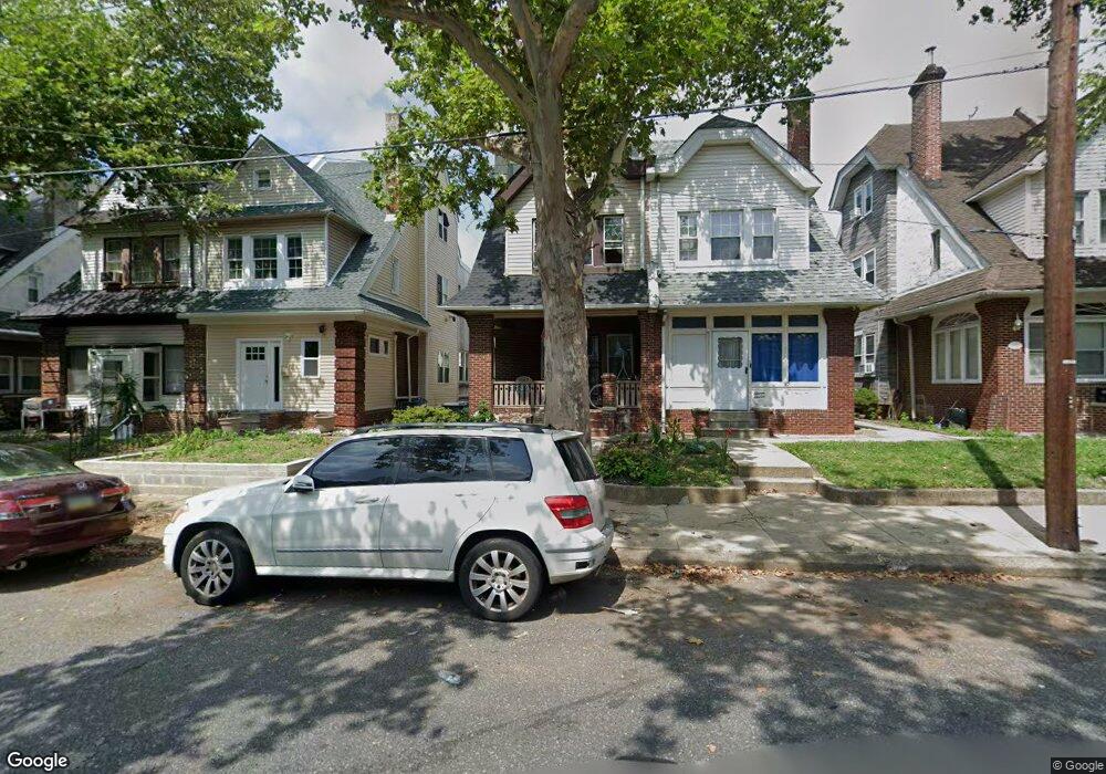
1109 Harrison St Philadelphia, PA 19124
Frankford NeighborhoodEstimated Value: $257,710 - $279,000
4
Beds
1
Bath
1,800
Sq Ft
$147/Sq Ft
Est. Value
About This Home
This home is located at 1109 Harrison St, Philadelphia, PA 19124 and is currently estimated at $264,928, approximately $147 per square foot. 1109 Harrison St is a home located in Philadelphia County with nearby schools including Frankford High School, The Philadelphia Charter School for the Arts & Sciences, and Northwood Academy Charter School.
Ownership History
Date
Name
Owned For
Owner Type
Purchase Details
Closed on
Mar 30, 2005
Sold by
Frankford Group Ministry Inc
Bought by
Magbe Thomas Donald and Magbe Thomas
Current Estimated Value
Home Financials for this Owner
Home Financials are based on the most recent Mortgage that was taken out on this home.
Original Mortgage
$64,900
Outstanding Balance
$33,248
Interest Rate
5.87%
Mortgage Type
Fannie Mae Freddie Mac
Estimated Equity
$231,680
Create a Home Valuation Report for This Property
The Home Valuation Report is an in-depth analysis detailing your home's value as well as a comparison with similar homes in the area
Home Values in the Area
Average Home Value in this Area
Purchase History
| Date | Buyer | Sale Price | Title Company |
|---|---|---|---|
| Magbe Thomas Donald | $114,900 | -- |
Source: Public Records
Mortgage History
| Date | Status | Borrower | Loan Amount |
|---|---|---|---|
| Open | Magbe Thomas Donald | $64,900 |
Source: Public Records
Tax History Compared to Growth
Tax History
| Year | Tax Paid | Tax Assessment Tax Assessment Total Assessment is a certain percentage of the fair market value that is determined by local assessors to be the total taxable value of land and additions on the property. | Land | Improvement |
|---|---|---|---|---|
| 2026 | $2,549 | $228,700 | $45,740 | $182,960 |
| 2025 | $2,549 | $228,700 | $45,740 | $182,960 |
| 2024 | $2,549 | $228,700 | $45,740 | $182,960 |
| 2023 | $2,549 | $182,100 | $36,420 | $145,680 |
| 2022 | $1,776 | $137,100 | $36,420 | $100,680 |
| 2021 | $2,406 | $0 | $0 | $0 |
| 2020 | $2,406 | $0 | $0 | $0 |
| 2019 | $2,308 | $0 | $0 | $0 |
| 2018 | $1,939 | $0 | $0 | $0 |
| 2017 | $2,359 | $0 | $0 | $0 |
| 2016 | $1,939 | $0 | $0 | $0 |
| 2015 | $1,856 | $0 | $0 | $0 |
| 2014 | -- | $168,500 | $39,333 | $129,167 |
| 2012 | -- | $15,776 | $2,304 | $13,472 |
Source: Public Records
Map
Nearby Homes
- 1052 Allengrove St
- 1859 Harrison St
- 1208 Haworth St
- 1214 Haworth St
- 4717 Northwood St
- 1300 Harrison St
- 1001-3 Arrott St
- 1335 Fillmore St
- 5118 Oakland St
- 926 Foulkrod St
- 5033 Akron St
- 1204 Pratt St
- 1218 Pratt St
- 1220 Pratt St
- 4632 Oakland St
- 1359 Dyre St
- 4046 E Roosevelt Blvd
- 4628 Pilling St
- 4600 Horrocks St
- 4626 Pilling St
- 1107 Harrison St
- 1111 Harrison St
- 1105 Harrison St
- 1113 Harrison St
- 1115 Harrison St
- 1103 Harrison St
- 1101 Harrison St
- 1117 Harrison St
- 1119 Harrison St
- 1106 Allengrove St
- 1108 Allengrove St
- 1104 Allengrove St
- 1110 Allengrove St
- 1102 Allengrove St
- 1121 Harrison St
- 1112 Allengrove St
- 1100 Allengrove St
- 1114 Allengrove St
- 1123 Harrison St
- 1112 Harrison St