Estimated Value: $283,000 - $348,875
3
Beds
3
Baths
2,640
Sq Ft
$117/Sq Ft
Est. Value
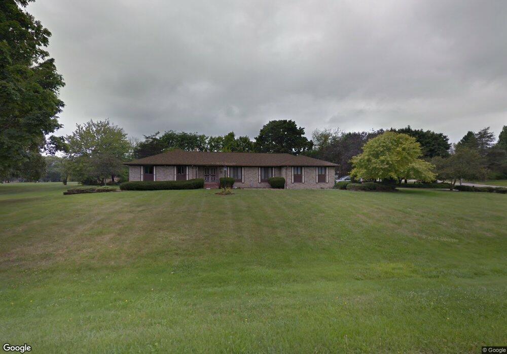
About This Home
This home is located at 1109 Maplekrest Dr, Flint, MI 48532 and is currently estimated at $307,719, approximately $116 per square foot. 1109 Maplekrest Dr is a home located in Genesee County with nearby schools including Carman-Ainsworth High School, Genesee STEM Academy, and First Flint Seventh-day Adventist Christian School.
Ownership History
Date
Name
Owned For
Owner Type
Purchase Details
Closed on
May 28, 2010
Sold by
Freeman L Neal and Freeman Marshall C
Bought by
Smith Tracee M
Current Estimated Value
Purchase Details
Closed on
Aug 31, 2005
Sold by
Freeman Harriet J and The Donald R & Harriet J Freem
Bought by
Donald R Freeman Revocable Grantor Trust and Harriet J Freeman Revocable Grantor Tr
Purchase Details
Closed on
Nov 17, 2004
Sold by
Freeman Donald R and Freeman Harriet J
Bought by
Donald R and Freeman Revocable T Harriet J
Create a Home Valuation Report for This Property
The Home Valuation Report is an in-depth analysis detailing your home's value as well as a comparison with similar homes in the area
Home Values in the Area
Average Home Value in this Area
Purchase History
| Date | Buyer | Sale Price | Title Company |
|---|---|---|---|
| Smith Tracee M | $121,000 | First American Title Ins Co | |
| Donald R Freeman Revocable Grantor Trust | -- | None Available | |
| Donald R | -- | -- |
Source: Public Records
Tax History
| Year | Tax Paid | Tax Assessment Tax Assessment Total Assessment is a certain percentage of the fair market value that is determined by local assessors to be the total taxable value of land and additions on the property. | Land | Improvement |
|---|---|---|---|---|
| 2025 | $3,901 | $155,700 | $0 | $0 |
| 2024 | $2,119 | $143,900 | $0 | $0 |
| 2023 | $2,022 | $136,700 | $0 | $0 |
| 2022 | $1,609 | $104,600 | $0 | $0 |
| 2021 | $3,447 | $100,500 | $0 | $0 |
| 2020 | $1,817 | $100,500 | $0 | $0 |
| 2019 | $1,791 | $99,000 | $0 | $0 |
| 2018 | $3,214 | $94,600 | $0 | $0 |
| 2017 | $3,092 | $94,600 | $0 | $0 |
| 2016 | $3,176 | $91,900 | $0 | $0 |
| 2015 | $3,008 | $78,800 | $0 | $0 |
| 2014 | $1,784 | $75,500 | $0 | $0 |
| 2012 | -- | $76,200 | $76,200 | $0 |
Source: Public Records
Map
Nearby Homes
- 5477 Fernwood Dr
- 5531 Sugarbush Ln
- 5551 Sugar Bush Ln
- 1246 Dyemeadow Ln
- 1161 S Dye Rd
- 6142 Noel Dr
- 1260 Springborrow Dr
- oo Walnut Creek Dr
- 1192 Citation Dr
- 1184 Citation Dr
- 00 Graham St
- 0 Country Ridge Trail
- 1090 Cabot Dr
- Covered Wagons Trail Covered Wagons Trail
- 5411 River Meadow Blvd
- 5021 Forest Side Dr
- 1321 Highland Meadows
- 6090 Lancaster Dr
- 5442 Meadow Creek Ct
- 2008 Beekman Ct
- 1119 Ranfield Ln
- 1083 Maplekrest Dr
- 1114 Maplekrest Dr
- 1135 Ranfield Ln
- 1123 Ranfield Ln
- 1071 Dye Krest Dr
- 1127 Ranfield Ln
- 1132 Maplekrest Dr
- 1138 Woodkrest Dr
- 1122 Woodkrest Dr
- 1057 Dye Krest Dr
- 1152 Woodkrest Dr
- 1089 Dye Krest Dr
- 1108 Woodkrest Dr
- 1159 Maplekrest Dr
- 1150 Maplekrest Dr
- 1168 Woodkrest Dr
- 1094 Woodkrest Dr
- 1048 Dye Krest Dr
- 1024 Briarcliffe Dr
Your Personal Tour Guide
Ask me questions while you tour the home.