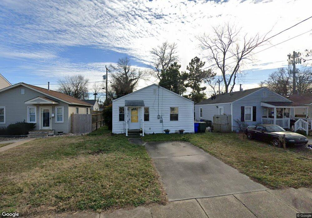
1109 Matthew Henson St Norfolk, VA 23505
Titustown NeighborhoodEstimated Value: $185,000 - $220,000
2
Beds
1
Bath
672
Sq Ft
$289/Sq Ft
Est. Value
About This Home
This home is located at 1109 Matthew Henson St, Norfolk, VA 23505 and is currently estimated at $194,404, approximately $289 per square foot. 1109 Matthew Henson St is a home located in Norfolk City with nearby schools including Camp Allen Elementary School, Blair Middle School, and Granby High School.
Ownership History
Date
Name
Owned For
Owner Type
Purchase Details
Closed on
Mar 3, 2009
Sold by
Woodbury Family Limited Partnership
Bought by
Tawney Angela G
Current Estimated Value
Home Financials for this Owner
Home Financials are based on the most recent Mortgage that was taken out on this home.
Original Mortgage
$97,206
Outstanding Balance
$62,202
Interest Rate
5.25%
Mortgage Type
FHA
Estimated Equity
$132,202
Purchase Details
Closed on
Sep 22, 2005
Sold by
Woodbury Family Lp
Bought by
Woodbury Dennis T
Home Financials for this Owner
Home Financials are based on the most recent Mortgage that was taken out on this home.
Original Mortgage
$50,100
Interest Rate
5.92%
Mortgage Type
Future Advance Clause Open End Mortgage
Create a Home Valuation Report for This Property
The Home Valuation Report is an in-depth analysis detailing your home's value as well as a comparison with similar homes in the area
Home Values in the Area
Average Home Value in this Area
Purchase History
| Date | Buyer | Sale Price | Title Company |
|---|---|---|---|
| Tawney Angela G | $99,000 | Shaffer Title & Escrow Inc | |
| Woodbury Dennis T | -- | -- |
Source: Public Records
Mortgage History
| Date | Status | Borrower | Loan Amount |
|---|---|---|---|
| Open | Tawney Angela G | $97,206 | |
| Previous Owner | Woodbury Dennis T | $50,100 |
Source: Public Records
Tax History Compared to Growth
Tax History
| Year | Tax Paid | Tax Assessment Tax Assessment Total Assessment is a certain percentage of the fair market value that is determined by local assessors to be the total taxable value of land and additions on the property. | Land | Improvement |
|---|---|---|---|---|
| 2025 | $1,778 | $142,200 | $46,500 | $95,700 |
| 2024 | $1,631 | $132,600 | $46,500 | $86,100 |
| 2023 | $1,518 | $121,400 | $46,500 | $74,900 |
| 2022 | $1,294 | $103,500 | $31,900 | $71,600 |
| 2021 | $1,256 | $100,500 | $26,600 | $73,900 |
| 2020 | $1,249 | $99,900 | $26,000 | $73,900 |
| 2019 | $1,173 | $93,800 | $23,500 | $70,300 |
| 2018 | $1,154 | $92,300 | $23,500 | $68,800 |
| 2017 | $1,055 | $91,700 | $22,000 | $69,700 |
| 2016 | $997 | $88,800 | $17,000 | $71,800 |
| 2015 | $1,011 | $88,800 | $17,000 | $71,800 |
| 2014 | $1,011 | $88,800 | $17,000 | $71,800 |
Source: Public Records
Map
Nearby Homes
- 7720 Dunfield Place Unit 3
- 7738 Castleton Place
- 7467 Dakota Ave
- 7711 Nesbitt Dr
- 7811 Nesbitt Dr
- 7454 Diven St
- 7803 Ruthven Rd
- 1505 Meads Rd Unit A-2
- 1048 Wilmington St
- 525 Birmingham Ave
- 537 Timothy Ave
- 535 Timothy Ave
- 7318 Major Ave
- 7320 Glenroie Ave Unit 2L
- 7320 Glenroie Ave Unit 2G
- 7320 Glenroie Ave Unit 4G
- 7320 Glenroie Ave Unit 7J
- 7320 Glenroie Ave Unit 9G
- 7320 Glenroie Ave Unit 4L
- 7320 Glenroie Ave Unit 10E
- 1107 Matthew Henson St
- 1111 Matthew Henson St
- 1113 Matthew Henson St
- 1105 Matthew Henson St
- 1103 Matthew Henson St
- 1108 Matthew Henson St
- 1119 Meads Rd
- 1110 Matthew Henson St
- 1106 Matthew Henson St
- 1112 Matthew Henson St
- 1101 Matthew Henson St
- 1117 Matthew Henson St
- 1109 Meads Rd
- 1104 Matthew Henson St
- 1125 Meads Rd
- 1125 Meads Rd Unit D
- 1125 Meads Rd Unit B
- 1125 Meads Rd Unit A
- 1125 Meads Rd Unit C
- 1114 Matthew Henson St