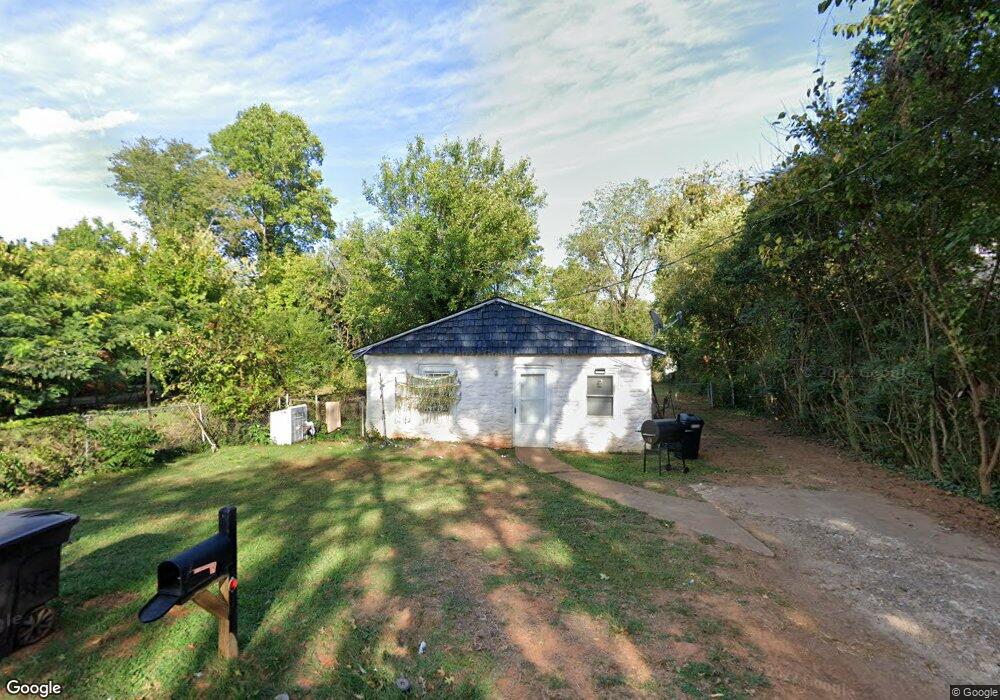
1109 Richland St High Point, NC 27260
Greater High Point NeighborhoodEstimated Value: $121,593 - $167,000
3
Beds
1
Bath
950
Sq Ft
$147/Sq Ft
Est. Value
About This Home
This home is located at 1109 Richland St, High Point, NC 27260 and is currently estimated at $139,898, approximately $147 per square foot. 1109 Richland St is a home located in Guilford County with nearby schools including Fairview Elementary School, Ferndale Middle School, and High Point Central High School.
Ownership History
Date
Name
Owned For
Owner Type
Purchase Details
Closed on
Jul 10, 2006
Sold by
Vileno Darla Jo
Bought by
Vileno Donald P
Current Estimated Value
Purchase Details
Closed on
Sep 30, 2004
Sold by
Abraham Daniel R and Abraham Catherine D
Bought by
Vileno Donald P and Vileno Darla Jo
Home Financials for this Owner
Home Financials are based on the most recent Mortgage that was taken out on this home.
Original Mortgage
$41,300
Interest Rate
5.73%
Mortgage Type
Purchase Money Mortgage
Create a Home Valuation Report for This Property
The Home Valuation Report is an in-depth analysis detailing your home's value as well as a comparison with similar homes in the area
Home Values in the Area
Average Home Value in this Area
Purchase History
| Date | Buyer | Sale Price | Title Company |
|---|---|---|---|
| Vileno Donald P | -- | None Available | |
| Vileno Donald P | $46,000 | -- |
Source: Public Records
Mortgage History
| Date | Status | Borrower | Loan Amount |
|---|---|---|---|
| Previous Owner | Vileno Donald P | $41,300 |
Source: Public Records
Tax History Compared to Growth
Tax History
| Year | Tax Paid | Tax Assessment Tax Assessment Total Assessment is a certain percentage of the fair market value that is determined by local assessors to be the total taxable value of land and additions on the property. | Land | Improvement |
|---|---|---|---|---|
| 2025 | $255 | $18,500 | $10,000 | $8,500 |
| 2024 | $255 | $18,500 | $10,000 | $8,500 |
| 2023 | $255 | $18,500 | $10,000 | $8,500 |
| 2022 | $249 | $18,500 | $10,000 | $8,500 |
| 2021 | $174 | $12,600 | $6,000 | $6,600 |
| 2020 | $174 | $12,600 | $6,000 | $6,600 |
| 2019 | $174 | $12,600 | $0 | $0 |
| 2018 | $173 | $12,600 | $0 | $0 |
| 2017 | $173 | $12,600 | $0 | $0 |
| 2016 | $201 | $14,300 | $0 | $0 |
| 2015 | $202 | $14,300 | $0 | $0 |
| 2014 | $205 | $14,300 | $0 | $0 |
Source: Public Records
Map
Nearby Homes
- 1010 Grace St
- 1035 Asheboro St
- 901 Richland St
- 915 Park St
- 909 Sharon St
- 650 Wesley Dr
- 702 Park St
- 640 Wesley Dr
- 507 E Grimes Ave
- 423 Tate St
- 1907 Apex Place
- 1222 Carter St
- 809 E Green Dr
- 527 Smith St Unit A & B
- 511 Hines St
- 518 Whiteoak St
- 1217 Cloverdale St
- 517 Walnut St
- 507 Hines St
- 4304 Griffins Gate Ln
- 1111 Richland St
- 1107 Richland St
- 1113 Richland St
- 1105 Richland St
- 1115 Richland St
- 1118 Jefferson St
- 1103 Richland St
- 1114 Jefferson St
- 1112 Jefferson St
- 1106 Richland St
- 1120 Jefferson St
- 1117 Richland St
- 1104 Richland St
- 1112 Richland St
- 1110 Jefferson St
- 1000 Lake Ave
- 1002 Lake Ave
- 1102 Richland St
- 1108 Jefferson St
- 1004 Lake Ave