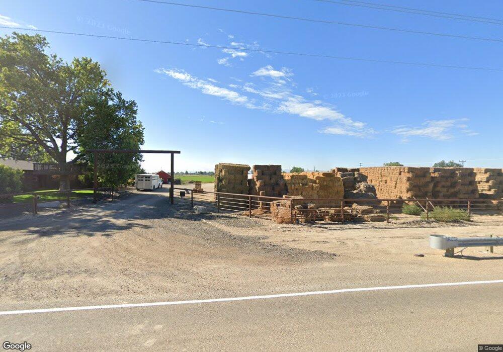
1109 W Ustick Rd Caldwell, ID 83605
Estimated Value: $666,000 - $817,760
5
Beds
3
Baths
3,040
Sq Ft
$247/Sq Ft
Est. Value
About This Home
This home is located at 1109 W Ustick Rd, Caldwell, ID 83605 and is currently estimated at $750,190, approximately $246 per square foot. 1109 W Ustick Rd is a home located in Canyon County with nearby schools including Lewis And Clark Elementary School, Syringa Middle School, and Caldwell Senior High School.
Ownership History
Date
Name
Owned For
Owner Type
Purchase Details
Closed on
Jun 2, 2025
Sold by
Mcdaniel Chad P and Mcdaniel Melinda A
Bought by
Tbc Land Holding Llc
Current Estimated Value
Purchase Details
Closed on
Jan 6, 2020
Sold by
Mcdaniel Chad and Mcdaniel Melinda
Bought by
Mcdaniel Melinda and Mcdaniel Chad
Home Financials for this Owner
Home Financials are based on the most recent Mortgage that was taken out on this home.
Original Mortgage
$451,000
Interest Rate
3.6%
Mortgage Type
New Conventional
Create a Home Valuation Report for This Property
The Home Valuation Report is an in-depth analysis detailing your home's value as well as a comparison with similar homes in the area
Home Values in the Area
Average Home Value in this Area
Purchase History
| Date | Buyer | Sale Price | Title Company |
|---|---|---|---|
| Tbc Land Holding Llc | -- | Venture Title | |
| Mcdaniel Melinda | -- | Titleone Boise |
Source: Public Records
Mortgage History
| Date | Status | Borrower | Loan Amount |
|---|---|---|---|
| Previous Owner | Mcdaniel Melinda | $451,000 |
Source: Public Records
Tax History Compared to Growth
Tax History
| Year | Tax Paid | Tax Assessment Tax Assessment Total Assessment is a certain percentage of the fair market value that is determined by local assessors to be the total taxable value of land and additions on the property. | Land | Improvement |
|---|---|---|---|---|
| 2025 | $2,571 | $826,200 | $435,200 | $391,000 |
| 2024 | $2,571 | $604,240 | $208,740 | $395,500 |
| 2023 | $2,886 | $632,160 | $209,360 | $422,800 |
| 2022 | $5,103 | $676,120 | $208,820 | $467,300 |
| 2021 | $4,676 | $503,340 | $127,640 | $375,700 |
| 2020 | $4,451 | $398,320 | $91,920 | $306,400 |
| 2019 | $4,211 | $358,960 | $76,960 | $282,000 |
| 2018 | $4,172 | $0 | $0 | $0 |
| 2017 | $3,256 | $0 | $0 | $0 |
| 2016 | $2,437 | $0 | $0 | $0 |
| 2015 | $1,891 | $0 | $0 | $0 |
| 2014 | $1,805 | $161,070 | $39,870 | $121,200 |
Source: Public Records
Map
Nearby Homes
- 4202 Farmway Rd
- 709 Glacier St
- 710 Keogh Ln
- 3517 Argyle Place
- 507 W Dewey Ln
- 621 Edmund St
- 314 Ravello St
- 220 Ravello St
- 219 Ravello St
- TBD 73+- Lonkey Ln
- 4114 & 4121 Laster Ln
- 213 Ravello St
- 4404 Portofino Way
- 4403 Portofino Way
- 4415 Portofino Way
- 4314 Portofino Way
- 4322 Portofino Way
- 4412 Portofino Way
- 3509 Sunset Ave
- 4310 Portofino Way
- TBD W Ustick Rd
- 4014 Dorman Ave
- 3944 Dorman Ave
- 3920 Dorman Ave
- Parcel 2 Farmway Rd
- TDB Farmway Rd
- 22841 Farmway Rd
- Lot 6 Farmway Rd
- 28820 Farmway Rd
- 3915 Dorman Ave
- 3914 Dorman Ave
- 916 W Ustick Rd
- 909 W Ustick Rd
- 908 W Ustick Rd
- 3909 Dorman Ave
- 914 W Ustick Rd
- 1011 Karndell St
- 1009 Karndell St
- 904 W Ustick Rd
- 3812 Dorman Ave
