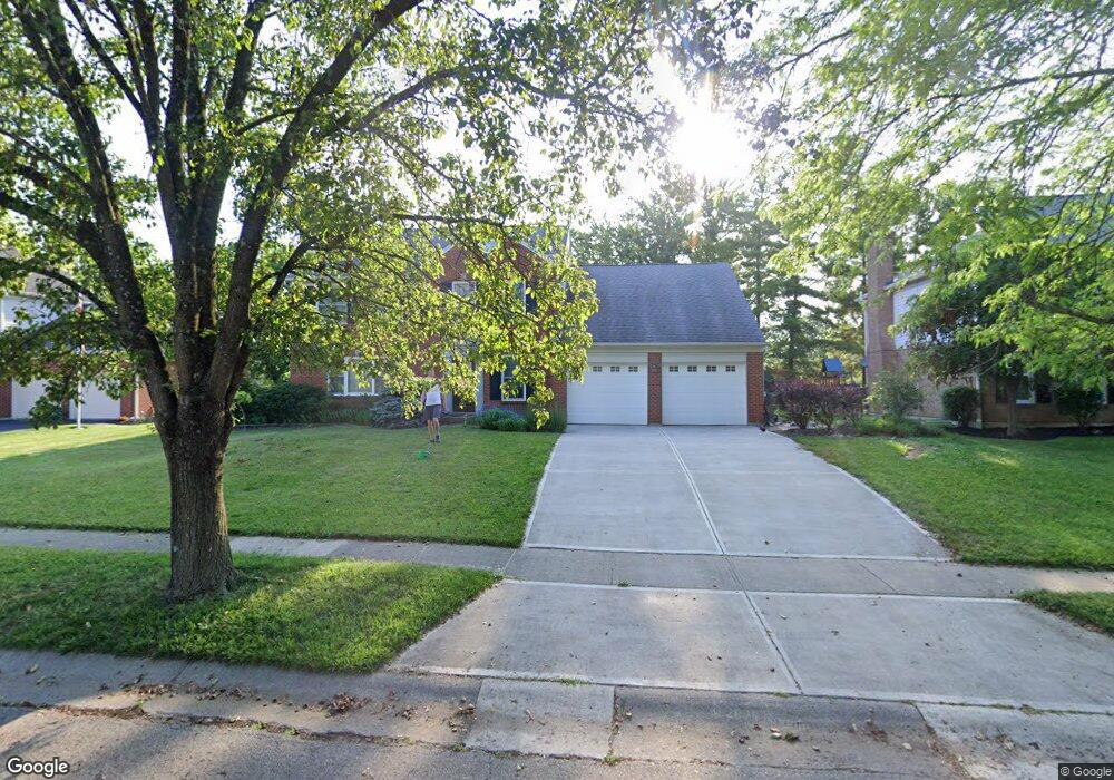
11093 Allenhurst Blvd W Cincinnati, OH 45241
Estimated Value: $389,492 - $519,000
4
Beds
3
Baths
2,103
Sq Ft
$217/Sq Ft
Est. Value
About This Home
This home is located at 11093 Allenhurst Blvd W, Cincinnati, OH 45241 and is currently estimated at $457,373, approximately $217 per square foot. 11093 Allenhurst Blvd W is a home located in Hamilton County with nearby schools including Sharonville Elementary School, Princeton Community Middle School, and Princeton High School.
Ownership History
Date
Name
Owned For
Owner Type
Purchase Details
Closed on
Aug 12, 2010
Sold by
Webbink Robert Frederick and Webbink Robert F
Bought by
Webbink Robert Frederick and Webbink Jennie Marie
Current Estimated Value
Purchase Details
Closed on
Sep 11, 2003
Sold by
Kuhnell Matthew S and Kuhnell Holly L
Bought by
Webbink Robert F
Home Financials for this Owner
Home Financials are based on the most recent Mortgage that was taken out on this home.
Original Mortgage
$189,600
Interest Rate
6.44%
Mortgage Type
Unknown
Purchase Details
Closed on
Jun 14, 1999
Sold by
Allen Kent D and Allen Elizabeth H
Bought by
Kuhnell Matthew S and Kuhnell Holly L
Home Financials for this Owner
Home Financials are based on the most recent Mortgage that was taken out on this home.
Original Mortgage
$185,700
Interest Rate
6.99%
Create a Home Valuation Report for This Property
The Home Valuation Report is an in-depth analysis detailing your home's value as well as a comparison with similar homes in the area
Home Values in the Area
Average Home Value in this Area
Purchase History
| Date | Buyer | Sale Price | Title Company |
|---|---|---|---|
| Webbink Robert Frederick | -- | Attorney | |
| Webbink Robert F | $237,000 | -- | |
| Kuhnell Matthew S | $195,500 | -- |
Source: Public Records
Mortgage History
| Date | Status | Borrower | Loan Amount |
|---|---|---|---|
| Previous Owner | Webbink Robert F | $189,600 | |
| Previous Owner | Kuhnell Matthew S | $185,700 | |
| Closed | Webbink Robert F | $27,400 |
Source: Public Records
Tax History
| Year | Tax Paid | Tax Assessment Tax Assessment Total Assessment is a certain percentage of the fair market value that is determined by local assessors to be the total taxable value of land and additions on the property. | Land | Improvement |
|---|---|---|---|---|
| 2025 | $4,885 | $102,718 | $19,075 | $83,643 |
| 2023 | $4,173 | $102,718 | $19,075 | $83,643 |
| 2022 | $4,331 | $85,680 | $18,886 | $66,794 |
| 2021 | $4,210 | $85,680 | $18,886 | $66,794 |
| 2020 | $4,259 | $85,680 | $18,886 | $66,794 |
| 2019 | $4,248 | $78,603 | $17,325 | $61,278 |
| 2018 | $3,985 | $78,603 | $17,325 | $61,278 |
| 2017 | $3,731 | $78,603 | $17,325 | $61,278 |
| 2016 | $3,795 | $79,293 | $16,853 | $62,440 |
| 2015 | $3,832 | $79,293 | $16,853 | $62,440 |
| 2014 | $3,845 | $79,293 | $16,853 | $62,440 |
| 2013 | $3,510 | $74,106 | $15,750 | $58,356 |
Source: Public Records
Map
Nearby Homes
- 4036 Haverstraw Dr
- 4051 Falling Creek Ct
- 4138 Radcliff Ln
- 10882 Willfleet Dr
- 11310 Foremark Dr
- 4071 E Kemper Rd
- 3380 Spurrier Ln
- 10480 Wintergreen Ct
- 4254 Fox Hollow Dr
- 3816 Glendale Milford Rd
- 3703 Moorhill Dr
- 3706 Glendale Milford Rd
- 4982 Bell Ave
- 3875 Hauck Rd
- 10301 Giverny Blvd
- 10561 Plainfield Rd
- 5300 Kenridge Dr
- 4204 Magnolia Aly
- 4270 Parkview Dr
- 5078 Arabella Cir
- 11099 Allenhurst Blvd E
- 11087 Allenhurst Blvd W
- 11099 Allenhurst Blvd W
- 11122 Mulligan St
- 11128 Mulligan St
- 11116 Mulligan St
- 11105 Allenhurst Blvd W
- 11081 Allenhurst Blvd W
- 11092 Allenhurst Blvd W
- 11086 Allenhurst Blvd W
- 11138 Mulligan St
- 11108 Mulligan St
- 11098 Allenhurst Blvd W
- 4078 Malaer Dr
- 11111 Allenhurst Blvd W
- 11144 Mulligan St
- 11119 Mulligan St
- 11104 Allenhurst Blvd W
- 11093 Zaring Ct
- 11135 Mulligan St